MyTopo
Armstrongs Mills Ohio US Topo Map
Couldn't load pickup availability
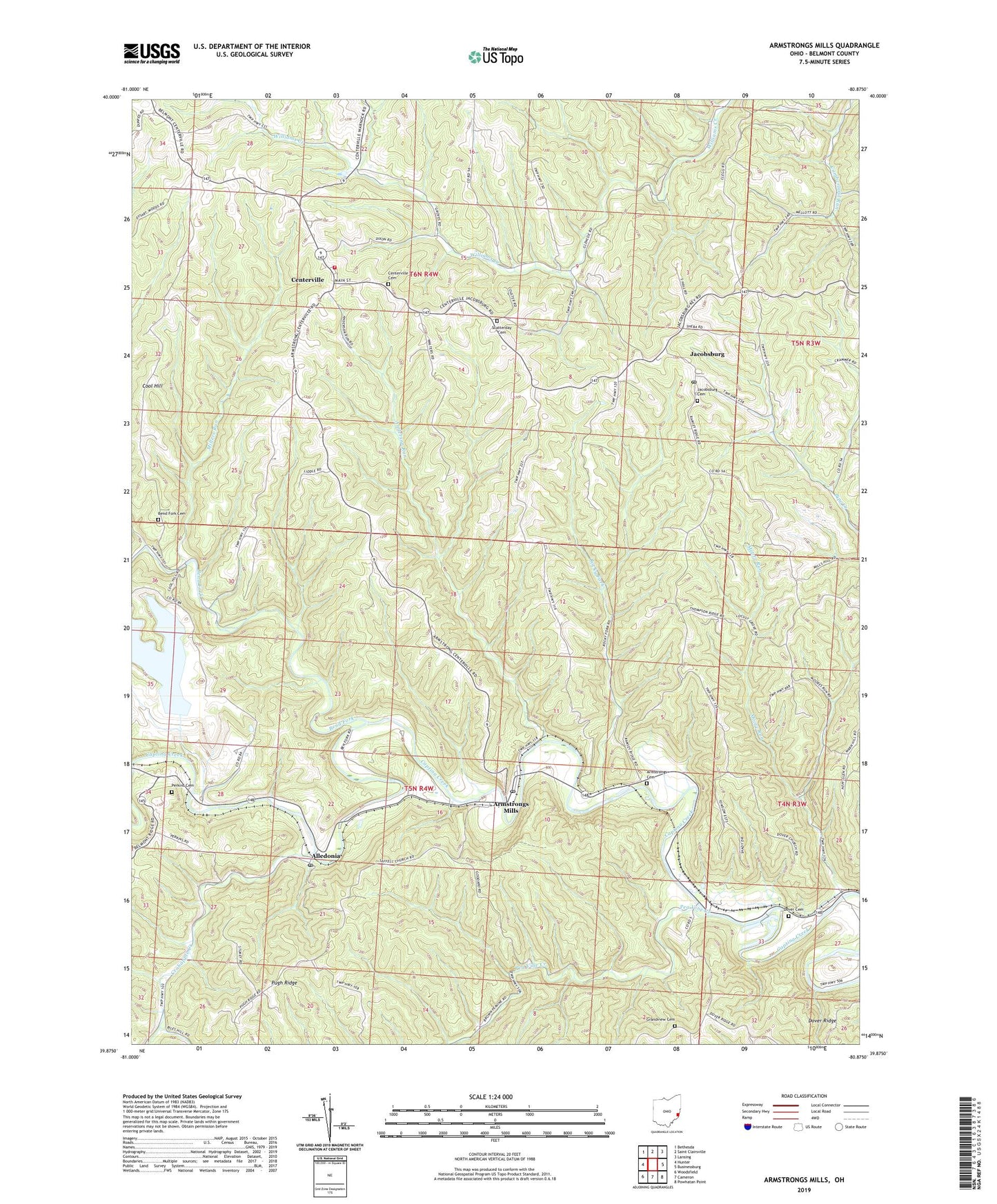
2023 topographic map quadrangle Armstrongs Mills in the state of Ohio. Scale: 1:24000. Based on the newly updated USGS 7.5' US Topo map series, this map is in the following counties: Belmont. The map contains contour data, water features, and other items you are used to seeing on USGS maps, but also has updated roads and other features. This is the next generation of topographic maps. Printed on high-quality waterproof paper with UV fade-resistant inks.
Quads adjacent to this one:
West: Hunter
Northwest: Bethesda
North: Saint Clairsville
Northeast: Lansing
East: Businessburg
South: Cameron
Southwest: Woodsfield
This map covers the same area as the classic USGS quad with code o39080h8.
Contains the following named places: Alledonia, Alledonia Post Office, Anderson Run, Armstrongs Cemetery, Armstrongs Mills, Armstrongs Mills Post Office, Becket, Bend Fork, Bend Fork Cemetery, Bend Fork Church, Bethel Church, Centerville, Centerville Cemetery, Centerville Elementary School, Concord Church, Cool Hill, Crabapple, Crabapple Creek, Dorsey, Dorsey Post Office, Dover Cemetery, Dover Church, Grandview Cemetery, Grandview Christian Church, Hogsink, Jacobsburg, Jacobsburg Cemetery, Jacobsburg Post Office, Joy Fork, Kelsey, Kelsey Post Office, Millers Run, Moore Run, Nacco Slurry Refuse Disposal Dam, Nacco Slurry Refuse Impoundment, Pea Vine Creek, Perkins Cemetery, Piney Creek, Powhatan Number 6 Mine, Rocky Fork, Scatterday Cemetery, Smith Township Volunteer Fire Company, Township of Smith, Township of Washington, ZIP Codes: 43902, 43933