MyTopo
Chatfield Ohio US Topo Map
Couldn't load pickup availability
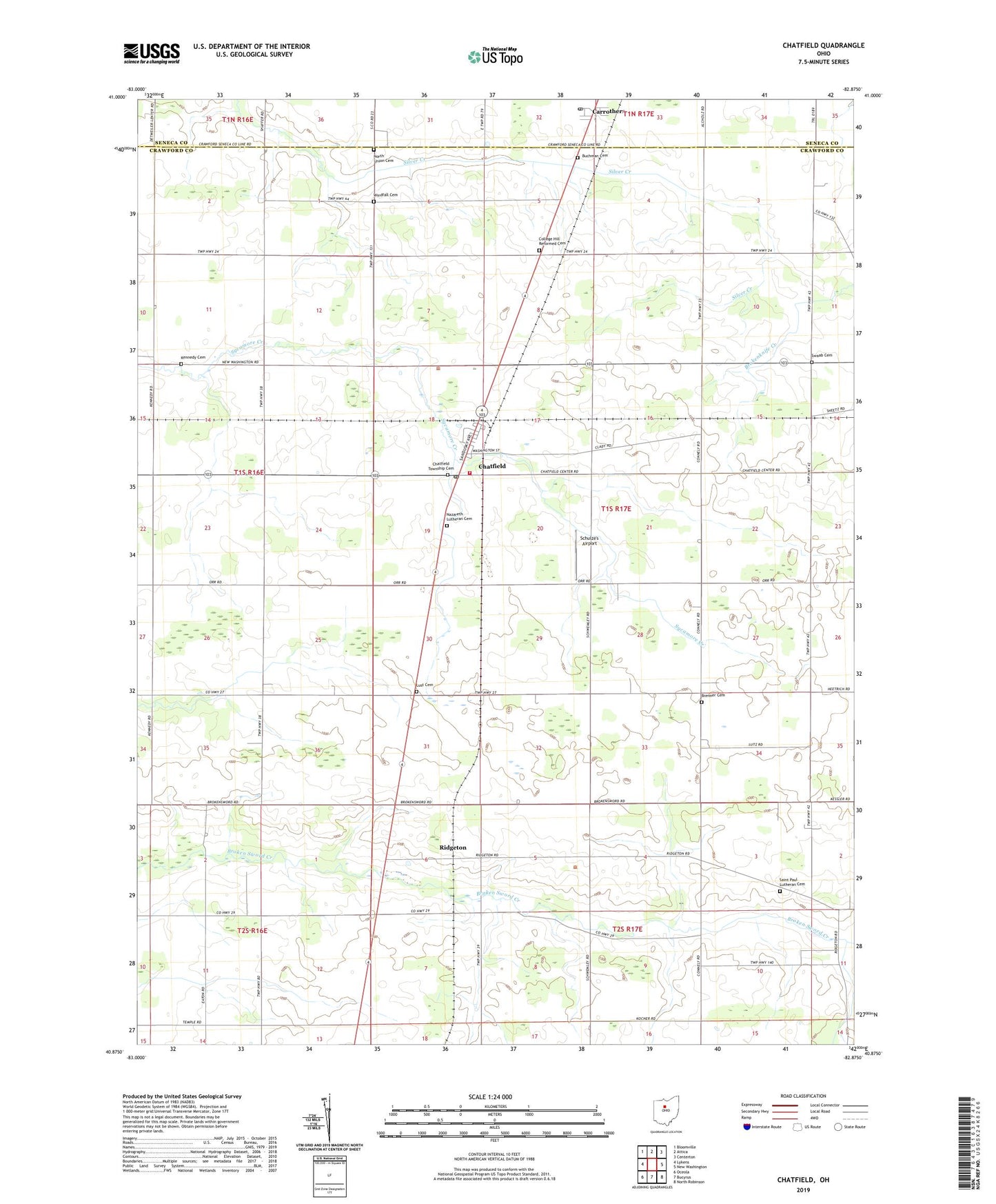
2023 topographic map quadrangle Chatfield in the state of Ohio. Scale: 1:24000. Based on the newly updated USGS 7.5' US Topo map series, this map is in the following counties: Crawford, Seneca. The map contains contour data, water features, and other items you are used to seeing on USGS maps, but also has updated roads and other features. This is the next generation of topographic maps. Printed on high-quality waterproof paper with UV fade-resistant inks.
Quads adjacent to this one:
West: Lykens
Northwest: Bloomville
North: Attica
Northeast: Centerton
East: New Washington
Southeast: North Robinson
South: Bucyrus
Southwest: Oceola
This map covers the same area as the classic USGS quad with code o40082h8.
Contains the following named places: Brenner Cemetery, Broken Sword Church, Buchman Cemetery, Buckeye West Elementary School, Carrothers, Carrothers Post Office, Chatfield, Chatfield Fire Department, Chatfield Post Office, Chatfield Township Cemetery, College Hill Church, College Hill Reformed Cemetery, Fauser, Heydinger School, Kennedy Cemetery, Lust Cemetery, Nazareth Church, Nazareth Lutheran Cemetery, North Union Cemetery, Pietist Church, Ridgeton, Saint Paul Church, Saint Paul Lutheran Cemetery, School Number 4, School Number 7, School Number 8, Schulze's Airport, Swaab Cemetery, Township of Chatfield, Village of Chatfield, Windfall Cemetery, Windfall Lutheran Church, ZIP Codes: 44818, 44825