MyTopo
Lykens Ohio US Topo Map
Couldn't load pickup availability
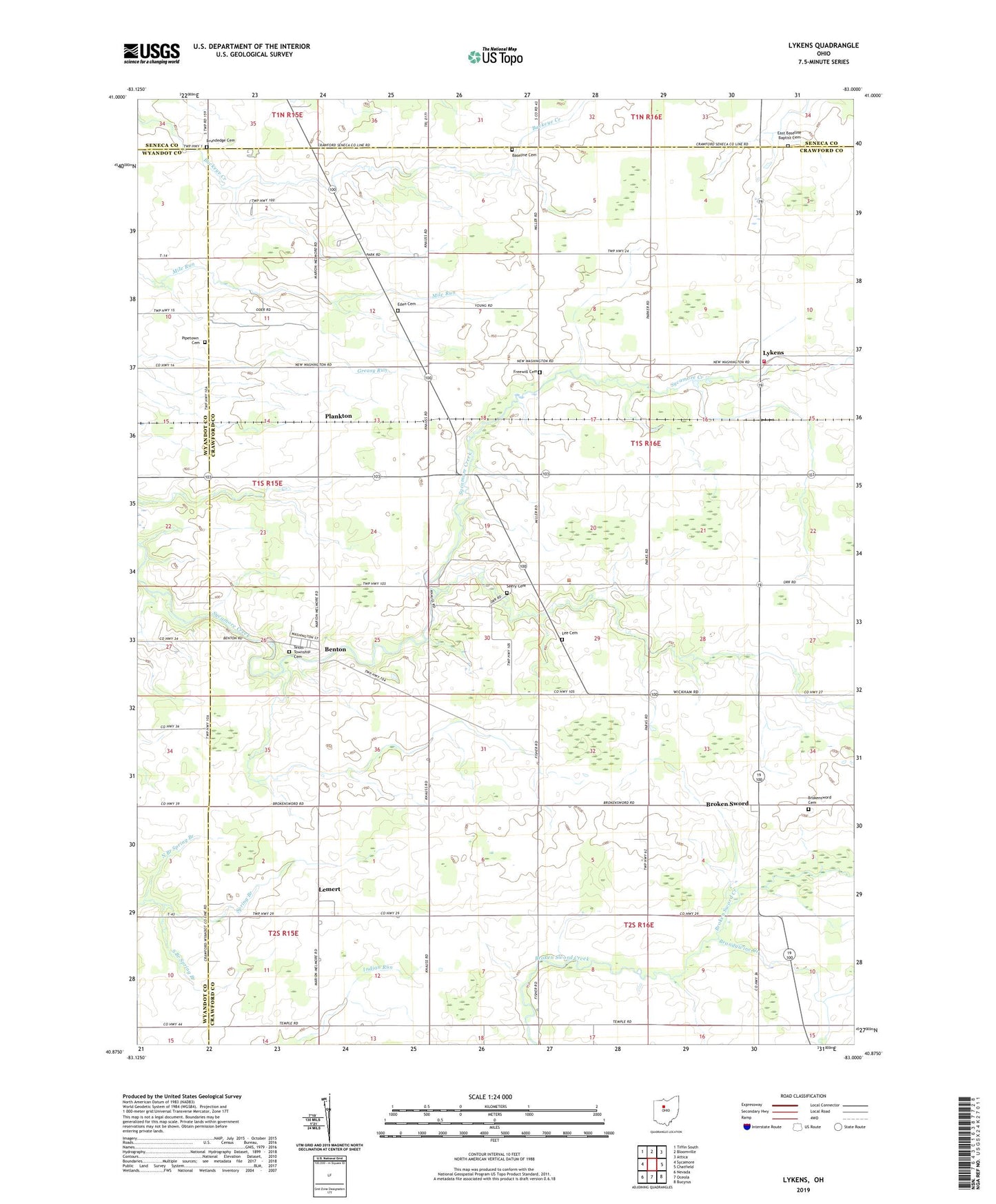
2023 topographic map quadrangle Lykens in the state of Ohio. Scale: 1:24000. Based on the newly updated USGS 7.5' US Topo map series, this map is in the following counties: Crawford, Wyandot, Seneca. The map contains contour data, water features, and other items you are used to seeing on USGS maps, but also has updated roads and other features. This is the next generation of topographic maps. Printed on high-quality waterproof paper with UV fade-resistant inks.
Quads adjacent to this one:
West: Sycamore
Northwest: Tiffin South
North: Bloomville
Northeast: Attica
East: Chatfield
Southeast: Bucyrus
South: Oceola
Southwest: Nevada
This map covers the same area as the classic USGS quad with code o40083h1.
Contains the following named places: Baseline Cemetery, Benton, Brandywine Creek, Broken Sword, Brokensword Cemetery, Brokensword Post Office, Brundedge Cemetery, East Baseline Baptist Cemetery, Eden Cemetery, Freewill Cemetery, Lee Cemetery, Lemert, Lemert Post Office, Lykens, Lykens Post Office, Lykens Township Fire Department, North Branch Spring Branch, Olive Branch Church, Pipetown Cemetery, Plankton, Pleasant Home Church, Saint Johns Church, Seery Cemetery, South Branch Spring Branch, Texas Township Cemetery, Township of Lykens, Township of Texas