MyTopo
Clearport Ohio US Topo Map
Couldn't load pickup availability
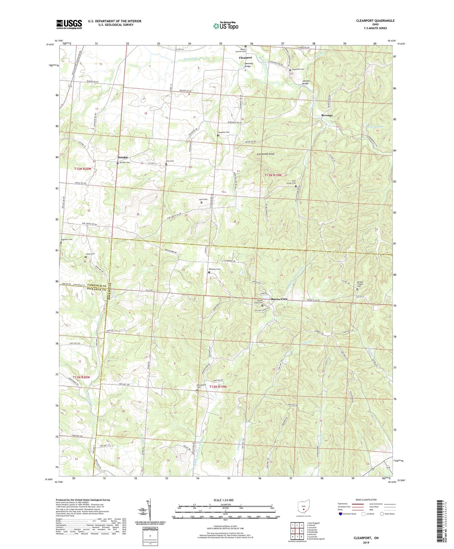
2019 topographic map quadrangle Clearport in the state of Ohio. Scale: 1:24000. Based on the newly updated USGS 7.5' US Topo map series, this map is in the following counties: Fairfield, Hocking, Pickaway. The map contains contour data, water features, and other items you are used to seeing on USGS maps, but also has updated roads and other features. This is the next generation of topographic maps. Printed on high-quality waterproof paper with UV fade-resistant inks.
Quads adjacent to this one:
West: Stoutsville
Northwest: East Ringgold
North: Amanda
Northeast: Lancaster
East: Rockbridge
Southeast: South Bloomingville
South: Laurelville
Southwest: Hallsville
Contains the following named places: Arney Run, Augustus Cemetery, Bethany Cemetery, Bethany Church, Blackburn, Buena Vista, Buena Vista Cemetery, Camp Indianola, Clearport, Clearport Post Office, Drinkle, Drinkle Cemetery, Emmanuel Knob, Fairfield Sanitary Landfill, Hanaway Bridge, Hopewell Cemetery, Hopewell Church, Johnson Bridge, Julian Cemetery, Kern Cemetery, Lake Romona, Lake Romona Dam, McClelland Cemetery, Morgan Chapel, Morgan Chapel Cemetery, Mount Carmel Cemetery, Muddy Prairie Run, Pine Grove Cemetery, Pine Grove United Methodist Church, Revenge, Revenge Post Office, Shaeffer Cemetery, Snortin Ridge Farm Lake, Snortin Ridge Farm Lake Dam, Stump Run Church, Township of Madison, Township of Perry, Zion Cemetery, Zion Church