MyTopo
Ansonia Ohio US Topo Map
Couldn't load pickup availability
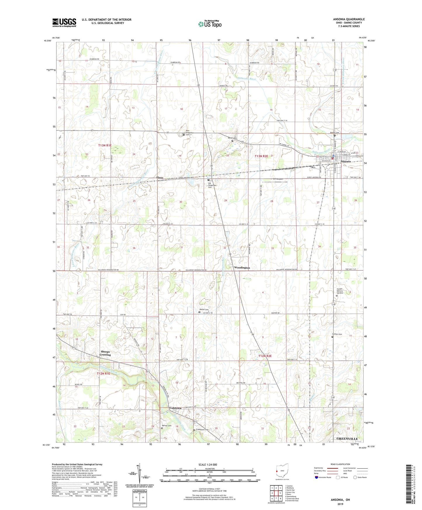
2023 topographic map quadrangle Ansonia in the state of Ohio. Scale: 1:24000. Based on the newly updated USGS 7.5' US Topo map series, this map is in the following counties: Darke. The map contains contour data, water features, and other items you are used to seeing on USGS maps, but also has updated roads and other features. This is the next generation of topographic maps. Printed on high-quality waterproof paper with UV fade-resistant inks.
Quads adjacent to this one:
West: Union City
Northwest: Cosmos
North: Rossburg
Northeast: North Star
East: Dawn
Southeast: Greenville East
South: Greenville West
Southwest: Spartanburg
This map covers the same area as the classic USGS quad with code o40084b6.
Contains the following named places: Ansonia, Ansonia Christian Church, Ansonia Elementary School, Ansonia High School, Ansonia Methodist Church, Ansonia Middle School, Ansonia Police Department, Ansonia Post Office, ANSONIA RESCUE SQUADS, Ansonia Volunteer Fire Department, Beeler Cemetery, Bethel Cemetery, Bethel Corners, Billenstein Farms, Byrds Mobile Home Park, Campbell Farms, Coletown, Coletown Congregational Christian Church, Coppess Nature Sanctuary, Creekbaum Cemetery, Dan Lo Farms, Dismal Creek, Duvall Cemetery, Earhart Cemetery, Eastwood Mobile Home Estates, Elroy, Elroy Post Office, Hetslerville Post Office, Hetzlerville, Hiestand Turkey Farm, Hopper School, Hunchberger Corners, J and K Swine Farm, Kramer Farm, Kraut Creek, Leis Airport, Manuel Cemetery, Maplegrove School, Meeker, Mississinawa Valley High School, Mississinawa Valley Middle School, Mount Heron, Mount Heron Post Office, New Teagarden Cemetery, North Fork Kraut Creek, North Fork Stillwater River, Old Teegarden Cemetery, Phoenix Farms, Raffel Farms, Roe Corners, S and S Swine Farm, Shady Grove Church, Sharps Crossing, Southfork Farms, Stoney Creek Farms, Sunset Memory Gardens, Suregreen Farms, Teegarden Congregational Christian Church, Township of Brown, Village of Ansonia, Waterhouse Church, Woodington, Woodington Congregational Christian Church, Woodington Park Post Office, Woodington Run, Woodland Heights Elementary School, Zumbrum Corners, ZIP Code: 45303