MyTopo
Northville Ohio US Topo Map
Couldn't load pickup availability
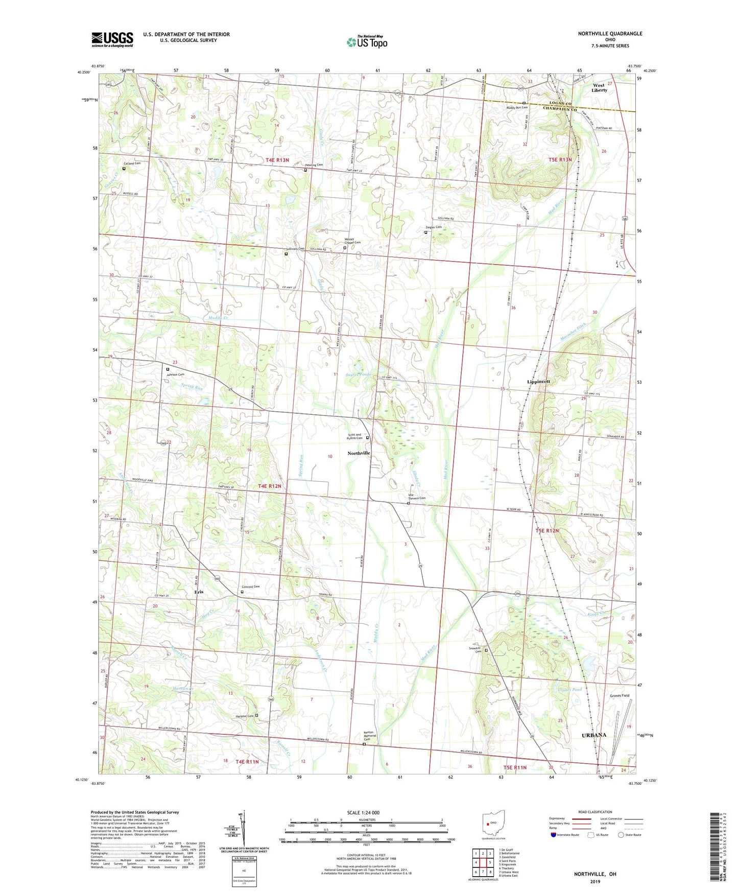
2023 topographic map quadrangle Northville in the state of Ohio. Scale: 1:24000. Based on the newly updated USGS 7.5' US Topo map series, this map is in the following counties: Champaign, Logan. The map contains contour data, water features, and other items you are used to seeing on USGS maps, but also has updated roads and other features. This is the next generation of topographic maps. Printed on high-quality waterproof paper with UV fade-resistant inks.
Quads adjacent to this one:
West: Saint Paris
Northwest: De Graff
North: Bellefontaine
Northeast: Zanesfield
East: Kingscreek
Southeast: Urbana East
South: Urbana West
Southwest: Thackery
This map covers the same area as the classic USGS quad with code o40083b7.
Contains the following named places: Calland Cemetery, Camp Shawnee, Champaign County, Concord Cemetery, Concord School, Concord United Methodist Church, Couchman School, Craft School, Cranes Pond, Eris, Eris Post Office, Glady Creek, Harban Creek, Harbour Cemetery, Hewling Cemetery, Hog Creek, Idle - Stevens Cemetery, Johnson Cemetery, Kenton Memorial Cemetery, Kings Creek, Lippincott, Lippincott Post Office, Macochee Creek, Macochee Ditch, Muddy Creek, Muddy Run Cemetery, Northville, Northville Post Office, Old Pimtown, Sayres Ponds, School Number 5, Scott and Pullins Cemetery, Siegenthaler-Kaestner Esker State Nature Preserve, Snow Hill School, Snowhill Cemetery, Spring Run, Sullivans Cemetery, Township of Concord, Township of Harrison, Wesley Chapel, Wesley Chapel Cemetery, Wesley Chapel School, West Liberty-Salem High School, Ziegler Cemetery