MyTopo
Dillonvale Ohio US Topo Map
Couldn't load pickup availability
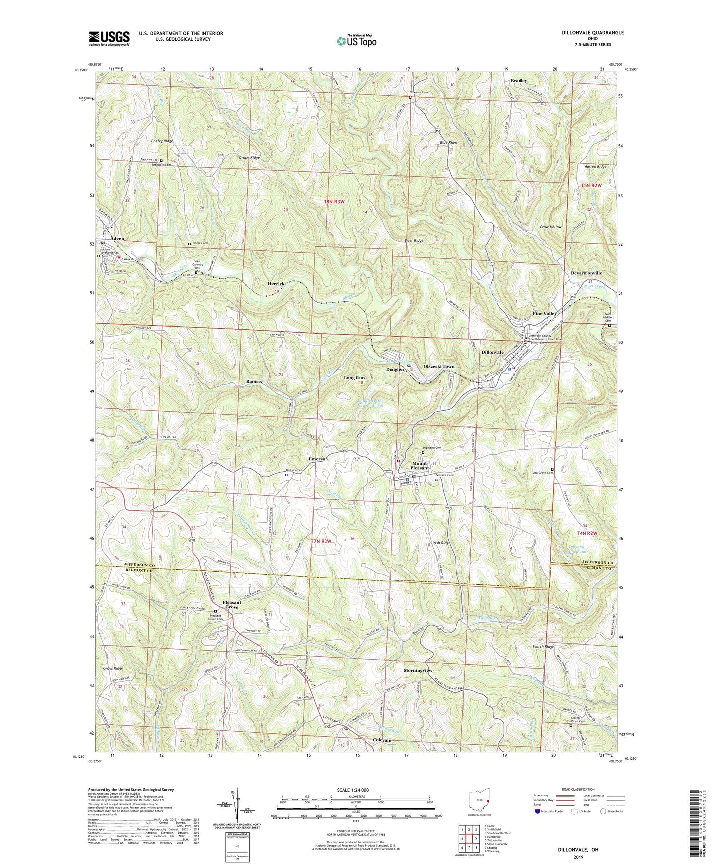
2023 topographic map quadrangle Dillonvale in the state of Ohio. Scale: 1:24000. Based on the newly updated USGS 7.5' US Topo map series, this map is in the following counties: Jefferson, Belmont. The map contains contour data, water features, and other items you are used to seeing on USGS maps, but also has updated roads and other features. This is the next generation of topographic maps. Printed on high-quality waterproof paper with UV fade-resistant inks.
Quads adjacent to this one:
West: Harrisville
Northwest: Cadiz
North: Smithfield
Northeast: Steubenville West
East: Tiltonsville
Southeast: Wheeling
South: Lansing
Southwest: Saint Clairsville
This map covers the same area as the classic USGS quad with code o40080b7.
Contains the following named places: Adena, Adena Elementary School, Adena Post Office, Adena Presbyterian Cemetery, Adena Presbyterian Church, Adena Volunteer Fire Company, Bradley, Cabbage Run, Central Elementary School, Cherry Ridge, Coal Run, Colerain, Colerain Post Office, Crow Hollow, Deyarmonville, Dillonvale, Dillonvale Emergency Medical Services, Dillonvale Police Department, Dillonvale Post Office, Dillonvale Volunteer Fire Department, Dorothy Mine Pond, Dorothy Mine Pond Dam, Dry Fork, Dunglen, Dunglen Mine Impoundment, Dunglen Mine Impoundment Dam, Dunglen Post Office, Emerson, Emerson Post Office, Goose Run, Grape Ridge, Grays Ridge, Herrick, Herrick Post Office, Hicksite Cemetery, Highland Cemetery, Hilltop Elementary School, Holmes Cemetery, Irish Ridge, Jug Run, Long Run, Morning View Post Office, Morningview, Mount Pleasant, Mount Pleasant Police Department, Mount Pleasant Post Office, Mount Pleasant Volunteer Fire Department, North Fork Short Creek, Oak Grove Cemetery, Olszeski Town, Parkers Run, Perrin Run, Pine Valley, Pine Valley Post Office, Piney Fork, Piney Fork Prep Plant Slurry Pond, Pleasant Grove, Pleasant Grove Cemetery, Pleasant Grove Post Office, Ramsey, Ramsey Post Office, Rehoboth Cemetery, Saint Adelbert Cemetery, Saint Casimirs Cemetery, Scotch Ridge, Scotch Ridge Cemetery, Scotch Ridge Church, Seceder Cemetery, Seminary Valley, Startle, Startle Post Office, Township of Mount Pleasant, Township of Smithfield, Trenton Church, Village of Dillonvale, Village of Mount Pleasant, Village of Mount Pleasant Historic District, Wheeler Cemetery, ZIP Codes: 43901, 43917, 43935, 43939