MyTopo
Smithfield Ohio US Topo Map
Couldn't load pickup availability
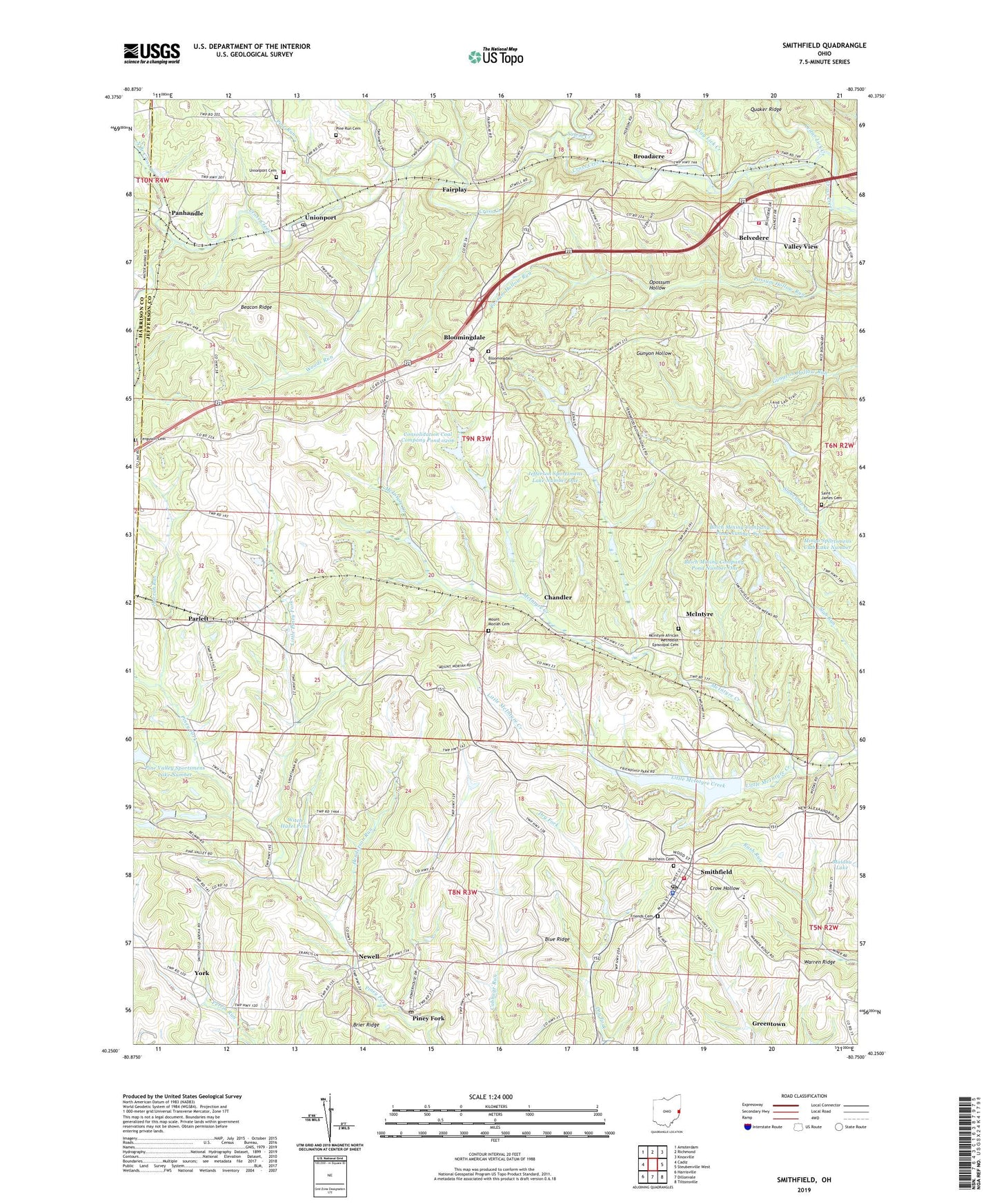
2023 topographic map quadrangle Smithfield in the state of Ohio. Scale: 1:24000. Based on the newly updated USGS 7.5' US Topo map series, this map is in the following counties: Jefferson, Harrison. The map contains contour data, water features, and other items you are used to seeing on USGS maps, but also has updated roads and other features. This is the next generation of topographic maps. Printed on high-quality waterproof paper with UV fade-resistant inks.
Quads adjacent to this one:
West: Cadiz
Northwest: Amsterdam
North: Richmond
Northeast: Knoxville
East: Steubenville West
Southeast: Tiltonsville
South: Dillonvale
Southwest: Harrisville
This map covers the same area as the classic USGS quad with code o40080c7.
Contains the following named places: Beacon Ridge, Belvedere, Belvedere Volunteer Fire Department, Bloomingdale, Bloomingdale Cemetery, Bloomingdale Fire Department, Bloomingdale Post Office, Blue Ridge, Boich Mining Company Pond Number One, Boich Mining Company Pond Number One Dam, Boich Mining Company Pond Number Two, Boich Mining Company Pond Number Two Dam, Brier Ridge, Broadacre, Broadacre Post Office, Cedar Lick Creek, Chandler, Chandler Post Office, Clay Lick Creek, Consolidation Coal Company Pond 0206, Fair Play Post Office, Fairplay, Ferguson Cemetery, Friends Cemetery, Friendship Airpark, Friendship Park Lake, Friendship Park Lake Dam, Greentown, Harrah Run, Henderson Run, Jefferson Sportsmens Lake Number One, Jefferson Sportsmens Lake Number One Dam, Jefferson Sportsmens Lake Number Three, Jefferson Sportsmens Lake Number Three Dam, Jefferson Sportsmens Lake Number Two, Jefferson Sportsmens Lake Number Two Dam, Little McIntyre Creek, Little Piney Fork, McIntyre, McIntyre African Methodist Episcopal Cemetery, Mingo Sportsmens Club Lake Number, Mount Moriah Cemetery, Mount Moriah Church, Newell, North Branch Cross Creek, Northern Cemetery, Opossum Hollow, Panhandle, Panhandle Post Office, Parlett, Parlett Post Office, Pine Run, Pine Run Cemetery, Pine Valley Sportsmens Lake Number, Piney Fork, Piney Fork Cemetery, Saint James Cemetery, Saint James Church, Salem Creek, Short Creek Joint Fire District Station 2, Smithfield, Smithfield Census Designated Place, Smithfield Elementary School, Smithfield Lions Club Lake, Smithfield Lions Club Lake Dam, Smithfield Police Department, Smithfield Post Office, Smithfield Volunteer Fire Department, Steubenville Post Office, Thompson Run, Township of Wayne, Unionport, Unionport Cemetery, Unionport Christian Church, Unionport post office, Unionport Volunteer Fire Department, Valley View, Village of Bloomingdale, Village of Smithfield, Warren Ridge, Wayne Elementary School, Weems, Weems Post Office, Witch Hazel Pond, Woods Run, WWYS-FM (Cadiz), York, ZIP Codes: 43910, 43948