MyTopo
Arcanum Ohio US Topo Map
Couldn't load pickup availability
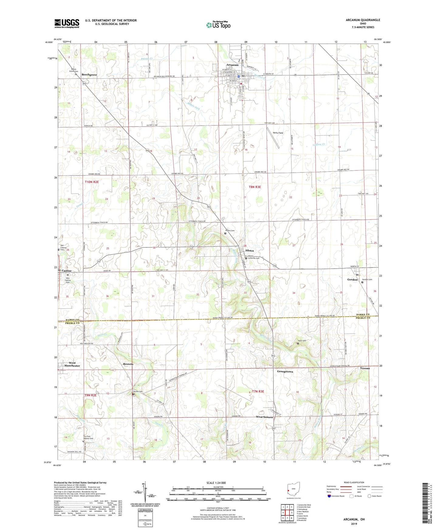
2023 topographic map quadrangle Arcanum in the state of Ohio. Scale: 1:24000. Based on the newly updated USGS 7.5' US Topo map series, this map is in the following counties: Darke, Preble. The map contains contour data, water features, and other items you are used to seeing on USGS maps, but also has updated roads and other features. This is the next generation of topographic maps. Printed on high-quality waterproof paper with UV fade-resistant inks.
Quads adjacent to this one:
West: New Madison
Northwest: Greenville West
North: Greenville East
Northeast: Gettysburg
East: Laura
Southeast: Brookville
South: Lewisburg
Southwest: Eaton North
This map covers the same area as the classic USGS quad with code o39084h5.
Contains the following named places: Arcanum, Arcanum City Building, Arcanum Community Rescue Squad, Arcanum Elementary School, Arcanum High School, Arcanum Police Department, Arcanum Post Office, Arcanum Public Library, Arcanum Volunteer Fire Department, Beech Grove Cemetery, Beech Grove Post Office, Beechgrove, Blumenstock School, Brown Cemetery, Browns, Brumbaugh Fruit Farm, Carrolls Farm, Castine, Castine Church of the Brethren, Castine Post Office, Castine United Methodist Church, Deejay Farms, Dry Fork Baptist Cemetery, Faith United Methodist Church, Gebhart Farm, Georgetown, Gordon, Gordon Cemetery, Gordon Post Office, Heins Field, Holsapple School, Hunt Cemetery, Immanuel Baptist Church, Ithaca, Ithaca Cemetery, Ithaca Lutheran Cemetery, Ithaca Post Office, Ithaca United Methodist Church, Neely School, New Castine Cemetery, Old Castine Cemetery, Salisbury Tree Farm, Township of Twin, Trinity United Methodist Church, Twin Creek Church, Village of Arcanum, Village of Castine, Village of Gordon, Village of Ithaca, Walnut Hill Farm, West Manchester United Methodist Church, West Sonora, West Sonora Post Office, Wetzeln Farm, ZIP Codes: 45304, 45382