MyTopo
Lewisburg Ohio US Topo Map
Couldn't load pickup availability
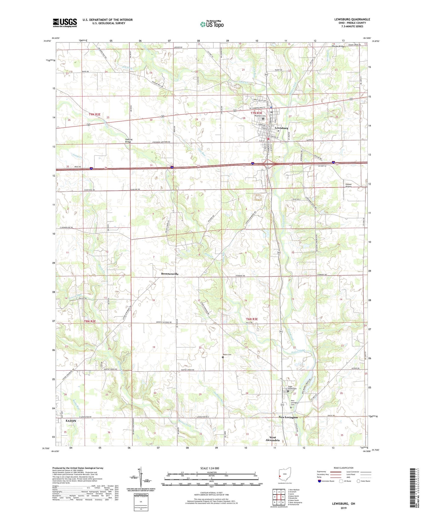
2023 topographic map quadrangle Lewisburg in the state of Ohio. Scale: 1:24000. Based on the newly updated USGS 7.5' US Topo map series, this map is in the following counties: Preble. The map contains contour data, water features, and other items you are used to seeing on USGS maps, but also has updated roads and other features. This is the next generation of topographic maps. Printed on high-quality waterproof paper with UV fade-resistant inks.
Quads adjacent to this one:
West: Eaton North
Northwest: New Madison
North: Arcanum
Northeast: Laura
East: Brookville
Southeast: Farmersville
South: West Alexandria
Southwest: Eaton South
This map covers the same area as the classic USGS quad with code o39084g5.
Contains the following named places: Baker Farm, Brennersville, Brennersville Post Office, Brown Memorial Library, Calvary United Methodist Church, Cedar Lane Farm, Coffman Run, Dandeecre Farm, Demotte Farm, Dry Fork, Egypt School, Euphemia, Euphemia Post Office, First United Church of Christ, Geeting Bridge, Gilmer Airport, Goose Creek, Hake Farms, Jims Run, Jones Farms, Lewisburg, Lewisburg Elementary School, Lewisburg Fire Department and Emergency Medical Services, Lewisburg Missionary Baptist Church, Lewisburg Police Department, Lewisburg Post Office, Lick Run, Lowry Run, Millers Fork, Myers Cemetery, New Lexington, New Lexington Cemetery, Odiam Farms, Price Creek, Roselawn Cemetery, Sugar Grove Cemetery, Swamp Creek, Thacker Farm, Township of Harrison, Township of Twin, Tri-County North High School, Trinity Lutheran Church, Twin Valley North High School, Village of Lewisburg, Warnke Bridge, Windy Heights Farm, ZIP Code: 45338