MyTopo
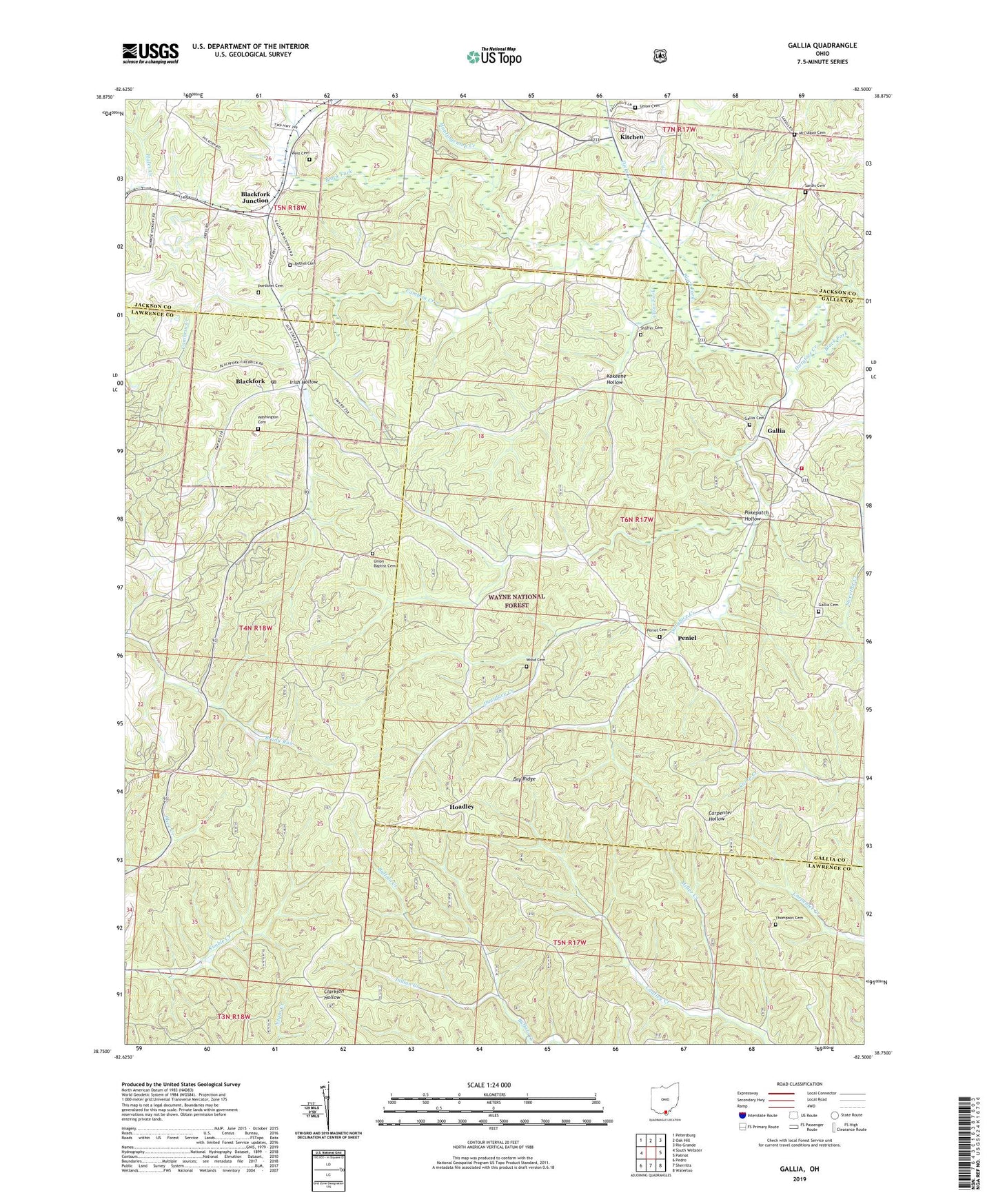
Gallia Ohio US Topo Map
Couldn't load pickup availability
Also explore the Gallia Forest Service Topo of this same quad for updated USFS data
2023 topographic map quadrangle Gallia in the state of Ohio. Scale: 1:24000. Based on the newly updated USGS 7.5' US Topo map series, this map is in the following counties: Lawrence, Gallia, Jackson. The map contains contour data, water features, and other items you are used to seeing on USGS maps, but also has updated roads and other features. This is the next generation of topographic maps. Printed on high-quality waterproof paper with UV fade-resistant inks.
Quads adjacent to this one:
West: South Webster
Northwest: Petersburg
North: Oak Hill
Northeast: Rio Grande
East: Patriot
Southeast: Waterloo
South: Sherritts
Southwest: Pedro
This map covers the same area as the classic USGS quad with code o38082g5.
Contains the following named places: Bethel Cemetery, Bethel Presbyterian Church, Black Fork, Blackfork, Blackfork Elementary School, Blackfork Junction, Blackfork Post Office, Bryn Hyfryd Church, Cambria Creek, Clear Fork, Dicks Creek, Dirtyface Creek, Dry Ridge, Gallia, Gallia Cemetery, Gallia Church, Gallia Post Office, Gallia School, Greenfield Township Volunteer Fire Department, Hoadley, Hoadley Post Office, Hoadley Station, Huntingcamp Creek, Indian Creek, Irish Hollow, Jefferson School, Kitchen, Kitchen Post Office, Kokeene Hollow, McCulgan Cemetery, Miller Creek, Old Country Tabernacle, Peniel, Peniel Cemetery, Peniel Post Office, Peniel Presbyterian Church, Poetkner Cemetery, Pokepatch Hollow, Sardis Cemetery, Sardis Presbyterian Church, Shaffer Cemetery, Telegraph Hill Lookout Tower, Thompson Cemetery, Township of Greenfield, Township of Washington, Union Baptist Cemetery, Union Baptist Church, Union Cemetery, Washington Cemetery, West Cemetery, Wood Cemetery