MyTopo
Good Hope Ohio US Topo Map
Couldn't load pickup availability
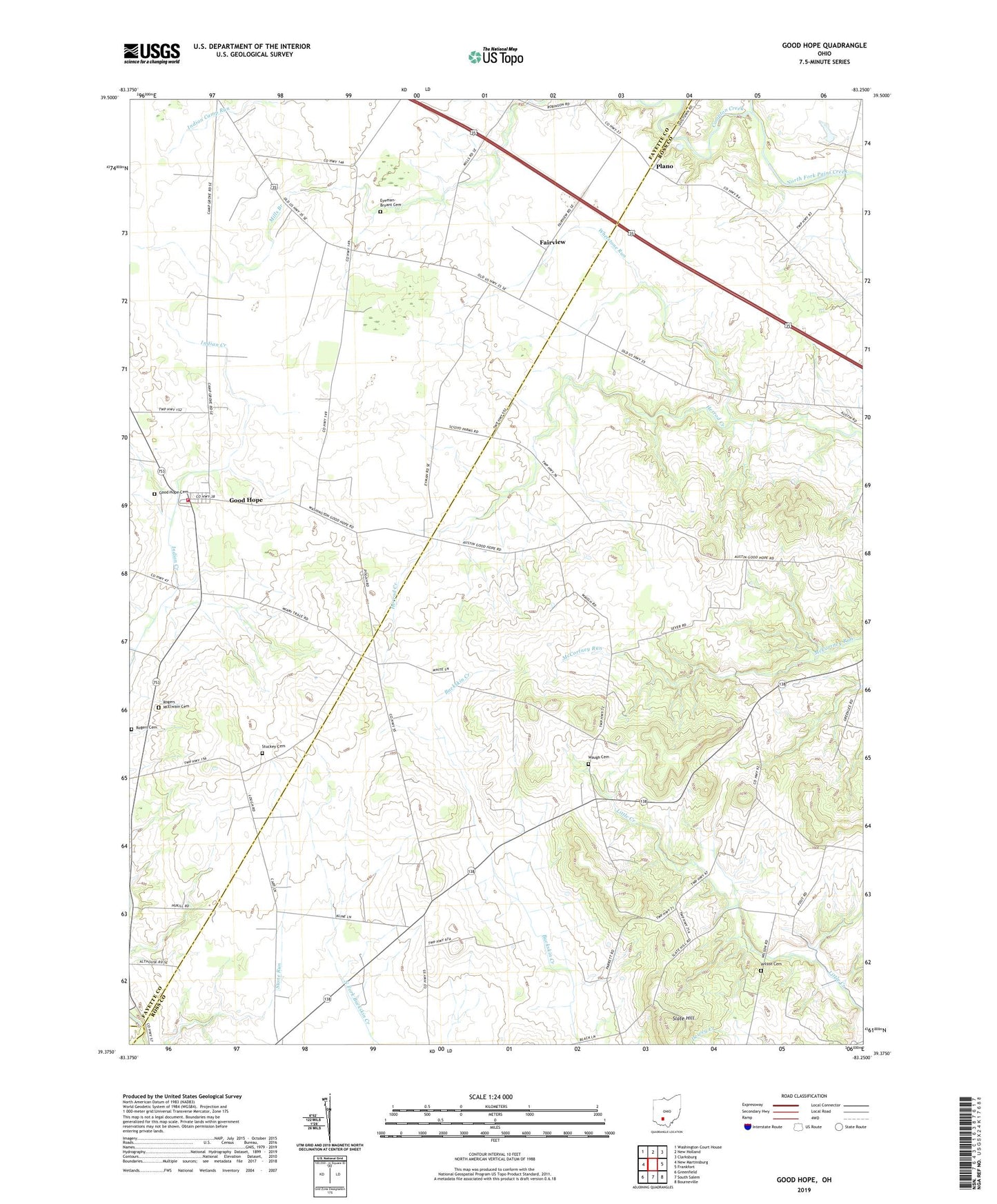
2019 topographic map quadrangle Good Hope in the state of Ohio. Scale: 1:24000. Based on the newly updated USGS 7.5' US Topo map series, this map is in the following counties: Ross, Fayette, Highland. The map contains contour data, water features, and other items you are used to seeing on USGS maps, but also has updated roads and other features. This is the next generation of topographic maps. Printed on high-quality waterproof paper with UV fade-resistant inks.
Quads adjacent to this one:
West: New Martinsburg
Northwest: Washington Court House
North: New Holland
Northeast: Clarksburg
East: Frankfort
Southeast: Bourneville
South: South Salem
Southwest: Greenfield
Contains the following named places: Barton Farm, Compton Creek, Eyeman-Bryant Cemetery, Fairview, Fairview School, Falama Farms, Ghormley School, Good Hope, Good Hope Cemetery, Good Hope Census Designated Place, Good Hope Post Office, Good Hope United Methodist Church, Heglers, Heglers School, Maple Grove School, Maple Grove United Methodist Church, McLean, McLean Post Office, Mills Branch, Pisgah Church, Pisgah School, Plano, Ratliff Farms, Rogers Cemetery, Rogers McElwain Cemetery, Rowe School, Slagle Farm, Slate Hill, Stuckey Cemetery, Thornton, Thornton Post Office, Thornton School, Township of Wayne, Waugh Cemetery, Waugh School, Wayne Elementary School, Wayne Township Fire Department Station 200, Whetstone Run, Whetstone School, Wilson Cemetery, Wilson School, Young School