MyTopo
South Salem Ohio US Topo Map
Couldn't load pickup availability
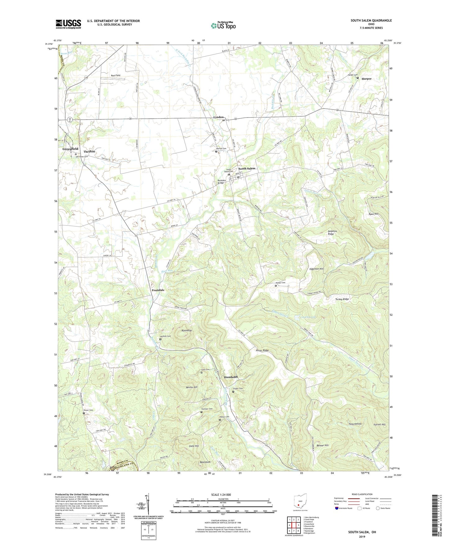
2023 topographic map quadrangle South Salem in the state of Ohio. Scale: 1:24000. Based on the newly updated USGS 7.5' US Topo map series, this map is in the following counties: Ross, Highland. The map contains contour data, water features, and other items you are used to seeing on USGS maps, but also has updated roads and other features. This is the next generation of topographic maps. Printed on high-quality waterproof paper with UV fade-resistant inks.
Quads adjacent to this one:
West: Greenfield
Northwest: New Martinsburg
North: Good Hope
Northeast: Frankfort
East: Bourneville
Southeast: Morgantown
South: Bainbridge
Southwest: Rainsboro
This map covers the same area as the classic USGS quad with code o39083c3.
Contains the following named places: Bald Knob, Barton Farms, Beech Glen School, Benner Hill, Blain School, Blueberry Hill Farm, Brown School, Buckskin Bridge, Buckskin Elementary School, Caldwell Farm, Cliff Creek, Crawley Lake, Crawley Lake Dam, Dhume School, Dolphins Ridge, Dwyer Cemetery, Dwyer School, Edginton Hill, Fruitdale, Fruitdale Post Office, Grey Cemetery, Harper, Harper Cemetery, Harper School, Hixson Cemetery, Humboldt, Humboldt Post Office, Hymiller Cemetery, Lyndon, Lyndon Post Office, Middleton School, Morton School, Mount Olive School, Nevins Hill, New Salem, North Fork Buckskin Creek, Nuckols Cemetery, Old Stone Cemetery, Paint Creek Dam, Paint Creek Lake, Pricer Ridge, Ross Field, Roundtop, Ryan Hill, Satchel Cemetery, Shoemaker Farm, Slate Hill, Slate Run, Snyder Cemetery, South Salem, South Salem Cemetery, South Salem Post Office, Stone Run, Sunnyside Church, Sunnyside School, Thrifton, Thrifton Post Office, Township of Buckskin, Township of Paint, Turkey Ridge, Turtlerock Farm, Valley School, Village of South Salem, Weller Cemetery, ZIP Code: 45681