MyTopo
Bourneville Ohio US Topo Map
Couldn't load pickup availability
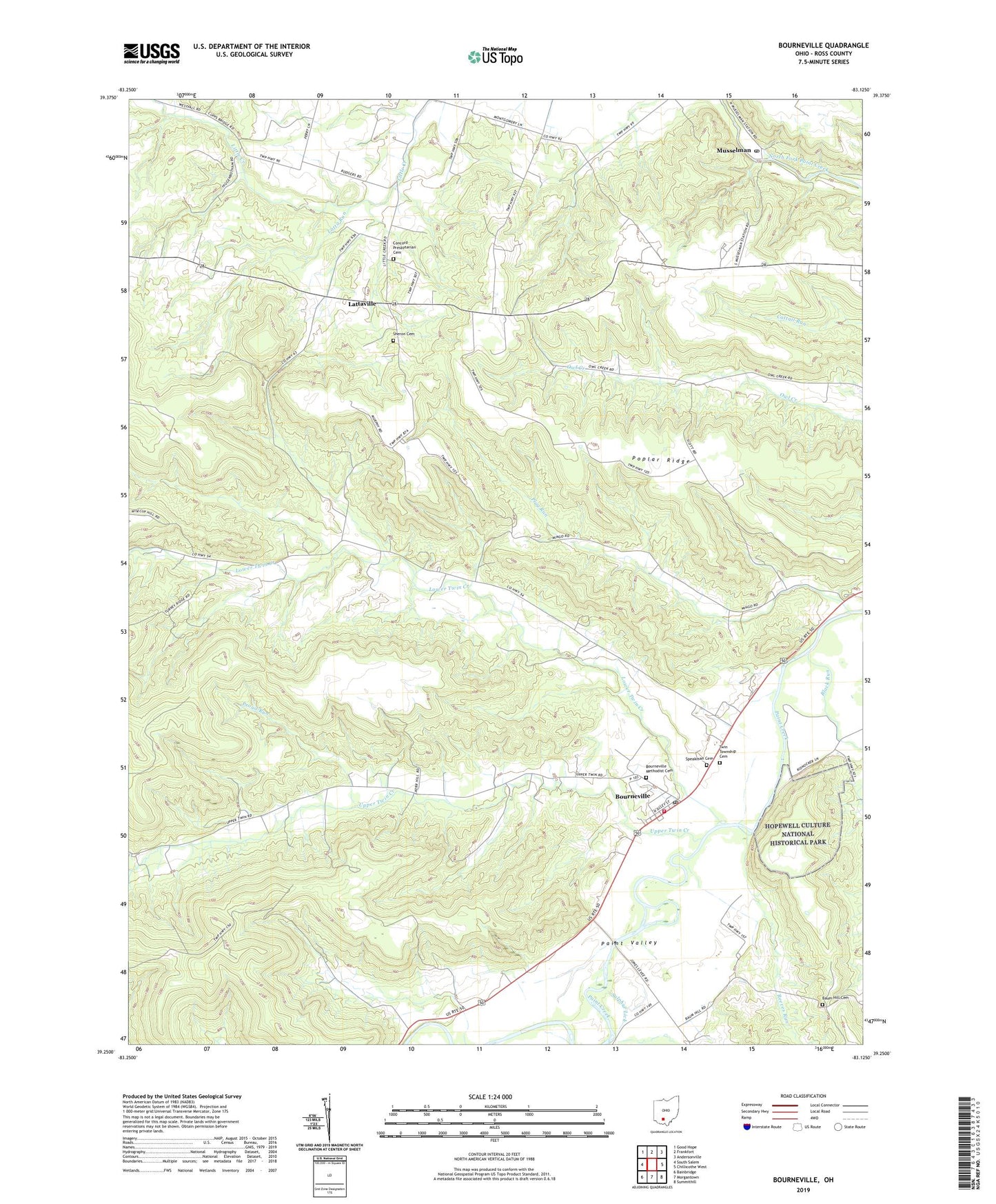
2023 topographic map quadrangle Bourneville in the state of Ohio. Scale: 1:24000. Based on the newly updated USGS 7.5' US Topo map series, this map is in the following counties: Ross. The map contains contour data, water features, and other items you are used to seeing on USGS maps, but also has updated roads and other features. This is the next generation of topographic maps. Printed on high-quality waterproof paper with UV fade-resistant inks.
Quads adjacent to this one:
West: South Salem
Northwest: Good Hope
North: Frankfort
Northeast: Andersonville
East: Chillicothe West
Southeast: Summithill
South: Morgantown
Southwest: Bainbridge
This map covers the same area as the classic USGS quad with code o39083c2.
Contains the following named places: Asher Hill, Barger Ridge, Baum Hill Cemetery, Baum School, Beath Ridge, Black Run, Bourneville, Bourneville Census Designated Place, Bourneville Methodist Cemetery, Bourneville Post Office, California Hollow, Concord Church, Concord Presbyterian Cemetery, Concord School, Eagle Hollow, Farrell Hill, Hester School, Hopewell Culture National Historical Park, Latta Run, Lattaville, Lower Twin Creek, McDonald Hill, Musselman, Musselman Post Office, Pierce School, Plug Run, Plyley Ridge, Poplar Ridge, Porter Hollow, Proud Run, Reeves Run, Roundtop School, Sheron Cemetery, Speakman Cemetery, Spruce Hill, Sulphur Lick, Township of Twin, Twin Elementary School, Twin Township Cemetery, Twin Township Volunteer Fire Department, Upland Orchard, Upper Twin Creek, WVXC-FM (Chillicothe), ZIP Code: 45617