MyTopo
Bowersville Ohio US Topo Map
Couldn't load pickup availability
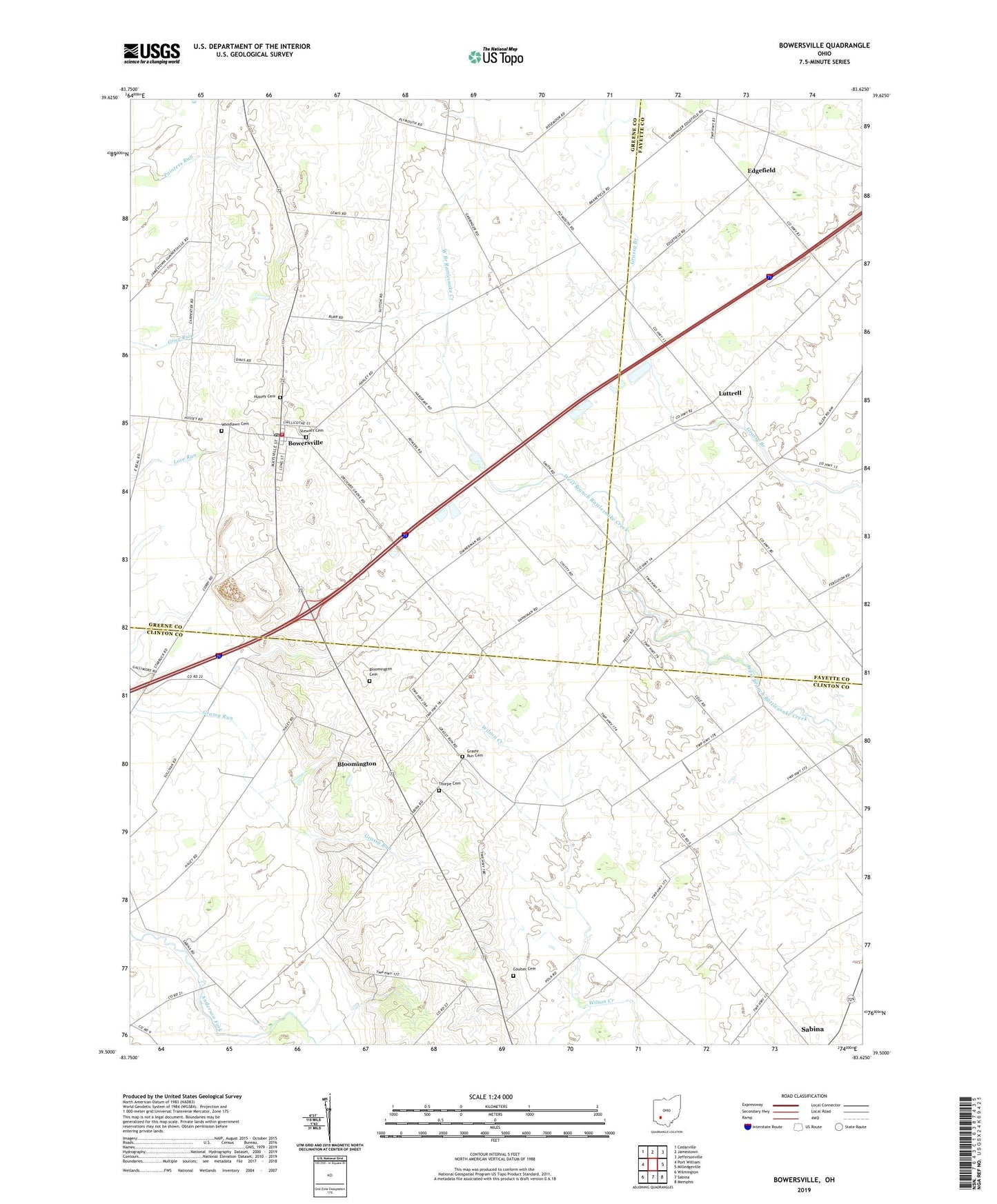
2023 topographic map quadrangle Bowersville in the state of Ohio. Scale: 1:24000. Based on the newly updated USGS 7.5' US Topo map series, this map is in the following counties: Clinton, Greene, Fayette. The map contains contour data, water features, and other items you are used to seeing on USGS maps, but also has updated roads and other features. This is the next generation of topographic maps. Printed on high-quality waterproof paper with UV fade-resistant inks.
Quads adjacent to this one:
West: Port William
Northwest: Cedarville
North: Jamestown
Northeast: Jeffersonville
East: Milledgeville
Southeast: Memphis
South: Sabina
Southwest: Wilmington
This map covers the same area as the classic USGS quad with code o39083e6.
Contains the following named places: Bloomington, Bloomington Cemetery, Bowersville, Bowersville Post Office, Burnstown School, Center, Center United Methodist Church, Coulter Cemetery, Dakin Chapel School, Edgefield, Edgefield Post Office, Grassy Run Cemetery, Grassy Run Church, Greenview South Elementary School, Hanshell Flying Apple Airport, Hussey Cemetery, Jefferson Township Fire Department, Lutrell Post Office, Luttrell, Luttrell School, Palmer School, Pearson Post Office, Pearsons, Pleasant Valley School, Riverside School, Stewart Cemetery, Tamarack School, Thorpe Cemetery, Township of Jefferson, Township of Wilson, Union School, Village of Bowersville, Woodlawn Cemetery, Woodside School, ZIP Codes: 45169, 45307