MyTopo
Urbana West Ohio US Topo Map
Couldn't load pickup availability
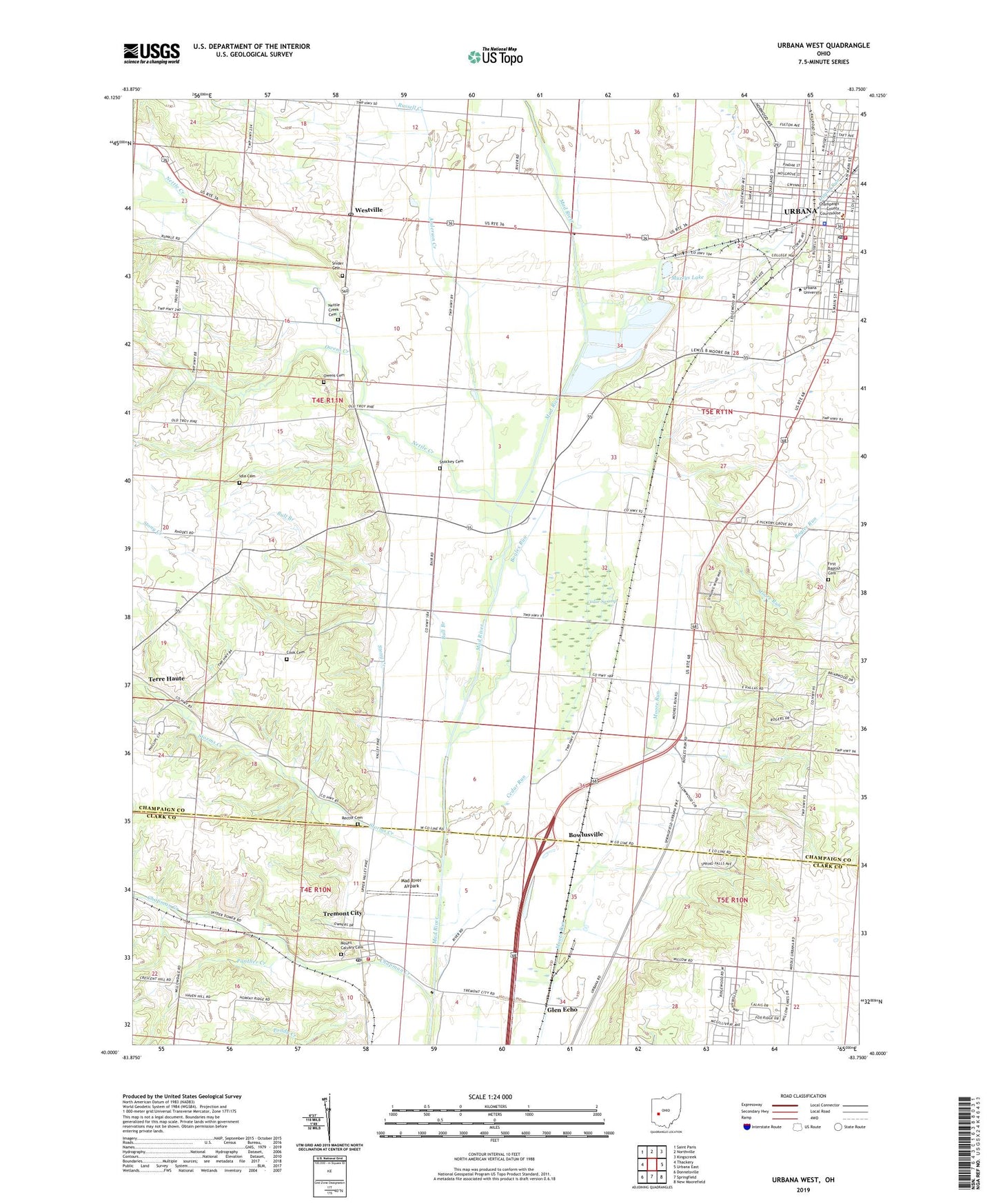
2023 topographic map quadrangle Urbana West in the state of Ohio. Scale: 1:24000. Based on the newly updated USGS 7.5' US Topo map series, this map is in the following counties: Champaign, Clark. The map contains contour data, water features, and other items you are used to seeing on USGS maps, but also has updated roads and other features. This is the next generation of topographic maps. Printed on high-quality waterproof paper with UV fade-resistant inks.
Quads adjacent to this one:
West: Thackery
Northwest: Saint Paris
North: Northville
Northeast: Kingscreek
East: Urbana East
Southeast: New Moorefield
South: Springfield
Southwest: Donnelsville
This map covers the same area as the classic USGS quad with code o40083a7.
Contains the following named places: Anderson Creek, Bogles Run, Bowlusville, Bowlusville United Methodist Church, Bull Branch, Bull School, Cedar Bog State Nature Preserve, Cedar Run, Cedar Swamp, Champaign County Courthouse, Champaign County Historical Society Museum, Champaign County Law Library, Champaign County Library, Champaign County Nursing Home, Champaign County Sheriff's Office, Chapman Creek, City of Urbana, Cook Cemetery, Dallas School, Dugan Run, First Baptist Cemetery, First Baptist Church, First Christian Church, First Presbyterian Church, Franklin School, Gainer Airport, Gentis Farms, German Township Fire and Emergency Medical Services Department Station 57, Glen Echo, Grace Methodist Episcopal Church, Harvest Square Mobile Home Park, Hickory Grove School, Hunter School, Idle Cemetery, Infirmary School, Mad River Airpark, Messiah Lutheran Church, Monument Square, Mount Calvary Cemetery, Muzzys Lake, Nettle Creek, Nettle Creek Cemetery, Nettleton, Nettleton Post Office, North Ward School, Owens Cemetery, Owens Creek, Owl Town, Panther Creek, Pence School, Rector Cemetery, Russell Creek, Saint Marys School, School Number 5, Shockey Cemetery, Snider Cemetery, South Ward School, Spunky Puddle, Stony Creek, Storms Creek, Swedenborgian Church, Township of Mad River, Tremont City, Tremont City Post Office, Urbana, Urbana City Hall, Urbana Fire and Emergency Medical Services Division, Urbana Friends Church, Urbana Junior College, Urbana Monument Square Historic District, Urbana Police Department, Urbana Post Office, Urbana United Methodist Church, Urbana Water Pollution Control Facility, Valley View Mobile Home Park, Village of Tremont City, Westville, Westville Post Office, Westville United Methodist Church, WKSW-FM (Urbana), ZIP Codes: 43078, 45372