MyTopo
Martinsville Ohio US Topo Map
Couldn't load pickup availability
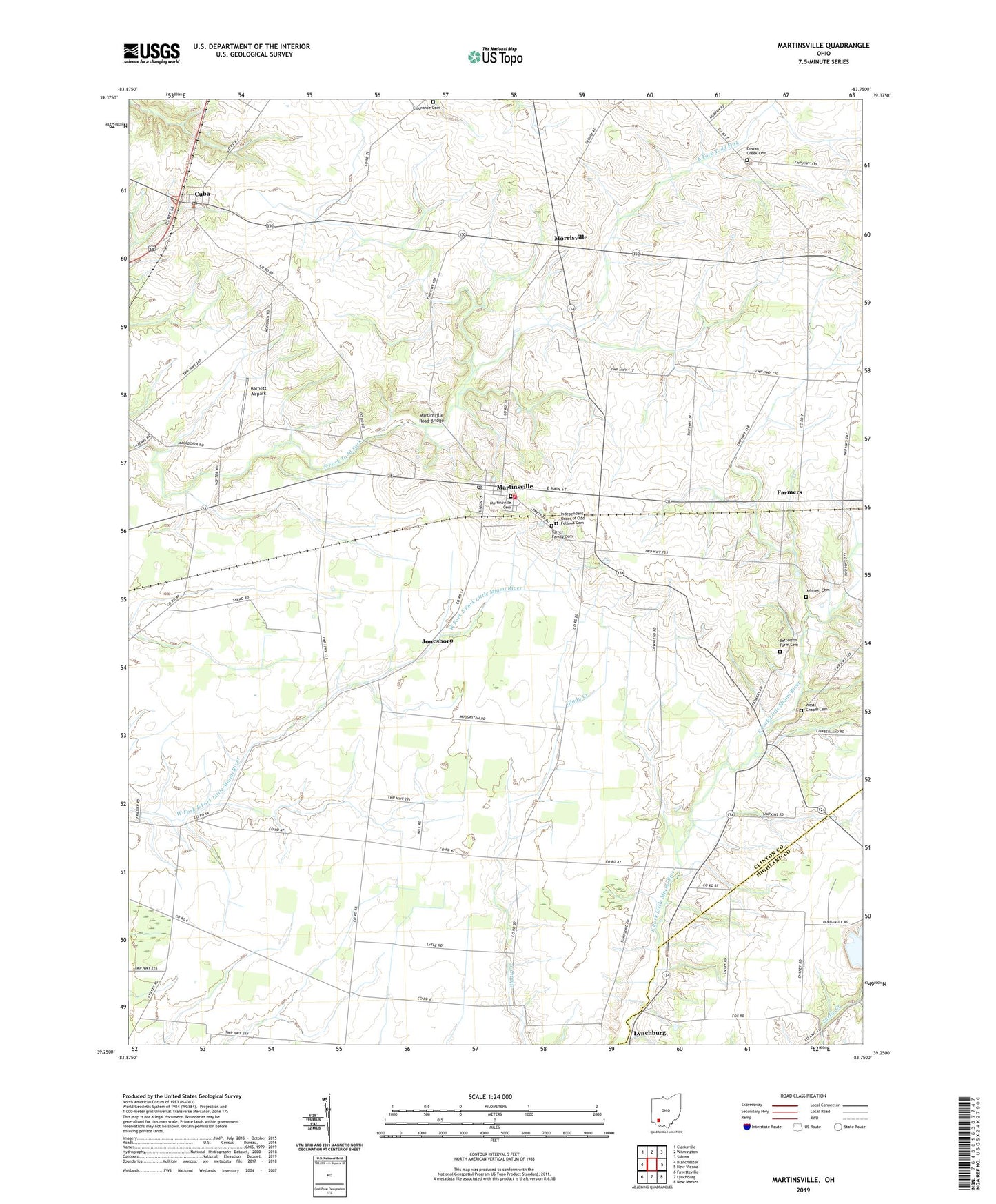
2023 topographic map quadrangle Martinsville in the state of Ohio. Scale: 1:24000. Based on the newly updated USGS 7.5' US Topo map series, this map is in the following counties: Clinton, Highland. The map contains contour data, water features, and other items you are used to seeing on USGS maps, but also has updated roads and other features. This is the next generation of topographic maps. Printed on high-quality waterproof paper with UV fade-resistant inks.
Quads adjacent to this one:
West: Blanchester
Northwest: Clarksville
North: Wilmington
Northeast: Sabina
East: New Vienna
Southeast: New Market
South: Lynchburg
Southwest: Fayetteville
This map covers the same area as the classic USGS quad with code o39083c7.
Contains the following named places: Barnett Airpark, Betterton Farm Cemetery, Big Onion, Clark Township Life Squad, Cowan Creek Cemetery, Cowans Creek Church, Cuba, Cuba Post Office, Farmers, Farmers Station Post Office, Glady Church, Glady School, Independent Order of Odd Fellows Cemetery, Johnson Cemetery, Jonesboro, Klocks Crossing, Lieurance Cemetery, Macedonia Church, Martinsville, Martinsville Cemetery, Martinsville Clark Township Fire / EMS Department, Martinsville Elementary School, Martinsville Post Office, Martinsville Road Bridge, Morrisville, Pfister Farm, Township of Clark, Township of Washington, Turner Cemetery, Village of Martinsville, Wallopsburg, West Chapel Cemetery, WSWO-FM (Wilmington), ZIP Code: 45146