MyTopo
Sabina Ohio US Topo Map
Couldn't load pickup availability
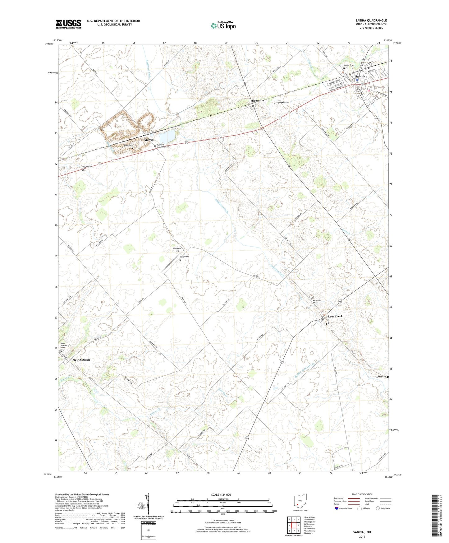
2023 topographic map quadrangle Sabina in the state of Ohio. Scale: 1:24000. Based on the newly updated USGS 7.5' US Topo map series, this map is in the following counties: Clinton. The map contains contour data, water features, and other items you are used to seeing on USGS maps, but also has updated roads and other features. This is the next generation of topographic maps. Printed on high-quality waterproof paper with UV fade-resistant inks.
Quads adjacent to this one:
West: Wilmington
Northwest: Port William
North: Bowersville
Northeast: Milledgeville
East: Memphis
Southeast: Leesburg
South: New Vienna
Southwest: Martinsville
This map covers the same area as the classic USGS quad with code o39083d6.
Contains the following named places: Brick School, Centerville Cemetery, Cherrybend Pheasant Farm, Church of Christ, East Clinton High School, Fairview School, Garface Cemetery, Hollister Field, Lees Creek, Lees Creek Post Office, Lees Creek United Church of Christ, Melvin, Melvin Post Office, Mount Olive School, New Antioch, New Antioch Cemetery, New Antioch Church of Christ, New Antioch Post Office, Powderlick, Powderlick School, Reesville, Reesville Post Office, Reesville United Methodist Church, Richland Methodist Cemetery, Richland Township House, Richland United Methodist Church, Rolfe Mobile Home Park, Sabina, Sabina - Richland - Wayne - Wilson Joint Fire District 2, Sabina Cemetery, Sabina Elementary School, Sabina Manor Estates, Sabina Municipal Building, Sabina Police Department, Sabina Post Office, Sabina Public Library, Sabina United Methodist Church, Sabina Water Treatment Plant, School Number 2, School Number 4, Simon Kenton School, Spurgeon Cemetery, Texas Cemetery, Township of Richland, Township of Wayne, Village of Sabina, Wade Cemetery, Wilson Cemetery, ZIP Code: 45166