MyTopo
McComb Ohio US Topo Map
Couldn't load pickup availability
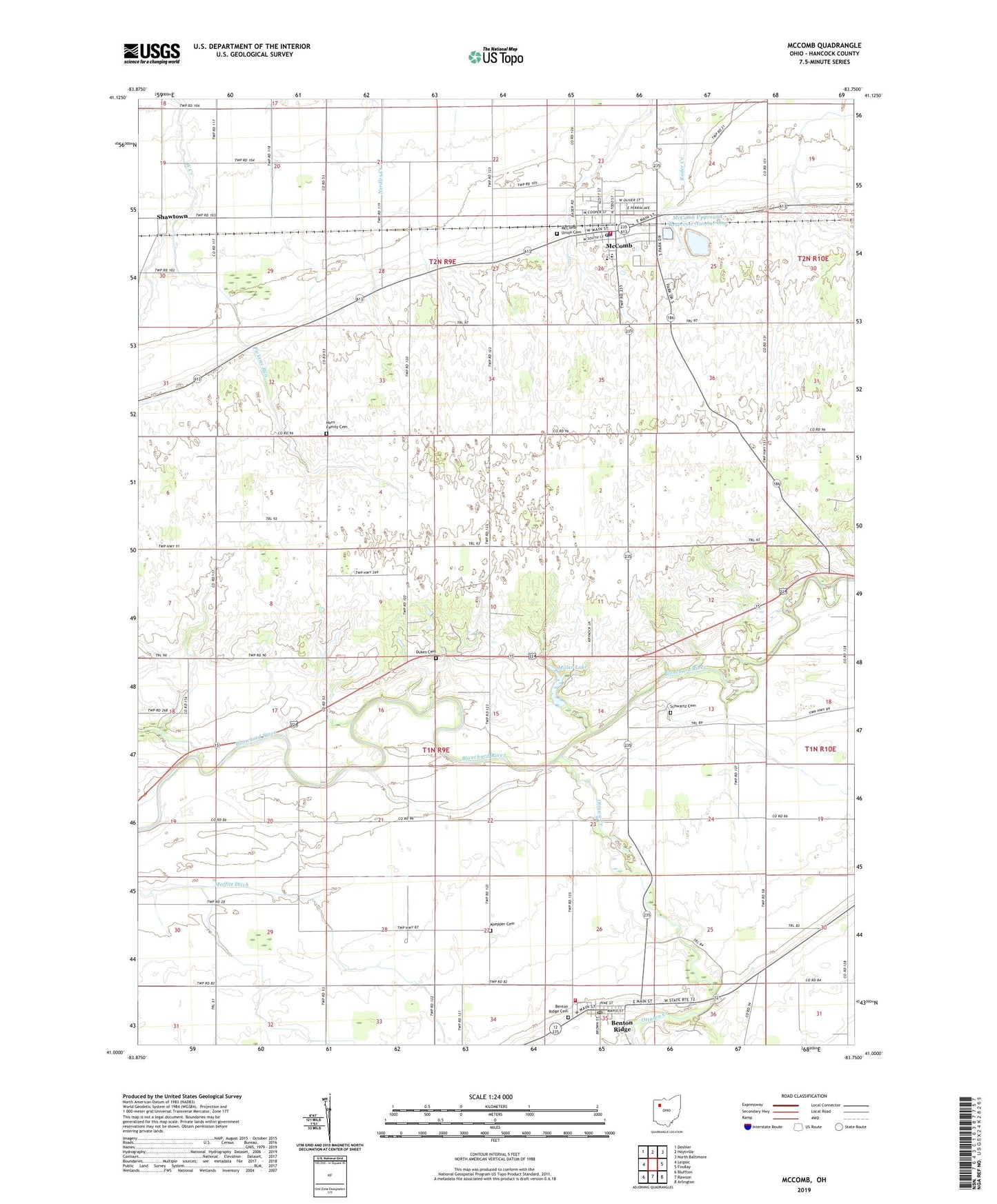
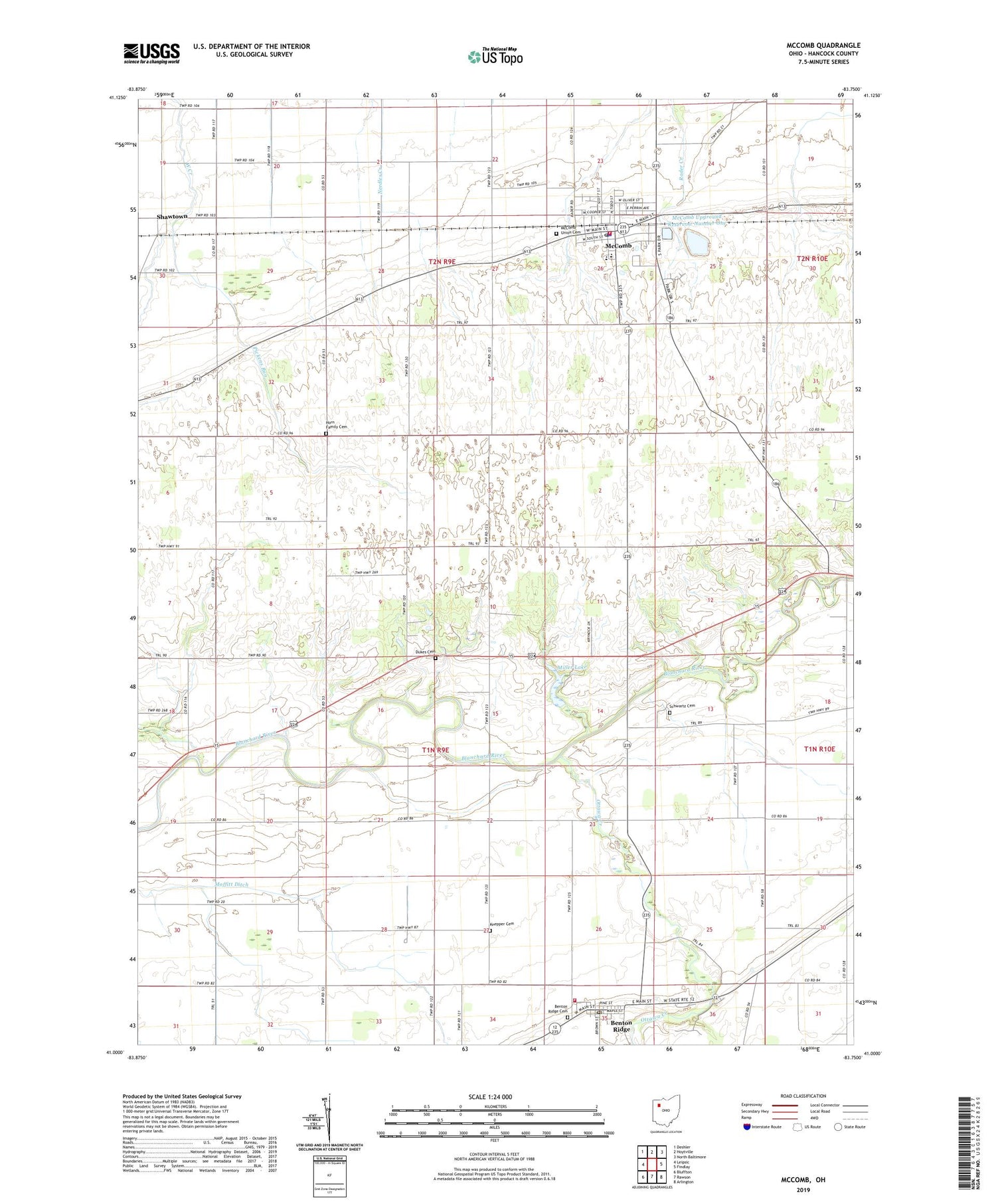
2019 topographic map quadrangle McComb in the state of Ohio. Scale: 1:24000. Based on the newly updated USGS 7.5' US Topo map series, this map is in the following counties: Hancock. The map contains contour data, water features, and other items you are used to seeing on USGS maps, but also has updated roads and other features. This is the next generation of topographic maps. Printed on high-quality waterproof paper with UV fade-resistant inks.
Quads adjacent to this one:
West: Leipsic
Northwest: Deshler
North: Hoytville
Northeast: North Baltimore
East: Findlay
Southeast: Arlington
South: Rawson
Southwest: Bluffton
Contains the following named places: Benton Post Office, Benton Ridge, Benton Ridge Cemetery, Benton Ridge Station, Blanchard Township Volunteer Fire Department, Center Church, Dukes Cemetery, Hillside Pines Mobile Home Park, Horn Family Cemetery, Indian Grove Cemetery, Knepper Cemetery, Lewisville, Litzenberg Memorial Woods, McComb, Mccomb Fire Department, McComb High School, Mccomb Police Department, McComb Post Office, McComb Union Cemetery, McComb Upground Reservoir Number One, McComb Upground Reservoir Number One Dam, McComb Upground Reservoir Number Two, McComb Upground Reservoir Number Two Dam, Miller Lake, Miller Lake Dam, Moffitt, Moffitt Ditch, Moffitt Post Office, Ottawa Creek, Pickens Run, Pleasant Hill Church, Pleasant Mccomb Portage Joint Ambulance District, Schwartz Cemetery, Shady Acres Golf Course, Shawtown, Shawtown Post Office, Township of Blanchard, Township of Pleasant, Trinity Baptist Church, Village of Benton Ridge, Village of McComb, ZIP Codes: 45816, 45858