MyTopo
Hoytville Ohio US Topo Map
Couldn't load pickup availability
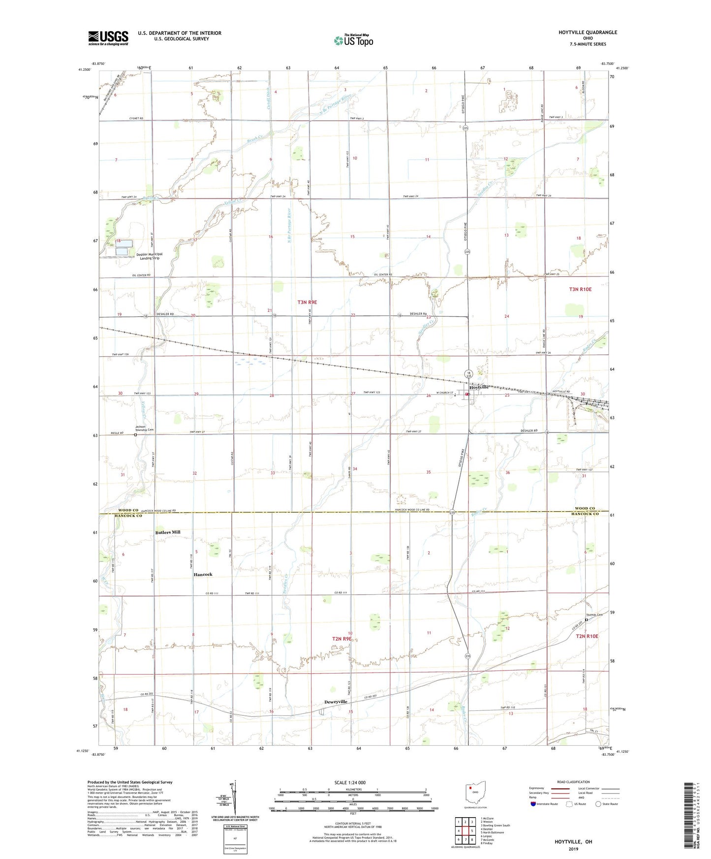
2023 topographic map quadrangle Hoytville in the state of Ohio. Scale: 1:24000. Based on the newly updated USGS 7.5' US Topo map series, this map is in the following counties: Wood, Hancock. The map contains contour data, water features, and other items you are used to seeing on USGS maps, but also has updated roads and other features. This is the next generation of topographic maps. Printed on high-quality waterproof paper with UV fade-resistant inks.
Quads adjacent to this one:
West: Deshler
Northwest: McClure
North: Weston
Northeast: Bowling Green South
East: North Baltimore
Southeast: Findlay
South: McComb
Southwest: Leipsic
This map covers the same area as the classic USGS quad with code o41083b7.
Contains the following named places: Bethel Church, Brethren Church, Brush Creek, Butlers Mill, Deshler Sewage Disposal, Deweyville, Deweyville Post Office, Hancock, Hoytville, Hoytville Fire Department, Hoytville Post Office, Jackson Middle School, Jackson Township Cemetery, North Ridgeville, Reyskens Dairy, Thomas Cemetery, Township of Jackson, Village of Hoytville, West Creek, Yellow Creek, ZIP Code: 43529