MyTopo
Deshler Ohio US Topo Map
Couldn't load pickup availability
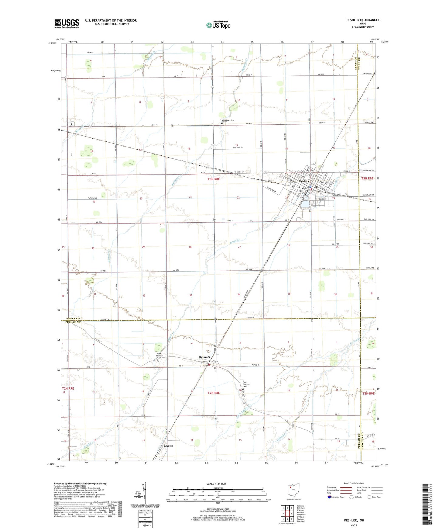
2023 topographic map quadrangle Deshler in the state of Ohio. Scale: 1:24000. Based on the newly updated USGS 7.5' US Topo map series, this map is in the following counties: Henry, Putnam, Wood, Hancock. The map contains contour data, water features, and other items you are used to seeing on USGS maps, but also has updated roads and other features. This is the next generation of topographic maps. Printed on high-quality waterproof paper with UV fade-resistant inks.
Quads adjacent to this one:
West: Hamler
Northwest: Malinta
North: McClure
Northeast: Weston
East: Hoytville
Southeast: McComb
South: Leipsic
Southwest: Ottawa
This map covers the same area as the classic USGS quad with code o41083b8.
Contains the following named places: Belmore, Belmore Fire Department, Belmore Post Office, Deshler, Deshler Elementary School, Deshler Fire Department, Deshler Municipal Landing Strip, Deshler Post Office, Deshler United Methodist Church, Deshler Village Police Department, East Belmore Cemetery, Eastland Acres Mobile Home Park, Edwin Wood Memorial Library, Farnham, Henry County South Joint Ambulance District Deshler Emergency Medical Services, Immaculate Conception Catholic Church, Immanuel Lutheran Church, Little Yellow Creek, Oakdale, Oakdale Post Office, Oakdale United Methodist Church, Patrick Henry High School, Presbyterian Church of Deshler, Saint Pauls United Methodist Church, Township of Bartlow, Village of Belmore, Village of Deshler, WBGU-TV (Bowling Green), West Belmore Cemetery, Woodlawn Cemetery, ZIP Code: 43516