MyTopo
Arcadia Ohio US Topo Map
Couldn't load pickup availability
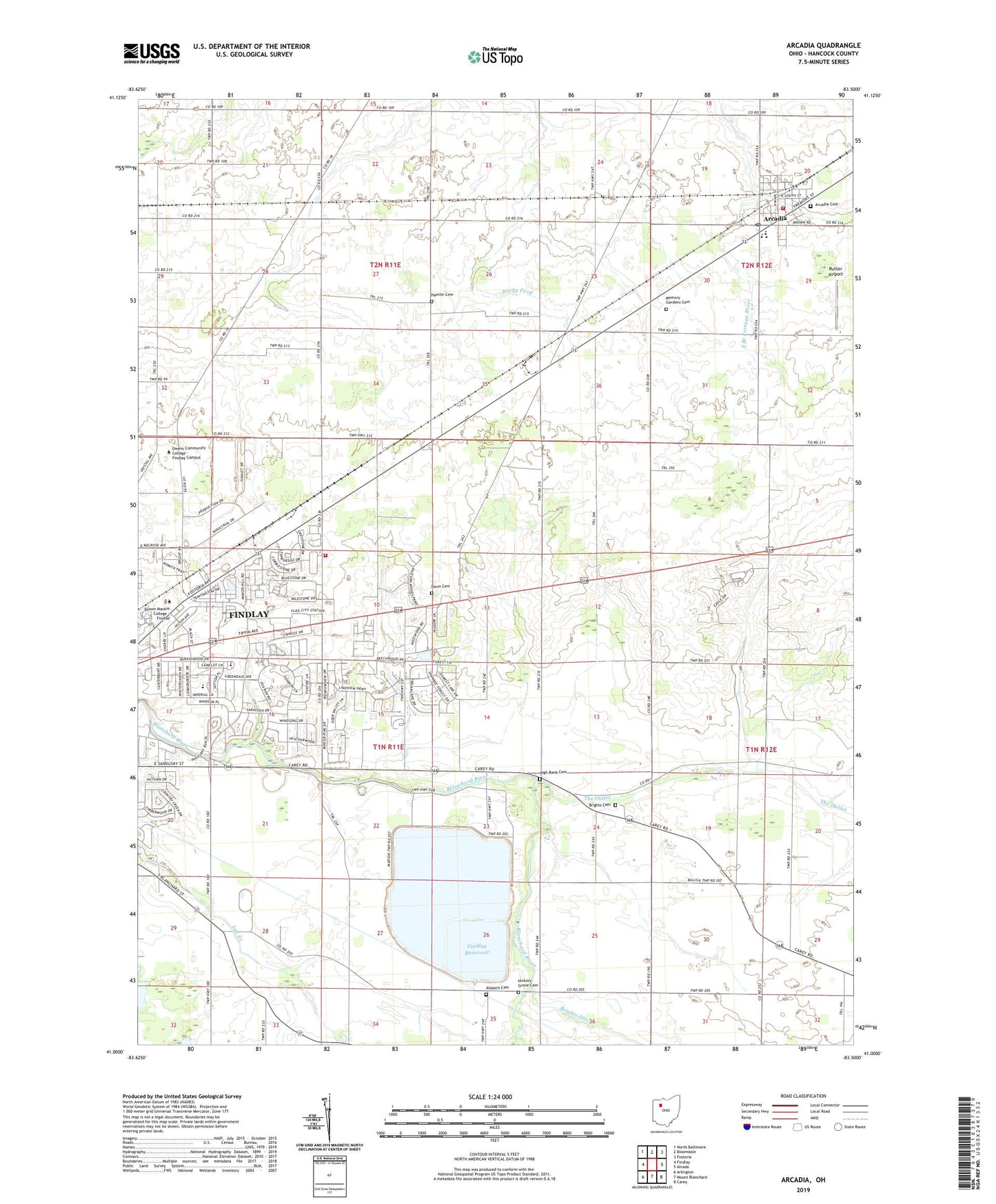
2023 topographic map quadrangle Arcadia in the state of Ohio. Scale: 1:24000. Based on the newly updated USGS 7.5' US Topo map series, this map is in the following counties: Hancock. The map contains contour data, water features, and other items you are used to seeing on USGS maps, but also has updated roads and other features. This is the next generation of topographic maps. Printed on high-quality waterproof paper with UV fade-resistant inks.
Quads adjacent to this one:
West: Findlay
Northwest: North Baltimore
North: Bloomdale
Northeast: Fostoria
East: Alvada
Southeast: Carey
South: Mount Blanchard
Southwest: Arlington
This map covers the same area as the classic USGS quad with code o41083a5.
Contains the following named places: Alspach Cemetery, Arcadia, Arcadia Cemetery, Arcadia Elementary School, Arcadia High School, Arcadia Post Office, Ark Church, Bethlehem United Methodist Church, Brights Cemetery, Chateau East, Cunningham Farm, Davis Cemetery, Eastowne Estates, Fairview Golf Course, Findlay Fire Department Far East Fire Station 4, Findlay Reservoir, Findlay Upground Reservoir Number One Dam, Findlay Upground Reservoir Number Two, Findlay Upground Reservoir Number Two Dam, Findlay Village Mall Shopping Center, Hamlin Cemetery, Hickory Grove Cemetery, High Bank Cemetery, Market Square Shopping Center, Memory Gardens Cemetery, Mount Zion United Methodist Church, Noel Farms, Rutter Airport, Salem United Methodist Church, Sattler Farms, Smith Dairy Farm, Spahr Jersey Farm, Stautzenberger College, Township of Cass, Township of Marion, Village of Arcadia, Washington Township Fire Department, Weaver Airport, WHMQ-FM (North Baltimore), Wilson Vance Elementary School, Wineland, ZIP Code: 44804