MyTopo
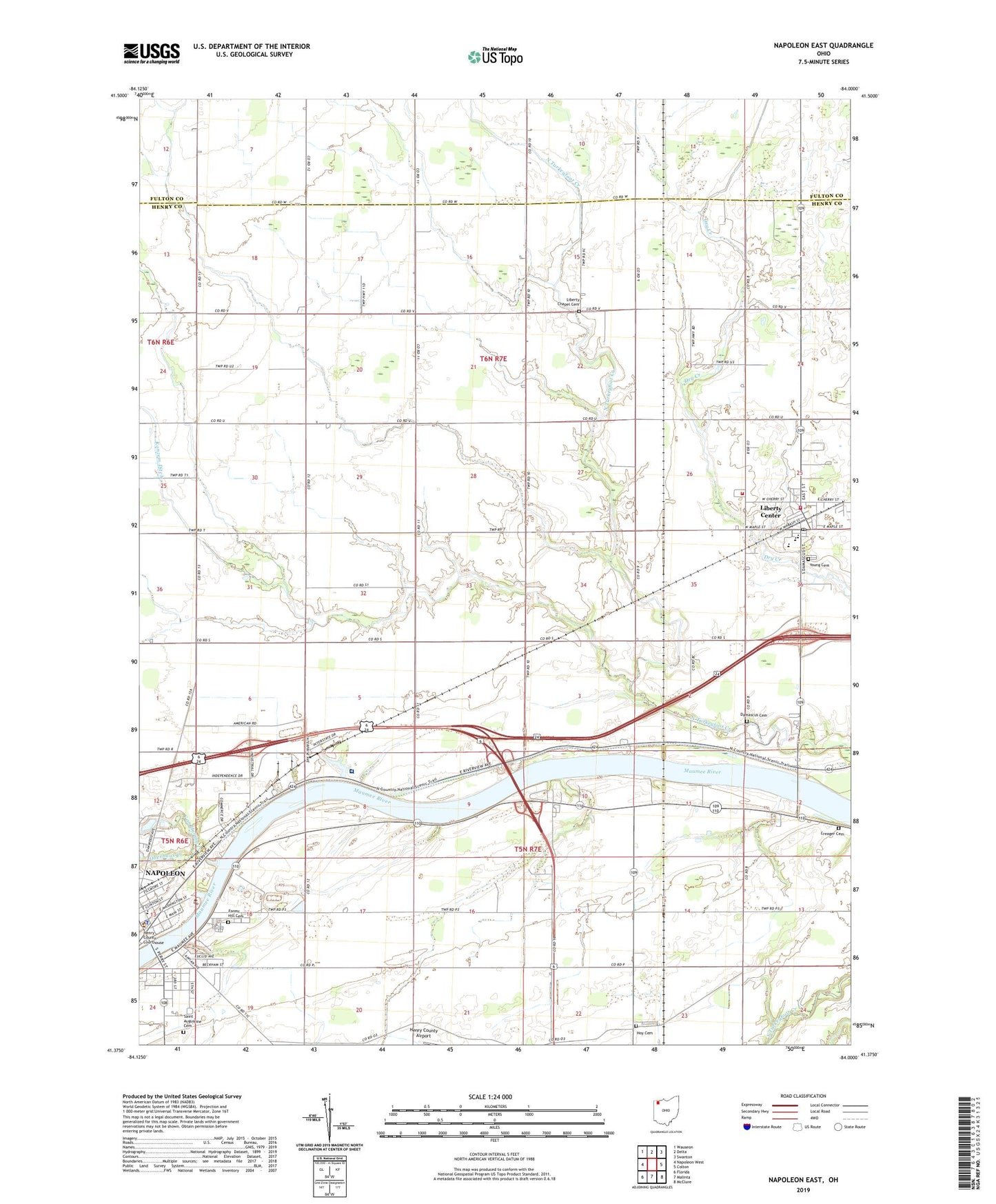
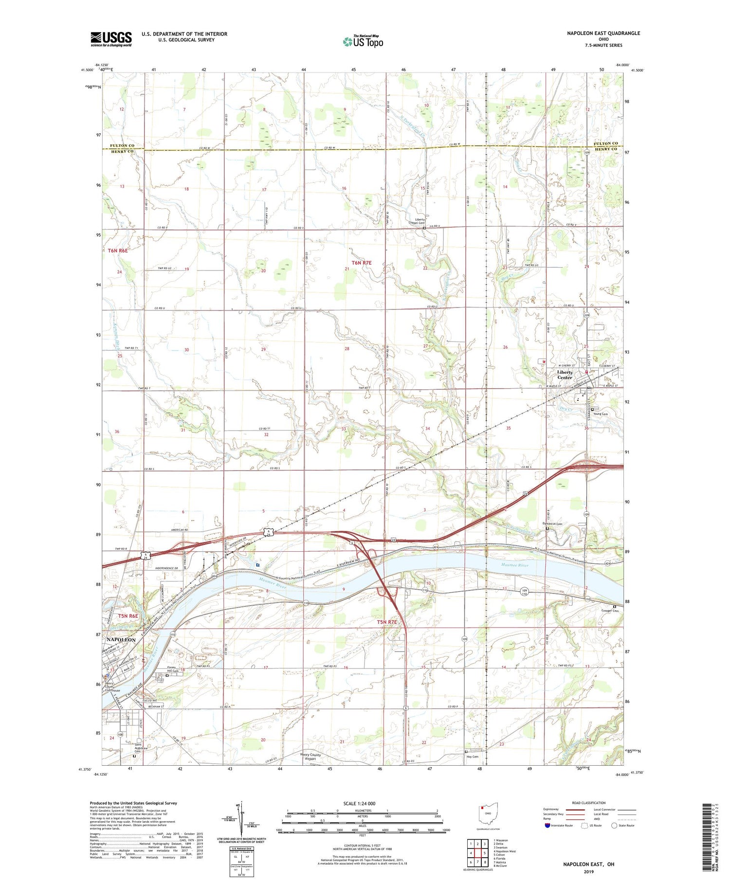
Napoleon East Ohio US Topo Map
Couldn't load pickup availability
2019 topographic map quadrangle Napoleon East in the state of Ohio. Scale: 1:24000. Based on the newly updated USGS 7.5' US Topo map series, this map is in the following counties: Henry, Fulton. The map contains contour data, water features, and other items you are used to seeing on USGS maps, but also has updated roads and other features. This is the next generation of topographic maps. Printed on high-quality waterproof paper with UV fade-resistant inks.
Quads adjacent to this one:
West: Napoleon West
Northwest: Wauseon
North: Delta
Northeast: Swanton
East: Colton
Southeast: McClure
South: Malinta
Southwest: Florida
Contains the following named places: City of Napoleon, Cloverleaf, Colonial Manor Mobile Home Park, Countryside Estates, Creager Cemetery, Damascus, Damascus Cemetery, Damascus Post Office, Forest Hill Cemetery, Henry County Courthouse, Henry County Fairground, Henry County Hospital, Henry County Jail, Henry County Sheriff's Office, Hoy Cemetery, Konzem Ditch, Liberty - Washington Township Fire and Rescue Department, Liberty Center, Liberty Center Elementary School, Liberty Center High School, Liberty Center Post Office, Liberty Center-Colton United Methodist Church, Liberty Chapel Cemetery, Liberty Chapel United Methodist Church, Oak Mobile Home Court, Oberhaus Creek, Pilgrimage Holiness Church, Ratsville, Saint Augustine Catholic Church, Saint Augustine Cemetery, Saint Augustine School, Saint Pauls Lutheran Church, Sharon United Methodist Church, South Public School, Southside School, Spiess Trailer Park, Township of Liberty, Van Hyning Creek, Victory Chapel, Village of Liberty Center, Young Cemetery