MyTopo
New Burlington Ohio US Topo Map
Couldn't load pickup availability
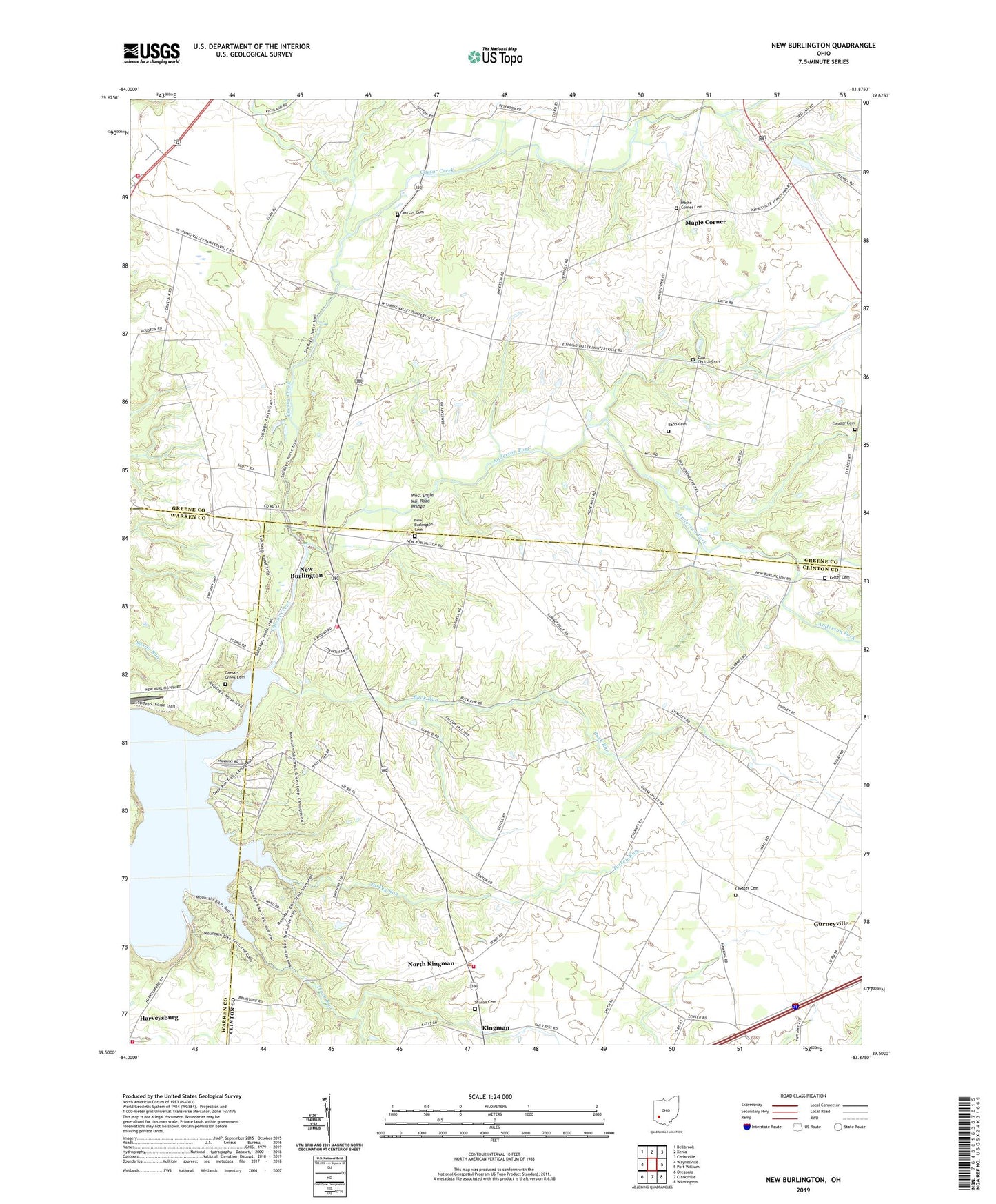
2019 topographic map quadrangle New Burlington in the state of Ohio. Scale: 1:24000. Based on the newly updated USGS 7.5' US Topo map series, this map is in the following counties: Greene, Clinton, Warren. The map contains contour data, water features, and other items you are used to seeing on USGS maps, but also has updated roads and other features. This is the next generation of topographic maps. Printed on high-quality waterproof paper with UV fade-resistant inks.
Quads adjacent to this one:
West: Waynesville
Northwest: Bellbrook
North: Xenia
Northeast: Cedarville
East: Port William
Southeast: Wilmington
South: Clarksville
Southwest: Oregonia
Contains the following named places: Anderson Fork, Babb Cemetery, Babbtown School, Buck Run, Buck Run School, Caesar Creek Alpaca Ranch, Caesar Creek Church, Caesars Creek Cemetery, Chester Cemetery, Chester Church, Chester School, Chester Township New Burlington Fire and Rescue Station 1, Chester Township New Burlington Fire and Rescue Station 2, Cornstalk, Craig School, Eleazer Church, Eleazor Cemetery, Fairview School, Fricke Airport, Glady School, Gurneyville, Gurneyville Post Office, Haines School, Hoffman School, Keiter Cemetery, Kingman, Kingman Post Office, Maple Corner, Maple Corner Cemetery, Massie Township Fire Department, McKay Station Post Office, McKays, McKnight School, Mercer Cemetery, New Burlington, New Burlington Cemetery, New Burlington Post Office, North Kingman, Painters Run, Peterson School, Pogue Corners, Richland Church, Richland School, Sharon Cemetery, Sharon United Methodist Church, Spring Valley School, Spring Valley Township Fire Department, Township of Chester, Township of Spring Valley, Trace Run, Turkey Run, Village of Harveysburg, West Engle Mill Road Bridge, Zoar Church, Zoar Church Cemetery