MyTopo
Waynesville Ohio US Topo Map
Couldn't load pickup availability
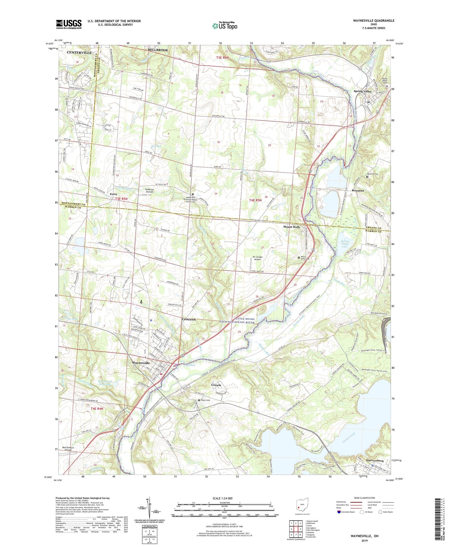
2023 topographic map quadrangle Waynesville in the state of Ohio. Scale: 1:24000. Based on the newly updated USGS 7.5' US Topo map series, this map is in the following counties: Warren, Greene, Montgomery. The map contains contour data, water features, and other items you are used to seeing on USGS maps, but also has updated roads and other features. This is the next generation of topographic maps. Printed on high-quality waterproof paper with UV fade-resistant inks.
Quads adjacent to this one:
West: Springboro
Northwest: Dayton South
North: Bellbrook
Northeast: Xenia
East: New Burlington
Southeast: Clarksville
South: Oregonia
Southwest: Lebanon
This map covers the same area as the classic USGS quad with code o39084e1.
Contains the following named places: Air Jordan Airport, Anderson Airfield, Bear Branch, Caesar Creek Dike B Dam, Caesar Creek Dike F Dam, Camp Stonybrook, Clear Springs School, College Hill School, Corwin, Corwin Pentecostal Church, Crosswick, Dakins Run, Ferry, Ferry Post Office, Fry Field Airport, Furnas Ditch, Glady Run, Glass Pond, Glass Pond Dam, Harmony Grove School, Harveysburg, Harveysburg Police Department, Harveysburg Post Office, Main Street Historic District, Miami Cemetery, Middle Run, Middle Run Church, Middle Run Primitive Baptist Church Cemetery, Mill Run, Mount Holly, Mount Holly Cemetery, Newman Run, Poore Pond, Poore Pond Dam, Rattail Branch, Red Stewart Airfield, Rooks Ravine Park, Roxanna, Roxanna Cemetery, Roxanna Post Office, Saint Marys Episcopal Church, Sandy Run, Satterthwaites Run, School Number 10, School Number 5, Shaffers Run, Spring Valley, Spring Valley Aggregates Pit, Spring Valley Baptist Church, Spring Valley Cemetery, Spring Valley Estates, Spring Valley Lake, Spring Valley Lake Dam, Spring Valley Post Office, Spring Valley United Methodist Church, Spring Valley Wildlife Area, Stoneybrook Farm Lake, Stoneybrook Farm Lake Dam, Sugar Creek, Sugar Creek Church, Sugar Grove School, Township of Sugarcreek, Township of Wayne, Treeline Park, Village of Corwin, Village of Spring Valley, Village of Waynesville, Wayne Township Fire and Emergency Medical Services Station 91, Waynesville, Waynesville Elementary School, Waynesville Friends Cemetery, Waynesville High School, Waynesville Methodist Church, Waynesville Police Department, Waynesville Post Office, ZIP Codes: 45032, 45068, 45370