MyTopo
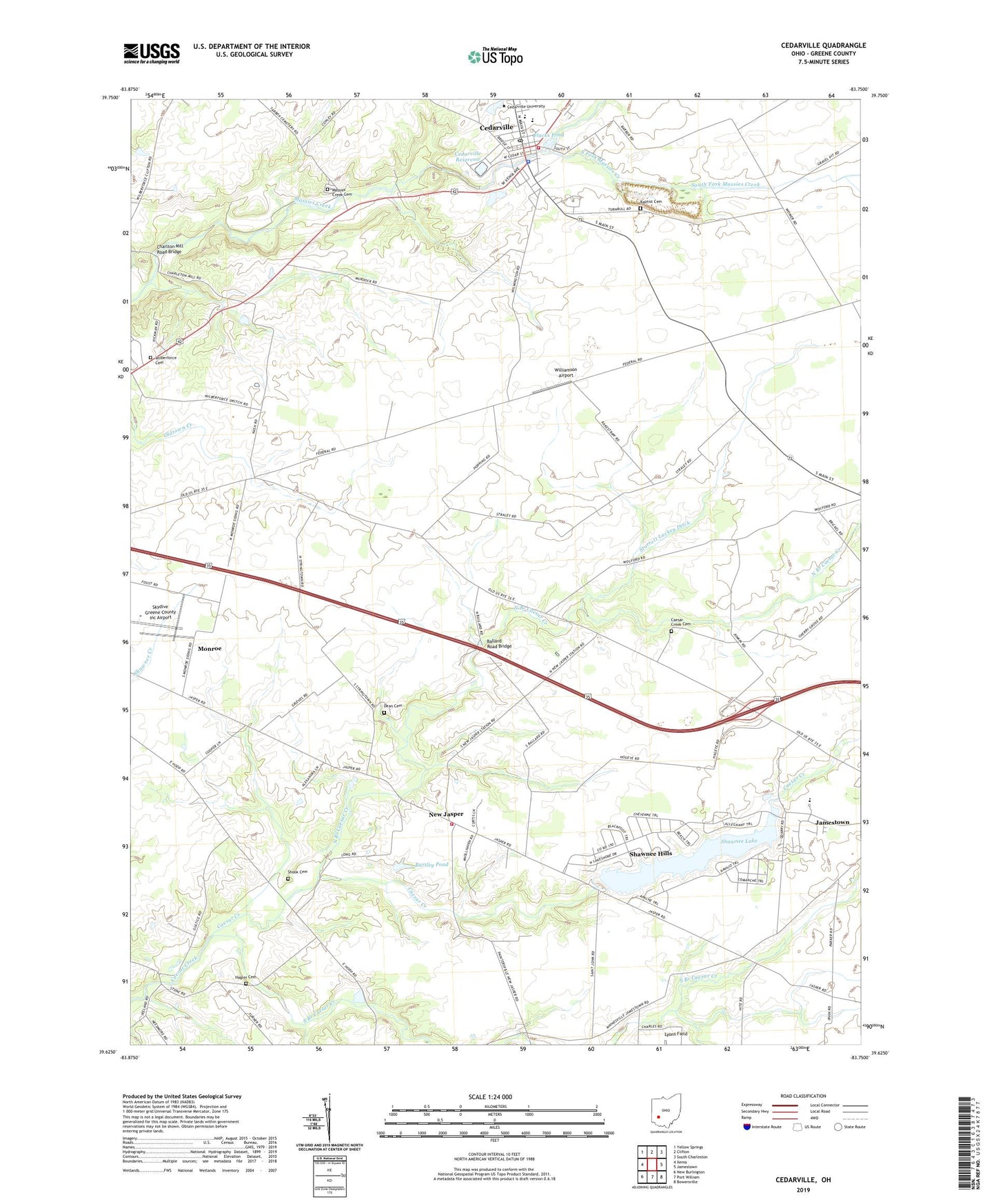
Cedarville Ohio US Topo Map
Couldn't load pickup availability
2023 topographic map quadrangle Cedarville in the state of Ohio. Scale: 1:24000. Based on the newly updated USGS 7.5' US Topo map series, this map is in the following counties: Greene. The map contains contour data, water features, and other items you are used to seeing on USGS maps, but also has updated roads and other features. This is the next generation of topographic maps. Printed on high-quality waterproof paper with UV fade-resistant inks.
Quads adjacent to this one:
West: Xenia
Northwest: Yellow Springs
North: Clifton
Northeast: South Charleston
East: Jamestown
Southeast: Bowersville
South: Port William
Southwest: New Burlington
This map covers the same area as the classic USGS quad with code o39083f7.
Contains the following named places: Anderson School, Apple Technology Resource Center, Ballard Road Bridge, Baptist Cemetery, Bartley Pond, Bartley Pond Dam, Caesar Creek Cemetery, Cedar Cliff School, Cedarville, Cedarville Church of the Nazarene, Cedarville Police Department, Cedarville Post Office, Cedarville Quarry, Cedarville Reservoir, Cedarville Reservoir Dam, Cedarville Township Volunteer Fire and Emergency Medical Services Department, Cedarville United Methodist Church, Cedarville United Presbyterian Church, Cedarville University, Cedarville University Emergency Medical Services, Centennial Library, Charlton Mill Road Bridge, Collins Hall, Dean Cemetery, Duncan School, Eastpoint School, Federal School, First Church of God, Flacks Pond, Founders Hall, Grace Baptist Church, Hagler Cemetery, Hazeldell School, Hyslop School, Lucinda Cook Laboratory School, Lyons Field, Maddox Hall, Massies Creek Cemetery, Milner Business Administration Building, Monroe, Myers School, New Jasper, New Jasper Fire Department, New Jasper Post Office, North Branch Caesar Creek, North Fork Massies Creek, Oldtown Creek School, Patterson Clinic, Pattersons Corner, Peterson Park, School Number 5, Schooley School, Seaman Park, Shawnee Hills, Shawnee Hills Census Designated Place, Shawnee Lake, Shawnee Lake Dam, Shook Cemetery, Silver Springs, Skydive Greene County Inc Airport, South Branch Caesar Creek, South Fork Massies Creek, Starrett Lackey Ditch, Stevens Student Center, Stringtown, Township of Cedarville, Township of New Jasper, Tyler Digital Communications Center, Village of Cedarville, WCSU-FM (Wilberforce), West Hall, Wilberforce Cemetery, William Patrick McPherson Memorial Stadium, Williams Hall, Williamson Airport, Williamson Mound State Memorial, Zaza School


