MyTopo
Polk Ohio US Topo Map
Couldn't load pickup availability
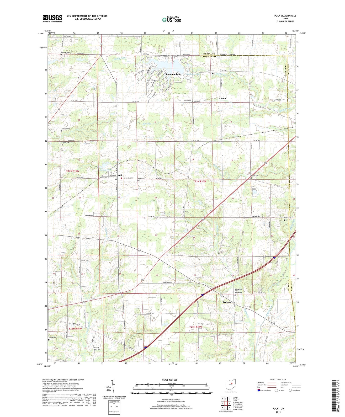
2023 topographic map quadrangle Polk in the state of Ohio. Scale: 1:24000. Based on the newly updated USGS 7.5' US Topo map series, this map is in the following counties: Ashland, Medina, Wayne. The map contains contour data, water features, and other items you are used to seeing on USGS maps, but also has updated roads and other features. This is the next generation of topographic maps. Printed on high-quality waterproof paper with UV fade-resistant inks.
Quads adjacent to this one:
West: Ashland North
Northwest: Nova
North: Sullivan
Northeast: Lodi
East: West Salem
Southeast: New Pittsburg
South: Jeromesville
Southwest: Ashland South
This map covers the same area as the classic USGS quad with code o40082h2.
Contains the following named places: Albion, Albion Cemetery, Albion Post Office, Burge Cemetery, Cannon Cemetery, Chilcote Cemetery, Cinnamon Lake, Cinnamon Lake Census Designated Place, Cinnamon Lake Dam, Dawson Farm, Evangelical Church Graveyard, France Farms, Hidden Acres Mobile Home Park, Hopewell Cemetery, King Cemetery, Mount Pleasant Church, Pleasant Valley Cemetery, Pleasant Valley Church, Polk, Polk Cemetery, Polk Elementary School, Polk Jackson Perry Fire Department, Polk Post Office, Redhaw, Redhaw Creek, Redhaw Post Office, Rickle Cemetery, Ripple Cemetery, Saint Johns Church, Spidel Farm, Starkey Pond, Starkey Pond Dam, Swope Cemetery, Township of Jackson, Village of Polk, ZIP Code: 44866