MyTopo
Oceola Ohio US Topo Map
Couldn't load pickup availability
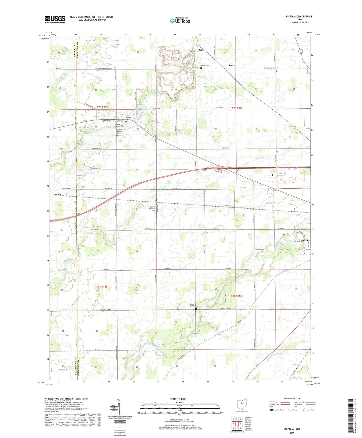
2019 topographic map quadrangle Oceola in the state of Ohio. Scale: 1:24000. Based on the newly updated USGS 7.5' US Topo map series, this map is in the following counties: Crawford, Wyandot. The map contains contour data, water features, and other items you are used to seeing on USGS maps, but also has updated roads and other features. This is the next generation of topographic maps. Printed on high-quality waterproof paper with UV fade-resistant inks.
Quads adjacent to this one:
West: Nevada
Northwest: Sycamore
North: Lykens
Northeast: Chatfield
East: Bucyrus
Southeast: Caledonia
South: Monnett
Southwest: Morral
Contains the following named places: American Church, Bethel Cemetery, Bucyrus Township Fire Department, Camp Michael, Carmean Woods State Nature Preserve, German Reformed Cemetery, Glenville, Holmes Township Volunteer Fire Department, Holmes-Liberty School, Mount Zion Cemetery, Mount Zion United Methodist Church, Oceola, Oceola Census Designated Place, Oceola Number 1 Cemetery, Oceola Number 2 Cemetery, Oceola Number 3 Cemetery, Oceola Post Office, Oceola United Methodist Church, Paul B Sears Woods State Nature Preserve, Quarry Lake, Spore, Township of Bucyrus, Township of Holmes, Township of Tod, Wayside Christian School, Wynford High School, Wynford Middle School