MyTopo
Prospect Ohio US Topo Map
Couldn't load pickup availability
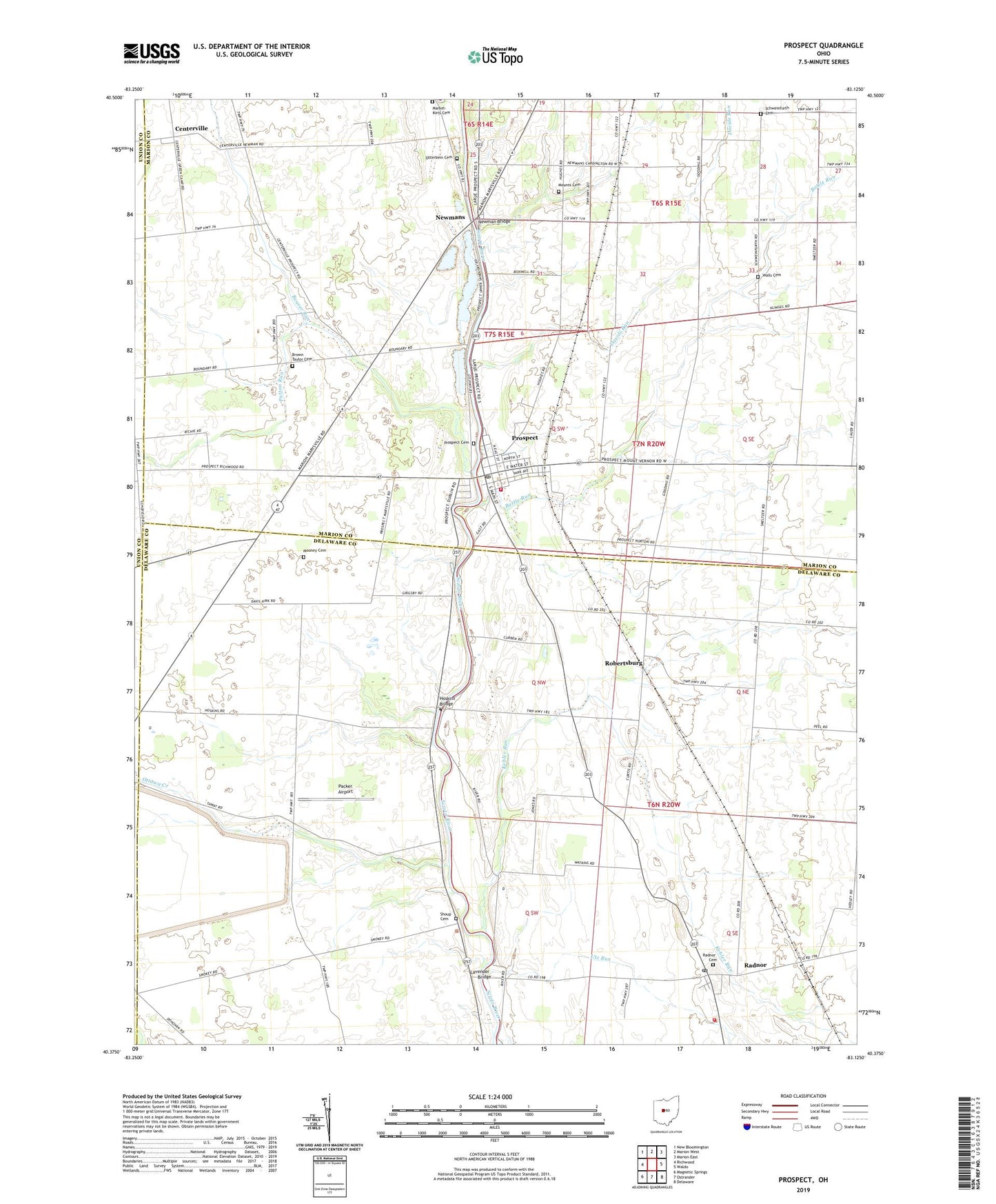
2019 topographic map quadrangle Prospect in the state of Ohio. Scale: 1:24000. Based on the newly updated USGS 7.5' US Topo map series, this map is in the following counties: Delaware, Marion, Union. The map contains contour data, water features, and other items you are used to seeing on USGS maps, but also has updated roads and other features. This is the next generation of topographic maps. Printed on high-quality waterproof paper with UV fade-resistant inks.
Quads adjacent to this one:
West: Richwood
Northwest: New Bloomington
North: Marion West
Northeast: Marion East
East: Waldo
Southeast: Delaware
South: Ostrander
Southwest: Magnetic Springs
Contains the following named places: Battle Run, Battle Run Fire Department, Beaver Run, Bethlehem, Brown Taylor Cemetery, Buckeye Valley Middle School, Centerville, Davids Run, Drumm School, Elgin South Elementary School, Gast Corner, Gooding Corners, Hoskins Bridge, Kebler Run, Kerr Corner, Lavender Bridge, Markel-Kirts Cemetery, Meredith, Mooney Cemetery, Mount Union Church of the United Brethren in Christ, Mounts Cemetery, Newman Bridge, Newmans, Norton Post Office, Ottawa Creek, Ottawa School, Otterbein Cemetery, Otterbine Church, Packer Airport, Patton Run, Prospect, Prospect Cemetery, Prospect Post Office, Radnor, Radnor Cemetery, Radnor Census Designated Place, Radnor Post Office, Radnor Township Volunteer Fire Department, Robertsburg, Schweinfurth Cemetery, Shiloh Church, Shoup Cemetery, Thompson Chapel, Township of Prospect, Township of Radnor, Township of Thompson, Trinity Evangelical Lutheran Church, Utz Run, Village of Prospect, Walls Cemetery, Williams School, ZIP Codes: 43066, 43342