MyTopo
Wills Creek Ohio US Topo Map
Couldn't load pickup availability
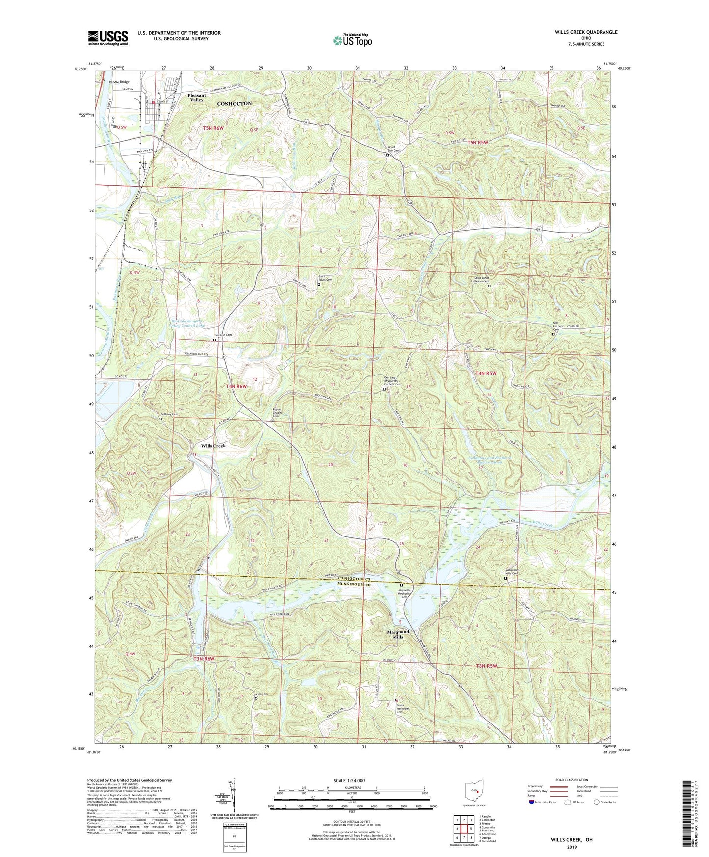
2023 topographic map quadrangle Wills Creek in the state of Ohio. Scale: 1:24000. Based on the newly updated USGS 7.5' US Topo map series, this map is in the following counties: Coshocton, Muskingum. The map contains contour data, water features, and other items you are used to seeing on USGS maps, but also has updated roads and other features. This is the next generation of topographic maps. Printed on high-quality waterproof paper with UV fade-resistant inks.
Quads adjacent to this one:
West: Conesville
Northwest: Randle
North: Coshocton
Northeast: Fresno
East: Plainfield
Southeast: Bloomfield
South: Otsego
Southwest: Adamsville
This map covers the same area as the classic USGS quad with code o40081b7.
Contains the following named places: Adams School, Bacon, Bacon Post Office, Bacon Run School, Bethany Cemetery, Bethany Methodist Episcopal Church, Big Run, Blue Row, Brelsford Run, BSA-Muskingum Valley Council Lake, Camp Fredrickson, Clark School, Clowville, Columbus and Southern Pond 0116-00, Coshocton Landfill, Emler Methodist Cemetery, Franklin Cemetery, Franklin Methodist Church, Marquand Mills, Marquands Mills Cemetery, Maysville, Maysville Methodist Cemetery, Mount Zion Cemetery, Old Catholic Cemetery, Our Lady of Lourdes Catholic Cemetery, Our Lady of Lourdes Church, Pinegrove School, Pleasant Valley, Pleasant Valley Baptist Church, Pleasant Valley School, Randle Bridge, Robinson Run, Robinson School, Rock Run, Royer Chapel, Royers Chapel Cemetery, Saint Johns Lutheran Cemetery, Saint Pauls Cemetery, Saint Pauls Church, Saltworks School, Scheetz Tree Farm, Science Hill School, Starkey School, Three Rivers Fire Department Station 2, Township of Franklin, Trio School, Wills Creek, Wills Creek Dam, Wills Creek Lake, Will's Creek Post Office, Zion Cemetery, Zion Evangelical Lutheran Church