
MyTopo
Ravenna Ohio US Topo Map
Couldn't load pickup availability
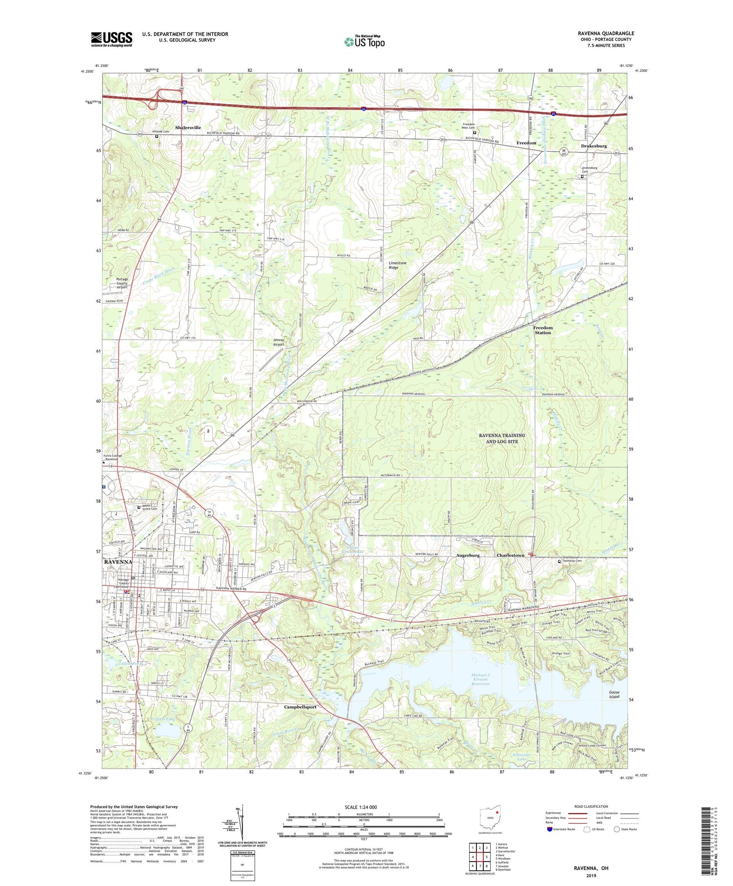
2019 topographic map quadrangle Ravenna in the state of Ohio. Scale: 1:24000. Based on the newly updated USGS 7.5' US Topo map series, this map is in the following counties: Portage. The map contains contour data, water features, and other items you are used to seeing on USGS maps, but also has updated roads and other features. This is the next generation of topographic maps. Printed on high-quality waterproof paper with UV fade-resistant inks.
Quads adjacent to this one:
West: Kent
Northwest: Aurora
North: Mantua
Northeast: Garrettsville
East: Windham
Southeast: Deerfield
South: Atwater
Southwest: Suffield
Contains the following named places: Alger Dairy, Augerburg, Barrel Run, Beechwood School, Bixon Creek, Campbellsport, Campells Port Post Office, Carlin Elementary School, Charlestown, Charlestown Post Office, Charlestown Station, Charlestown Township Cemetery, Charlestown Township Volunteer Fire Department, Charlestown United Methodist Church, Chestnut Hill Golf Course, Church of God, City of Ravenna, Clara Root Creek, Collins Pond, Countryside Estates, Crane Black Ditch, Crystal Lake, Desatnik Tree Farms, Drakesburg, Drakesburg Cemetery, East Main Street Historic District, Edgewood Mobile Home Park, Evans Farm, Evergreen Village, Fair Acres, First Christian Church, First Church of Christ Scientist, First Church of the Nazarene, First Congregational Church, First Congregational Church of Freedom, First United Methodist Church of Ravenna, Freedom, Freedom Post Office, Freedom Station, Freedom Station Post Office, Freedom West Cemetery, Goose Island, Grace Episcopal Church, Grand View Farms, Guilitto Farm, Hamlet Park, Harmon Brook, Havres Woods Park, Heasley Farm, Highland Avenue School, Hillside Cemetery, Hinkley Creek, Immaculate Conception Roman Catholic Church, Immaculate Conception School, Indian Canoe Lake, Indian Canoe Lake Dam, Jetway Airport, Kaiser Farm, Liberty Airpark, Lime Ridge School, Limestone Ridge, Maple Crest Farms, Maple Del Manor, Maple Grove Cemetery, Michael J Kirwan Reservoir, North East Ambulance Service, Ohio State Highway Patrol - Ravenna Patrol Post, Portage County, Portage County Airport, Portage County Courthouse, Promise Land Farm, Ravenna, Ravenna Fire Department, Ravenna High School, Ravenna Police Department, Ravenna Post Office, Redgate Farm, Reed Memorial Library, Regency Hospital - Ravenna, Robinson Memorial Hospital Heliport, Rogers Farm, Saint Pauls Lutheran Church, Schneider Lake, Schneider Lake Dam, Shalersville, Shalersville Elementary School, Shalersville Post Office, Tappan Elementary School, Township of Charlestown, Township of Freedom, Township of Shalersville, University Hospitals Portage Medical Center, West Boat Ramp, Windmill Lakes Golf Course, ZIP Code: 44266


