MyTopo
Windham Ohio US Topo Map
Couldn't load pickup availability
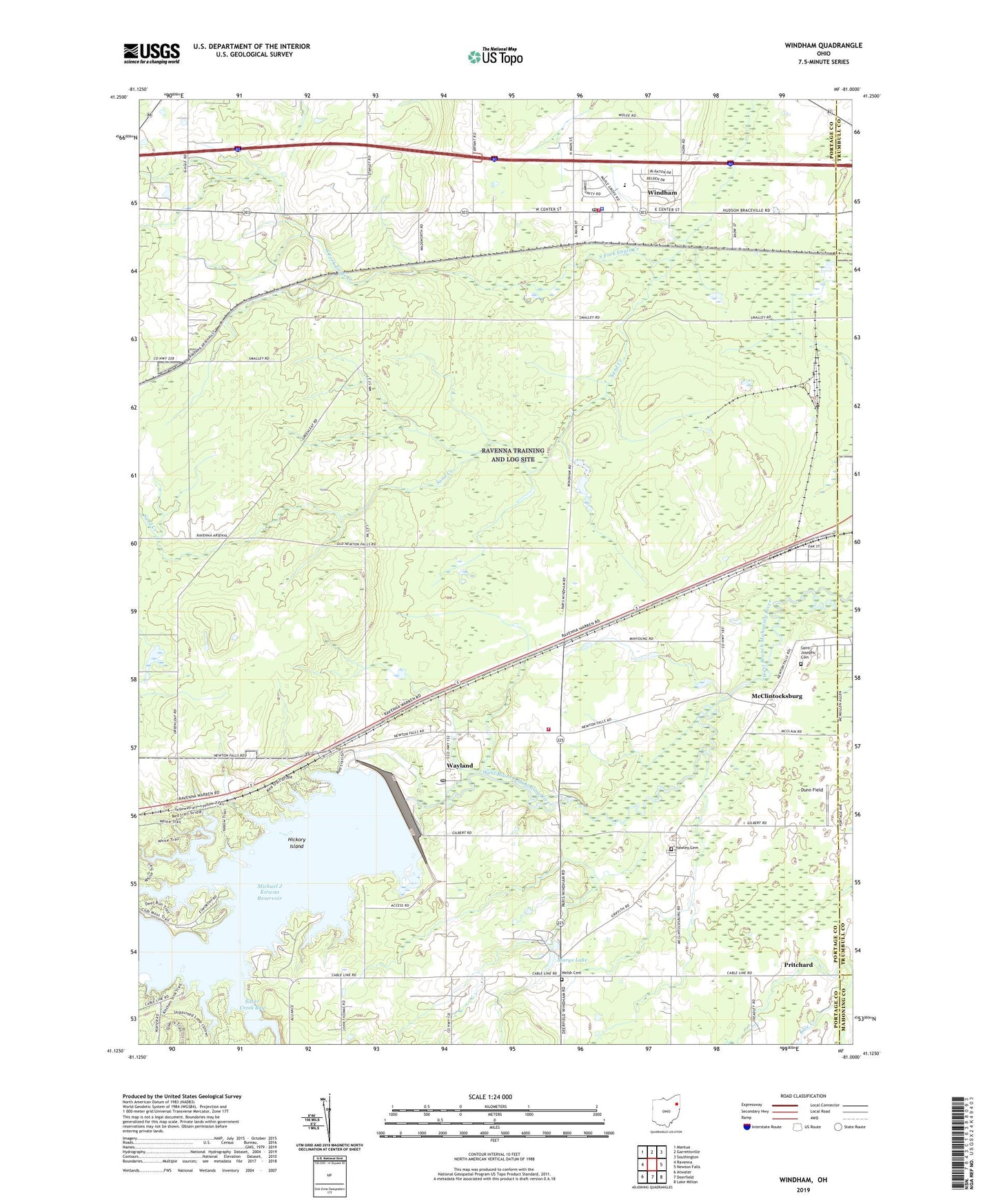
2023 topographic map quadrangle Windham in the state of Ohio. Scale: 1:24000. Based on the newly updated USGS 7.5' US Topo map series, this map is in the following counties: Portage, Trumbull. The map contains contour data, water features, and other items you are used to seeing on USGS maps, but also has updated roads and other features. This is the next generation of topographic maps. Printed on high-quality waterproof paper with UV fade-resistant inks.
Quads adjacent to this one:
West: Ravenna
Northwest: Mantua
North: Garrettsville
Northeast: Southington
East: Newton Falls
Southeast: Lake Milton
South: Deerfield
Southwest: Atwater
This map covers the same area as the classic USGS quad with code o41081b1.
Contains the following named places: Bossow Airport, Church of Christ, Church of the Nazarene, Congregational Church of Christ, Dreamland Acres, Dunn Field, East Boat Ramp, East Davis, East Elementary School, First Baptist Church, First Church of God, Four Leaf Farm, Greenleaf School, Greenleafs Corners, Harrisport, Hawley Cemetery, Hickory Island, Katherine Thomas Elementary School, Longacre Farms, Marys Lake, McClintocksburg, Michael J Kirwan Dam, Morningstar Farm, Paris, Paris Township Fire Department, Pritchard, Pritchard Post Office, Purdys Trailer Park, Ravenna Training and Logistics Site, Red Clover Farm, Rocky Meadow Farms, Saint Josephs Cemetery, Sand Creek, Silver Creek Bay, Township of Paris, Township of Windham, Village of Windham, Wayland, Wayland Community Church, Wayland Post Office, Welsh Cemetery, West Branch State Park, Windham, Windham Elementary School, Windham High School, Windham Police Department, Windham Post Office, Windham Station, Windham Volunteer Fire Department, Windham Water Treatment Plant, ZIP Codes: 44285, 44288