MyTopo
Deerfield Ohio US Topo Map
Couldn't load pickup availability
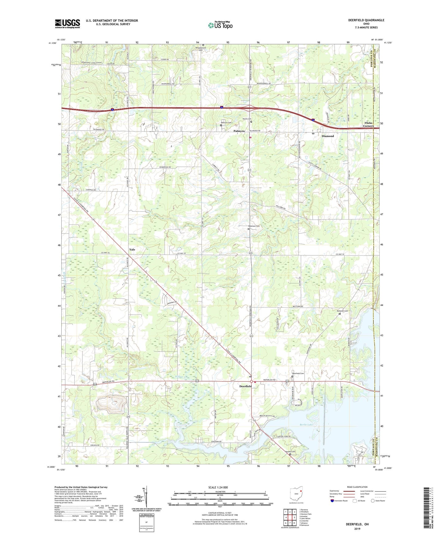
2023 topographic map quadrangle Deerfield in the state of Ohio. Scale: 1:24000. Based on the newly updated USGS 7.5' US Topo map series, this map is in the following counties: Portage, Mahoning. The map contains contour data, water features, and other items you are used to seeing on USGS maps, but also has updated roads and other features. This is the next generation of topographic maps. Printed on high-quality waterproof paper with UV fade-resistant inks.
Quads adjacent to this one:
West: Atwater
Northwest: Ravenna
North: Windham
Northeast: Newton Falls
East: Lake Milton
Southeast: Damascus
South: Alliance
Southwest: Limaville
This map covers the same area as the classic USGS quad with code o41081a1.
Contains the following named places: Akron Y W C A Camp, All Seasons Lake Park, Berlin Dam, Berlin Lake, Bloody Corners, Davis, Deerfield, Deerfield Cemetery, Deerfield Fire Department, Deerfield Post Office, Deerfield Station, Diamond, Diamond Post Office, Flicks Corners, Hayden Cemetery, Hutson, Ireland School, Karas Farms, Keans, Lloyd, Lloyd Post Office, Mill Creek, Mottown Cemetery, North Cemetery, Palmyra, Palmyra Cemetery, Palmyra Post Office, Palmyra Township Fire Department, Robinson Cemetery, Silver Creek, Southeast Elementary School, Southeast High School, Southeast Middle School, Township of Deerfield, Township of Palmyra, Whippoorwill Cemetery, Whippoorwill School, Willow Creek, Yale, Yale Church, Yale Post Office, ZIP Codes: 44411, 44412