MyTopo
Silver Creek Ohio US Topo Map
Couldn't load pickup availability
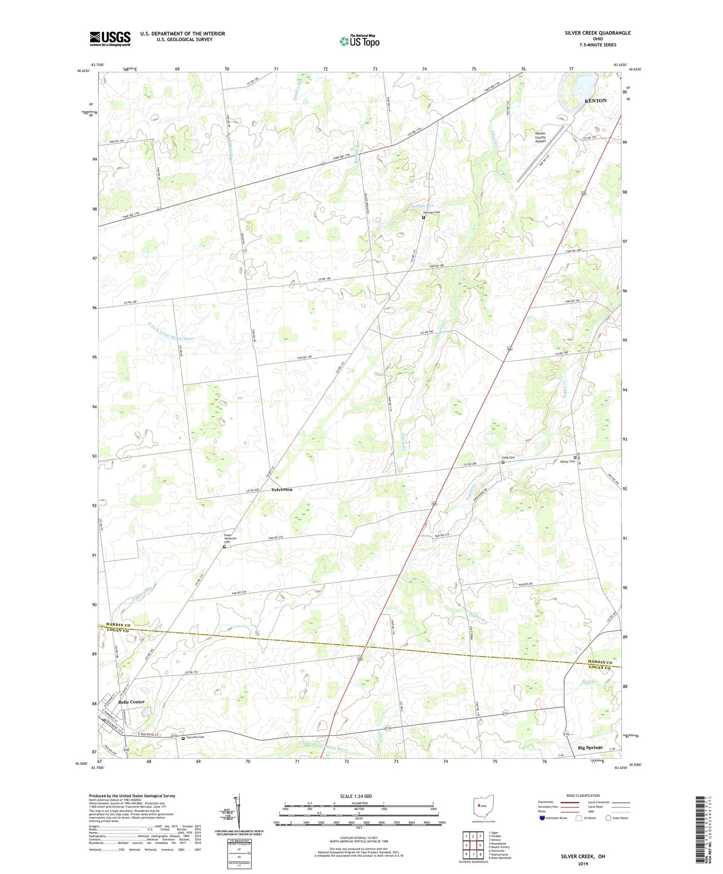
2019 topographic map quadrangle Silver Creek in the state of Ohio. Scale: 1:24000. Based on the newly updated USGS 7.5' US Topo map series, this map is in the following counties: Hardin, Logan. The map contains contour data, water features, and other items you are used to seeing on USGS maps, but also has updated roads and other features. This is the next generation of topographic maps. Printed on high-quality waterproof paper with UV fade-resistant inks.
Quads adjacent to this one:
West: Roundhead
Northwest: Alger
North: Foraker
Northeast: Kenton
East: Mount Victory
Southeast: West Mansfield
South: Rushsylvania
Southwest: Huntsville
Contains the following named places: Bailey Cemetery, Belle Center, Benjamin Logan Elementary School, Big Spring Post Office, Big Spring School, Big Springs, Bigsprings Post Office, Derrs School, Dunn School, Enterprise School, Fairview Cemetery, Graystone School, Hardin County Airport, Hickory Grove School, Independent School, Jordan Run, Kings Corners, Liggitt Ditch, Norman Cemetery, Norman School, Reform Presbyterian Church, Saulisberry Park, Sieg Cemetery, Silver Creek, Silvercreek Post Office, Sloan-Yelverton Cemetery, Taylor Creek School, Township of Taylor Creek, Village of Belle Center, Whitetown School, Wildcat School, Yelverton, Yelverton Post Office