MyTopo
Thackery Ohio US Topo Map
Couldn't load pickup availability
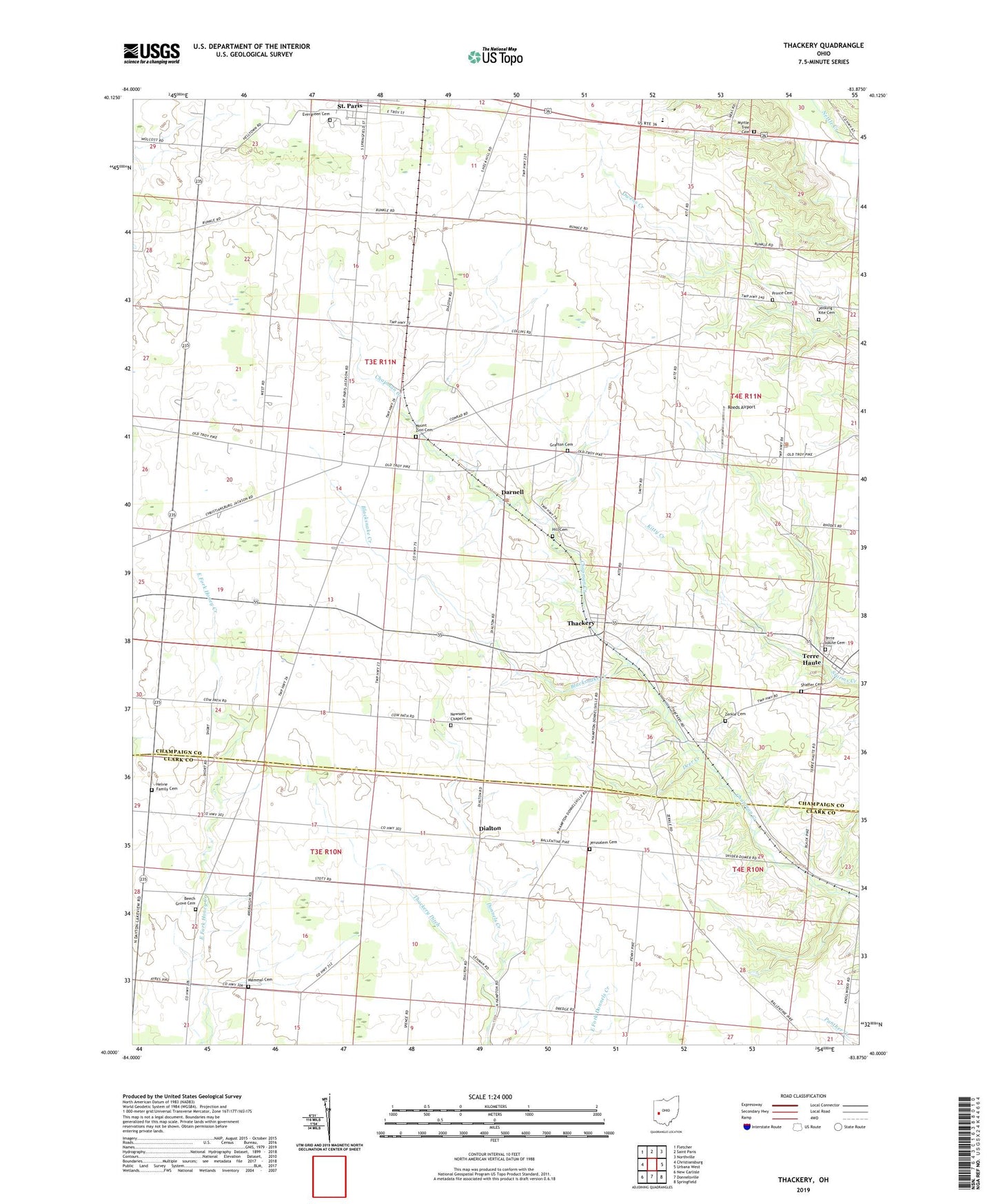
2019 topographic map quadrangle Thackery in the state of Ohio. Scale: 1:24000. Based on the newly updated USGS 7.5' US Topo map series, this map is in the following counties: Champaign, Clark. The map contains contour data, water features, and other items you are used to seeing on USGS maps, but also has updated roads and other features. This is the next generation of topographic maps. Printed on high-quality waterproof paper with UV fade-resistant inks.
Quads adjacent to this one:
West: Christiansburg
Northwest: Fletcher
North: Saint Paris
Northeast: Northville
East: Urbana West
Southeast: Springfield
South: Donnelsville
Southwest: New Carlisle
Contains the following named places: Apple School, Bar W Equestrian Center, Beech Crossing School, Beech Grove Cemetery, Blacksnake Creek, Bryar, Christiansburg-Jackson High School, Circle Farms, Coffin Station, Darnell, Deer Creek, Dialton, Dialton Post Office, Evergreen Cemetery, Grafton Cemetery, Grafton Church, Grafton School, Graham Local High School, Helvie Family Cemetery, Hill Cemetery, Jenking - Kite Cemetery, Jerusalem Cemetery, Kitty Creek, Mammal Cemetery, Mohawk School, Mount Zion Cemetery, Myrtle Tree Cemetery, Myrtle Tree Church, Newsom Chapel Cemetery, Paris Court East, Prince Cemetery, Proctor, Reeds Airport, School Number 6, Seth Corners, Shaffer Cemetery, Terre Haute, Terre Haute Cemetery, Terre Haute Post Office, Terre Haute United Methodist Church, Thackery, Thackery Ditch, Thackery Post Office, Township of Jackson, Windy Corner, Yale School, Zerkle Cemetery, ZIP Code: 43072