MyTopo
Donnelsville Ohio US Topo Map
Couldn't load pickup availability
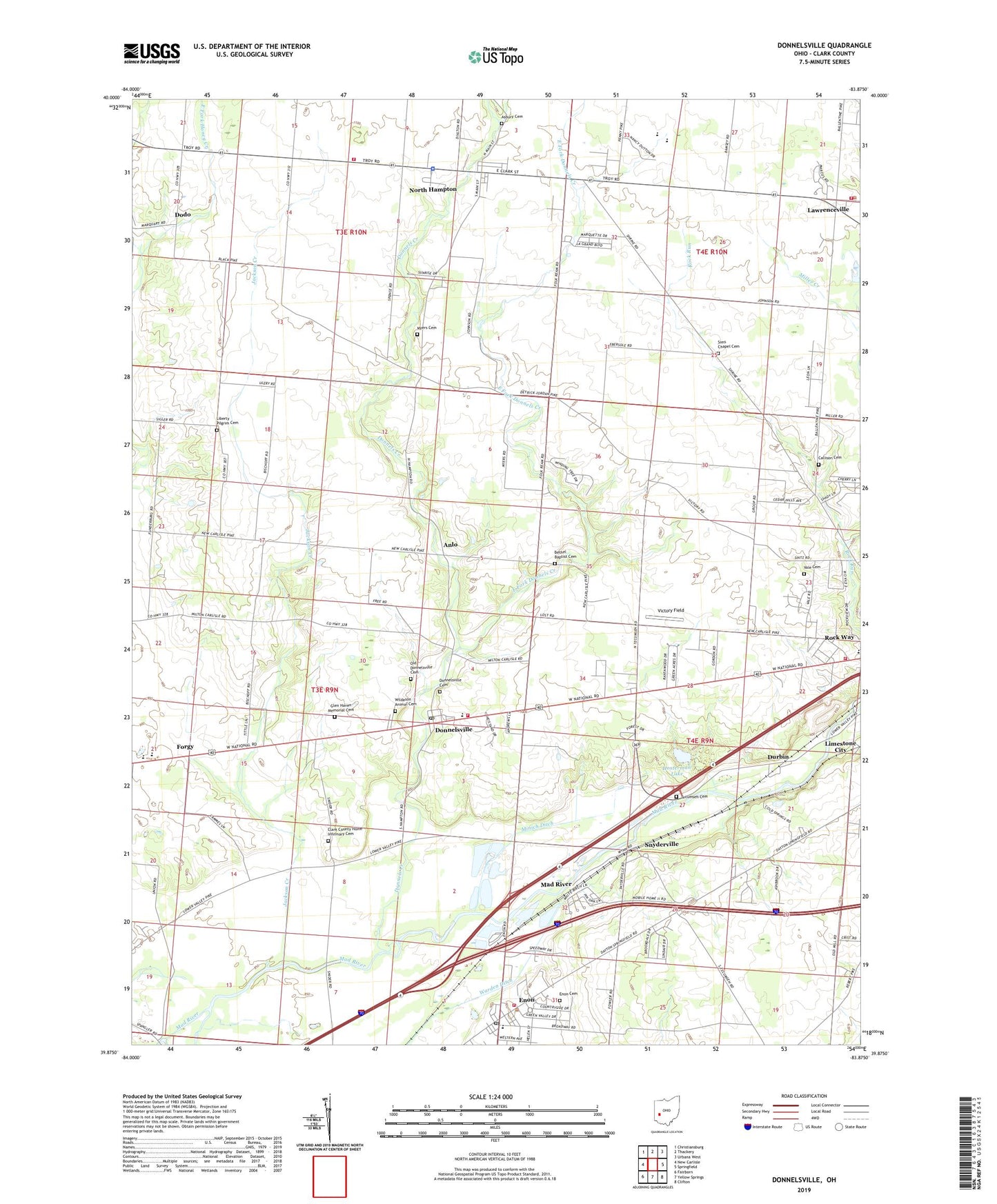
2023 topographic map quadrangle Donnelsville in the state of Ohio. Scale: 1:24000. Based on the newly updated USGS 7.5' US Topo map series, this map is in the following counties: Clark. The map contains contour data, water features, and other items you are used to seeing on USGS maps, but also has updated roads and other features. This is the next generation of topographic maps. Printed on high-quality waterproof paper with UV fade-resistant inks.
Quads adjacent to this one:
West: New Carlisle
Northwest: Christiansburg
North: Thackery
Northeast: Urbana West
East: Springfield
Southeast: Clifton
South: Yellow Springs
Southwest: Fairborn
This map covers the same area as the classic USGS quad with code o39083h8.
Contains the following named places: Anlo, Anlo Post Office, Asbury Cemetery, Asbury Untied Methodist Church, Balentine Acres, Bethel Baptist Cemetery, Bethel Baptist Church, Bethel Township Fire Department Station 54, Boone Station School, Broadview Acres, Callison Cemetery, Cedar Hills, Chateau Estates Mobile Home Park, Clark County Home, Clark County Home Infirmary Cemetery, Cold Springs Station, Dodo, Dodo Post Office, Donnels Creek, Donnels Creek Church, Donnelsville, Donnelsville Cemetery, Donnelsville Elementary School, Donnelsville Post Office, Donnelsville Station, Durbin, East Fork Donnels Creek, Edgewood Mobile Home Park, Enon, Enon Cemetery, Enon Elementary School, Enon Heights Mobile Home Park, Enon Mills, Enon Mobile Home Park, Enon Park, Enon Post Office, Enon Station, Enon United Methodist Church, First Evangelical Lutheran Church of Donnelsville, Forgy, Forgy Post Office, George Rogers Clark Park, German Township Fire and EMS Station 78, German Township Hall, Glen Haven Memorial Cemetery, Hampton Woods, Hosterman Lake, Hosterman Lake Dam, Jackson Creek, Jenkins Field Airport, Jersey Manor Farms, Karen Woods, Knob Prairie Church, Lawrenceville, Lawrenceville Census Designated Place, Lawrenceville Post Office, Liberty Pilgrim Cemetery, Liberty Pilgrim Church, Limestone City, Lindair Acres, Mad River, Mad River Township / Enon Fire and EMS Station, Mad River Township Hall, Madriver Post Office, Miller Creek, Minich Ditch, Myers Cemetery, North Hampton, North Hampton Police Department, North Hampton Post Office, North Hampton School, Northwestern Elementary School, Northwestern High School, Old Donnelsville Cemetery, Old German Church, Olive Branch Middle School, Oscar T Hawke School, Pike Township Fire and Rescue, Pike Township Hall, Pleasant Valley Estates Mobile Home Park, Rock Way, Rockway Elementary School, Saint Pauls Church, Shrine Road Mobile Home Park, Sims Chapel Cemetery, Snyderville, Snyderville Post Office, Springfield Township Fire / EMS Department Station 3, Sturgeon Park, Sycamore West, Tecumseh Cemetery, Tecumseh High School, Township of Bethel, Township of Pike, Vale Cemetery, Victoria Villa, Victory Field, Village of Donnelsville, Village of North Hampton, Wildason Animal Cemetery, Windy Acres, ZIP Codes: 45319, 45349