MyTopo
Union Furnace Ohio US Topo Map
Couldn't load pickup availability
Also explore the Union Furnace Forest Service Topo of this same quad for updated USFS data
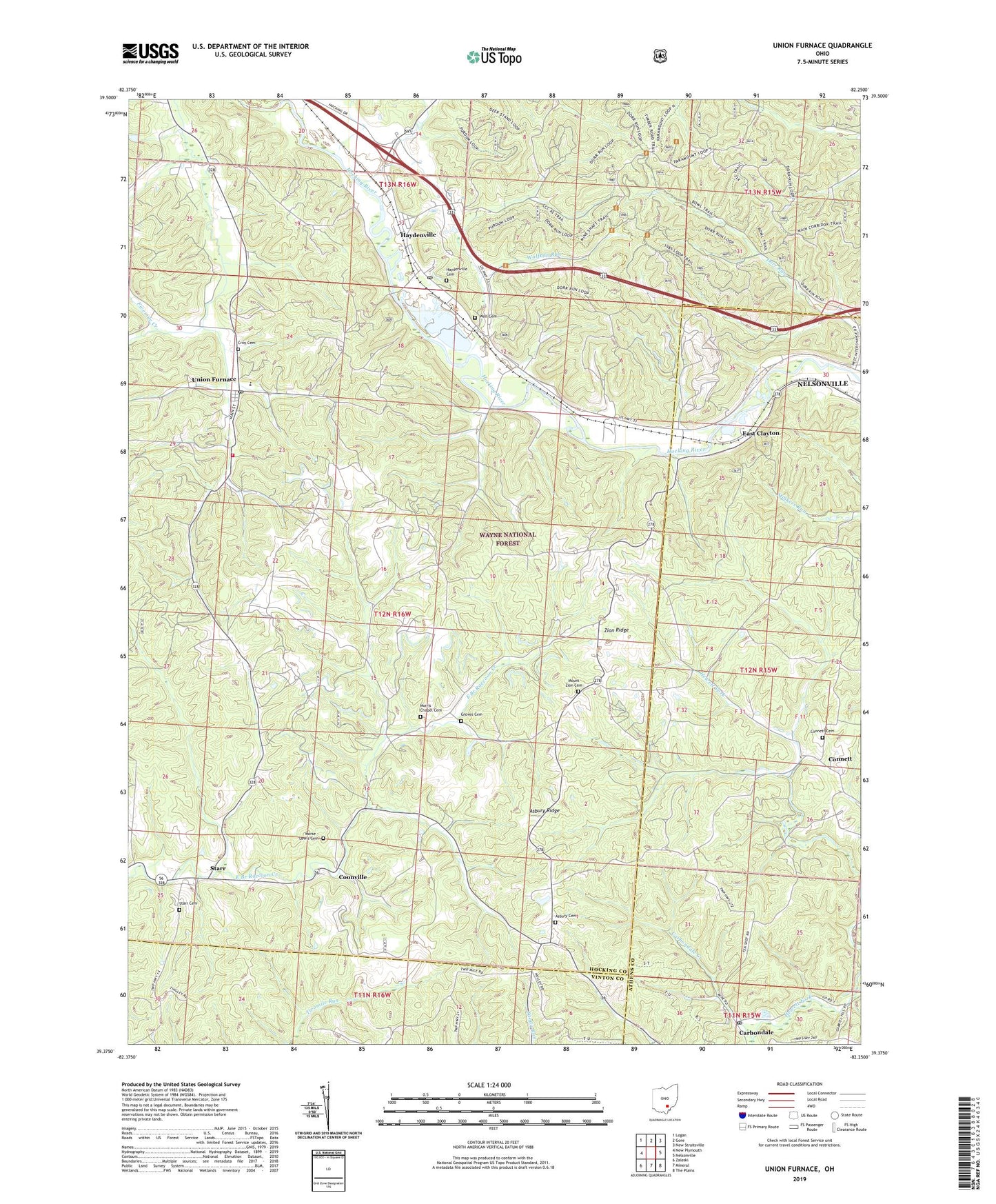
2023 topographic map quadrangle Union Furnace in the state of Ohio. Scale: 1:24000. Based on the newly updated USGS 7.5' US Topo map series, this map is in the following counties: Hocking, Athens, Vinton. The map contains contour data, water features, and other items you are used to seeing on USGS maps, but also has updated roads and other features. This is the next generation of topographic maps. Printed on high-quality waterproof paper with UV fade-resistant inks.
Quads adjacent to this one:
West: New Plymouth
Northwest: Logan
North: Gore
Northeast: New Straitsville
East: Nelsonville
Southeast: The Plains
South: Mineral
Southwest: Zaleski
This map covers the same area as the classic USGS quad with code o39082d3.
Contains the following named places: Asbury Cemetery, Asbury Church, Asbury Ridge, Athens - Hocking Reclamation Center, Camp Otterbein Lake Dam, Carbondale, Carbondale Creek, Carbondale Post Office, Church of God, Community Church, Connett, Connett Cemetery, Coonville, Croy Cemetery, East Clayton, Green Elementary School, Groves Cemetery, Haydenville, Haydenville Cemetery, Haydenville Census Designated Place, Haydenville Historic Town, Haydenville Post Office, Haydenville Station, Morris Chapel, Morris Chapel Cemetery, Morse - Lewis Cemetery, Mount Zion Cemetery, Mount Zion Church, Starr, Starr Cemetery, Starr Post Office, Starr Township Volunteer Fire Department, Summit, Township of Starr, Union Furnace, Union Furnace Elementary School, Union Furnace Post Office, Wolf Basin, Wolf Cemetery, Wolfkiln Run, Zion Ridge, ZIP Codes: 43127, 43158