MyTopo
Waynesfield Ohio US Topo Map
Couldn't load pickup availability
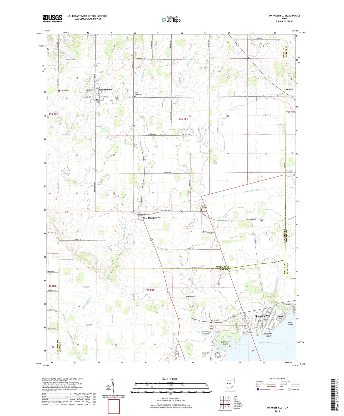
2019 topographic map quadrangle Waynesfield in the state of Ohio. Scale: 1:24000. Based on the newly updated USGS 7.5' US Topo map series, this map is in the following counties: Auglaize, Logan, Hardin. The map contains contour data, water features, and other items you are used to seeing on USGS maps, but also has updated roads and other features. This is the next generation of topographic maps. Printed on high-quality waterproof paper with UV fade-resistant inks.
Quads adjacent to this one:
West: Uniopolis
Northwest: Lima
North: Harrod
Northeast: Alger
East: Roundhead
Southeast: Huntsville
South: Russells Point
Southwest: Jackson Center
Contains the following named places: Beehive School, Berry Cemetery, Blackhawk Island, Blackhawk Mobile Home Park, Blackhawk Park, Blackhawk Run, Chippewa Island, Chippewa Park, Chippewa Park Census Designated Place, Concord Cemetery, East Lynn School, Elm Grove School, Fawn Island, Goshen School, Holden, Holiday Shores Mobile Home Park, Houchin School, Island View, Island View Post Office, Lone Oak School, Lucys Pond, Manchester School, New Hampshire, New Hampshire Census Designated Place, New Hampshire Church of the Nazarene, New Hampshire Methodist Church, New Hampshire Post Office, Prairie Fork School, Red Oak Island, Sandee Farms, School Number 1, Scioto River Ditch, Township of Goshen, Township of Wayne, Van Horn Cemetery, Van Horn Creek, Van Horn School, Village of Waynesfield, Wallace Fork, Wallace Fork School, Walnut Hill Cemetery, Wayne Township Fire and Rescue Services, Waynesfield, Waynesfield Baptist Church, Waynesfield High School, Waynesfield Post Office, Waynesfield United Methodist Church, Waynesfield-Goshen Elementary School, Willow Branch Cemetery, Willow Branch School, Willow Creek, ZIP Codes: 43331, 45870, 45896