MyTopo
Ames Oklahoma US Topo Map
Couldn't load pickup availability
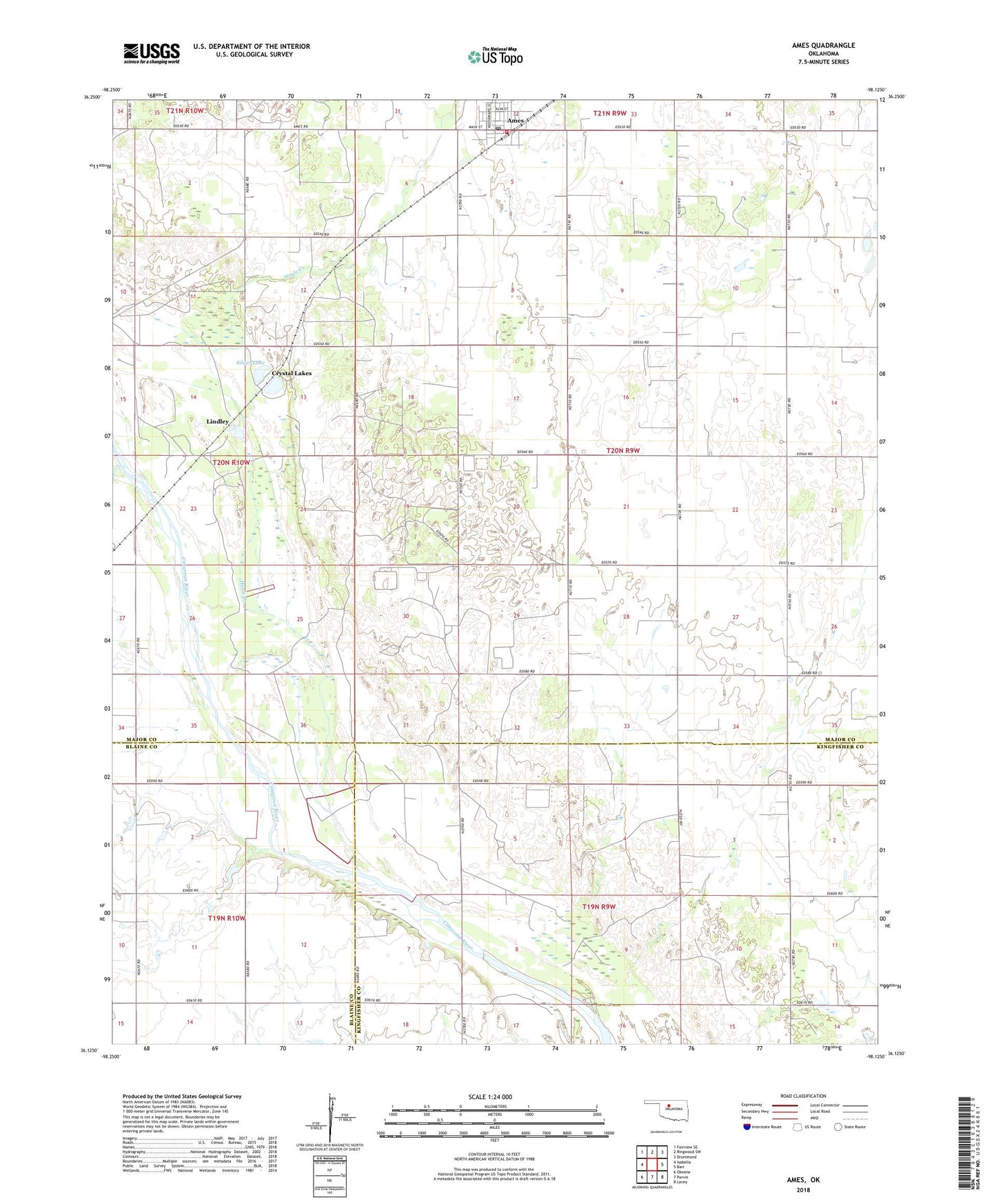
2018 topographic map quadrangle Ames in the state of Oklahoma. Scale: 1:24000. Based on the newly updated USGS 7.5' US Topo map series, this map is in the following counties: Major, Kingfisher, Blaine. The map contains contour data, water features, and other items you are used to seeing on USGS maps, but also has updated roads and other features. This is the next generation of topographic maps. Printed on high-quality waterproof paper with UV fade-resistant inks.
Quads adjacent to this one:
West: Isabella
Northwest: Fairview SE
North: Ringwood SW
Northeast: Drummond
East: Barr
Southeast: Lacey
South: Parvin
Southwest: Okeene
Contains the following named places: Ames, Ames Post Office, Ames Volunteer Fire Department, Antioch Church, Crystal Lakes, Deep Creek, Hoyle Creek, Lindley, Oak Glade Church, Silver Lake, Town of Ames, Township of Cimarron, ZIP Code: 73718