MyTopo
Lacey Oklahoma US Topo Map
Couldn't load pickup availability
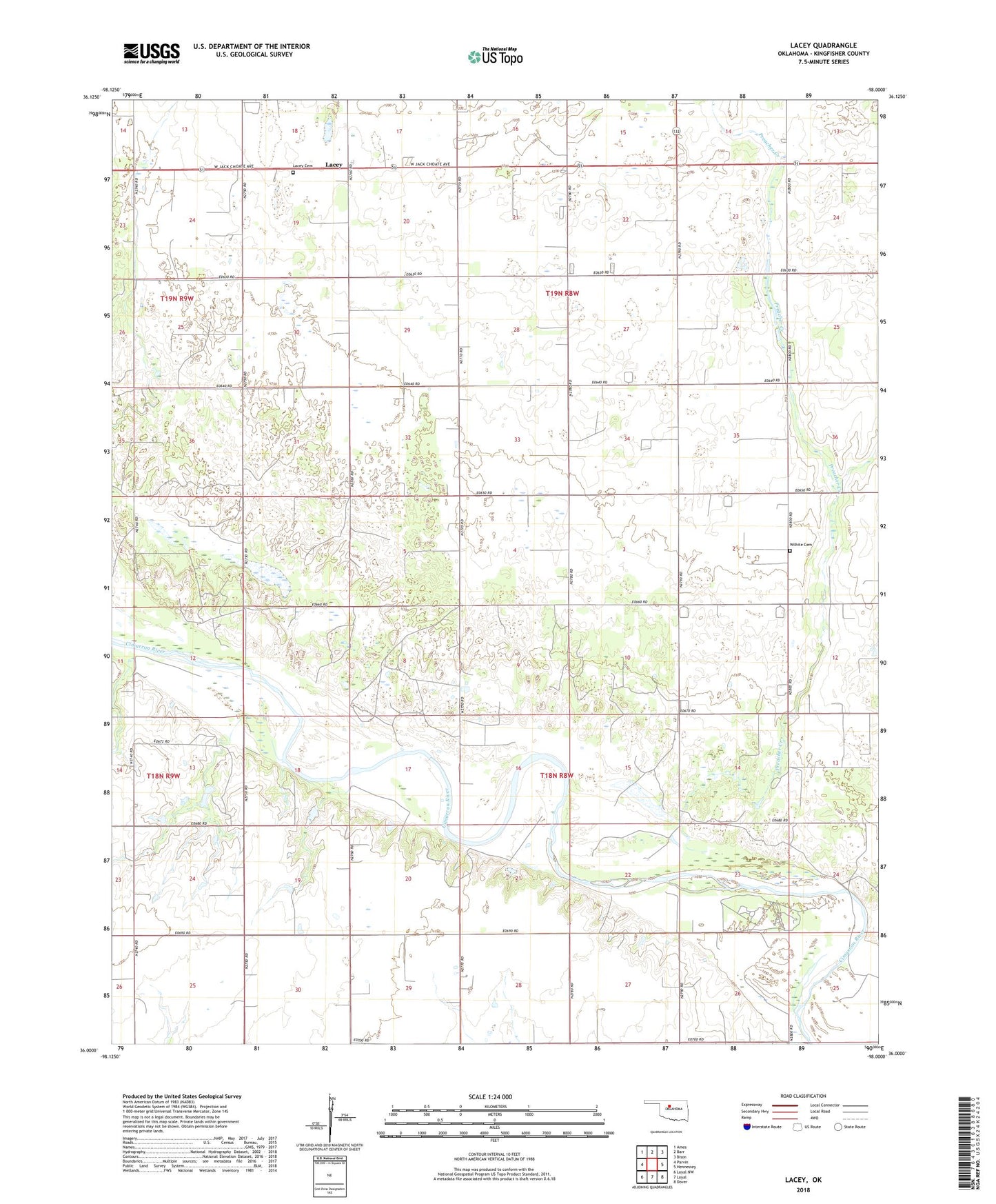
2022 topographic map quadrangle Lacey in the state of Oklahoma. Scale: 1:24000. Based on the newly updated USGS 7.5' US Topo map series, this map is in the following counties: Kingfisher. The map contains contour data, water features, and other items you are used to seeing on USGS maps, but also has updated roads and other features. This is the next generation of topographic maps. Printed on high-quality waterproof paper with UV fade-resistant inks.
Quads adjacent to this one:
West: Parvin
Northwest: Ames
North: Barr
Northeast: Bison
East: Hennessey
Southeast: Dover
South: Loyal
Southwest: Loyal NW
This map covers the same area as the classic USGS quad with code o36098a1.
Contains the following named places: Bollenbach Landing Strip, Huff Landing Strip, Lacey, Lacey Cemetery, Mound Ridge School, Preacher Creek, Township of Coronado, Township of Lacey, Wilhite Cemetery