MyTopo
Arcadia Oklahoma US Topo Map
Couldn't load pickup availability
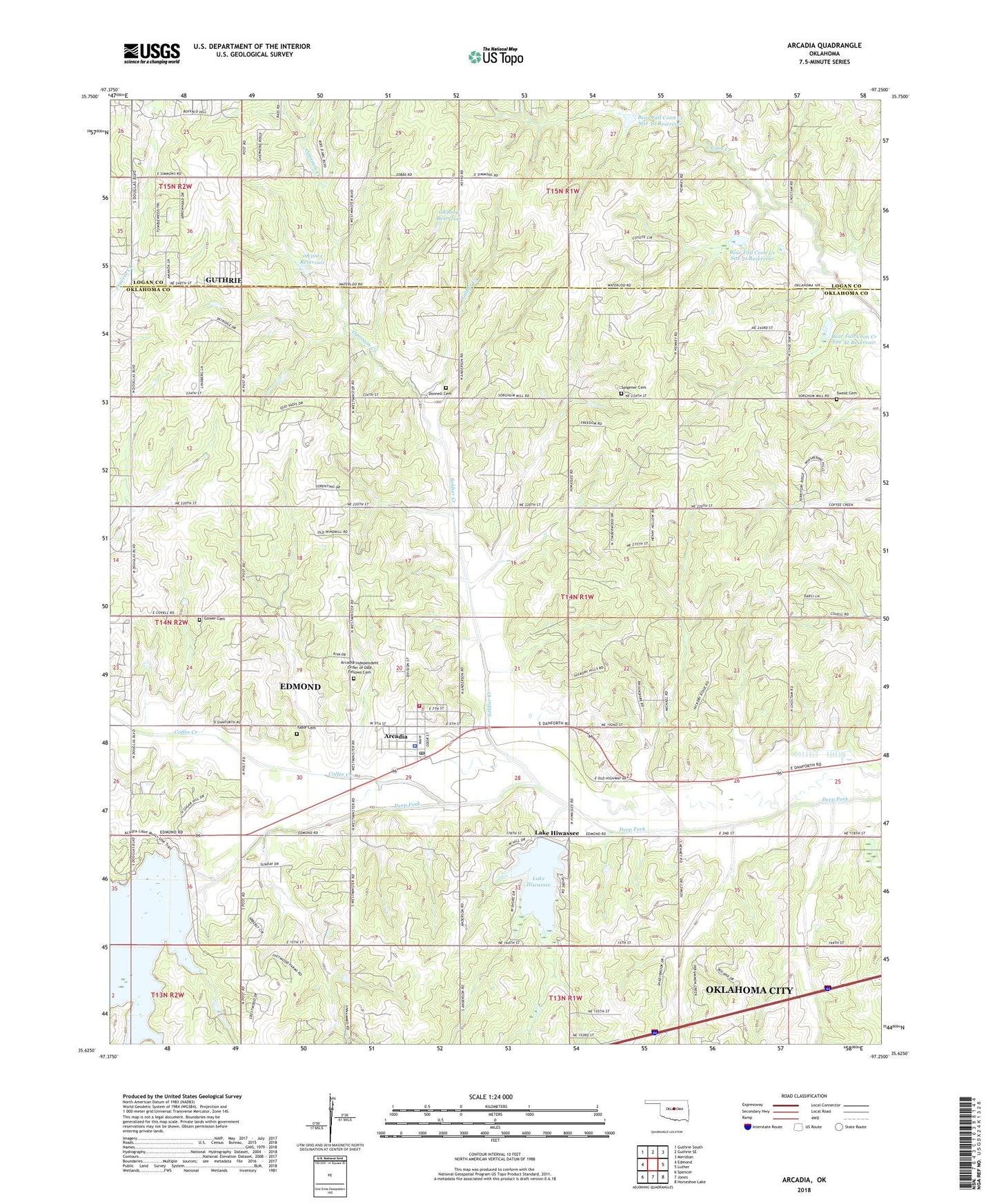
2022 topographic map quadrangle Arcadia in the state of Oklahoma. Scale: 1:24000. Based on the newly updated USGS 7.5' US Topo map series, this map is in the following counties: Oklahoma, Logan. The map contains contour data, water features, and other items you are used to seeing on USGS maps, but also has updated roads and other features. This is the next generation of topographic maps. Printed on high-quality waterproof paper with UV fade-resistant inks.
Quads adjacent to this one:
West: Edmond
Northwest: Guthrie South
North: Guthrie SE
Northeast: Meridian
East: Luther
Southeast: Horseshoe Lake
South: Jones
Southwest: Spencer
This map covers the same area as the classic USGS quad with code o35097f3.
Contains the following named places: Arcadia, Arcadia Fire Department, Arcadia Independent Order of Odd Fellows Cemetery, Arcadia Police Department, Arcadia Post Office, Bear Fall Coon Creek Site 30 Dam, Bear Fall Coon Creek Site 30 Reservoir, Bear Fall Coon Creek Site 31 Dam, Bear Fall Coon Creek Site 31 Reservoir, Bear Fall Coon Creek Site 32 Dam, Bear Fall Coon Creek Site 32 Reservoir, Coffee Creek, Coon Creek Gas and Oil Field, Donnell Cemetery, Gower Cemetery, Gregg Airport, Hiwassee Lake Dam, Lake Arcadia, Lake Hiwassee, Northwest Coon Creek Gas and Oil Field, Oklahoma City Northeast Division, Oknoname 083005 Dam, Oknoname 083005 Reservoir, Oknoname 083006 Dam, Oknoname 083006 Reservoir, Saint James AME Church, Soldier Creek, Spigener Cemetery, Spring Creek, Sweat Cemetery, Tinker Creek, Town of Arcadia, Township of Deep Fork, Township of Lincoln, Tudor Cemetery, Woodleaf Aero Estates Airport, ZIP Code: 73007