MyTopo
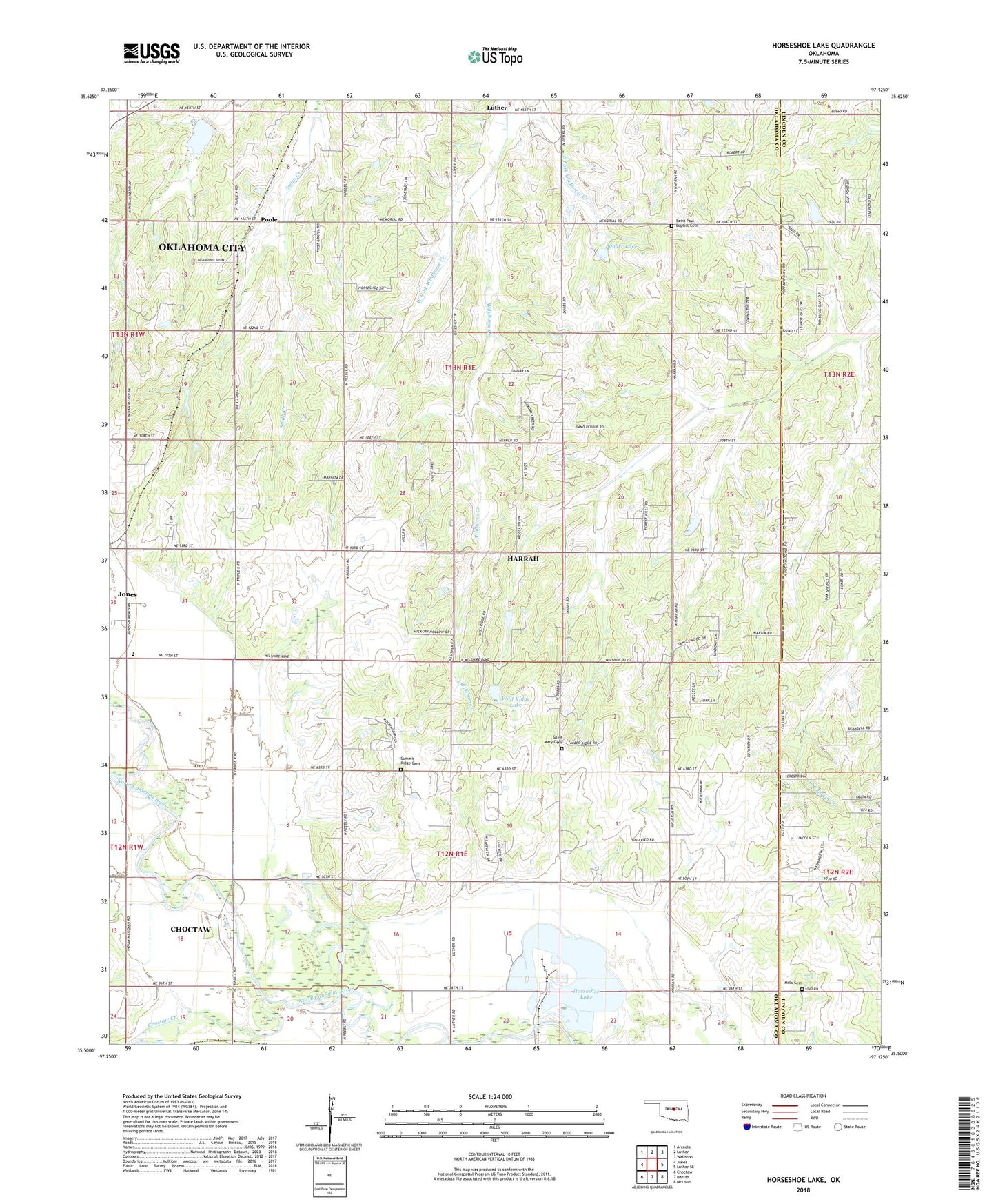
Horseshoe Lake Oklahoma US Topo Map
Couldn't load pickup availability
2022 topographic map quadrangle Horseshoe Lake in the state of Oklahoma. Scale: 1:24000. Based on the newly updated USGS 7.5' US Topo map series, this map is in the following counties: Oklahoma, Lincoln. The map contains contour data, water features, and other items you are used to seeing on USGS maps, but also has updated roads and other features. This is the next generation of topographic maps. Printed on high-quality waterproof paper with UV fade-resistant inks.
Quads adjacent to this one:
West: Jones
Northwest: Arcadia
North: Luther
Northeast: Wellston
East: Luther SE
Southeast: McLoud
South: Harrah
Southwest: Choctaw
This map covers the same area as the classic USGS quad with code o35097e2.
Contains the following named places: Booher Dam, Booher Lake, Choctaw Creek, Douglas Church, East Fork Wildhorse Creek, Hickory Hills Volunteer Fire Department, Horseshoe Lake, Jones Middle School, Mills Cemetery, Mission Field, Oklahoma Academy, Poole, Saint Mary Cemetery, Saint Paul Baptist Cemetery, Saint Paul Church, Summit Ridge Cemetery, Township of Dewey, Township of Elk, West Fork Wildhorse Creek, Wolf Ridge Dam, Wolf Ridge Lake, ZIP Code: 73045