MyTopo
Luther Oklahoma US Topo Map
Couldn't load pickup availability
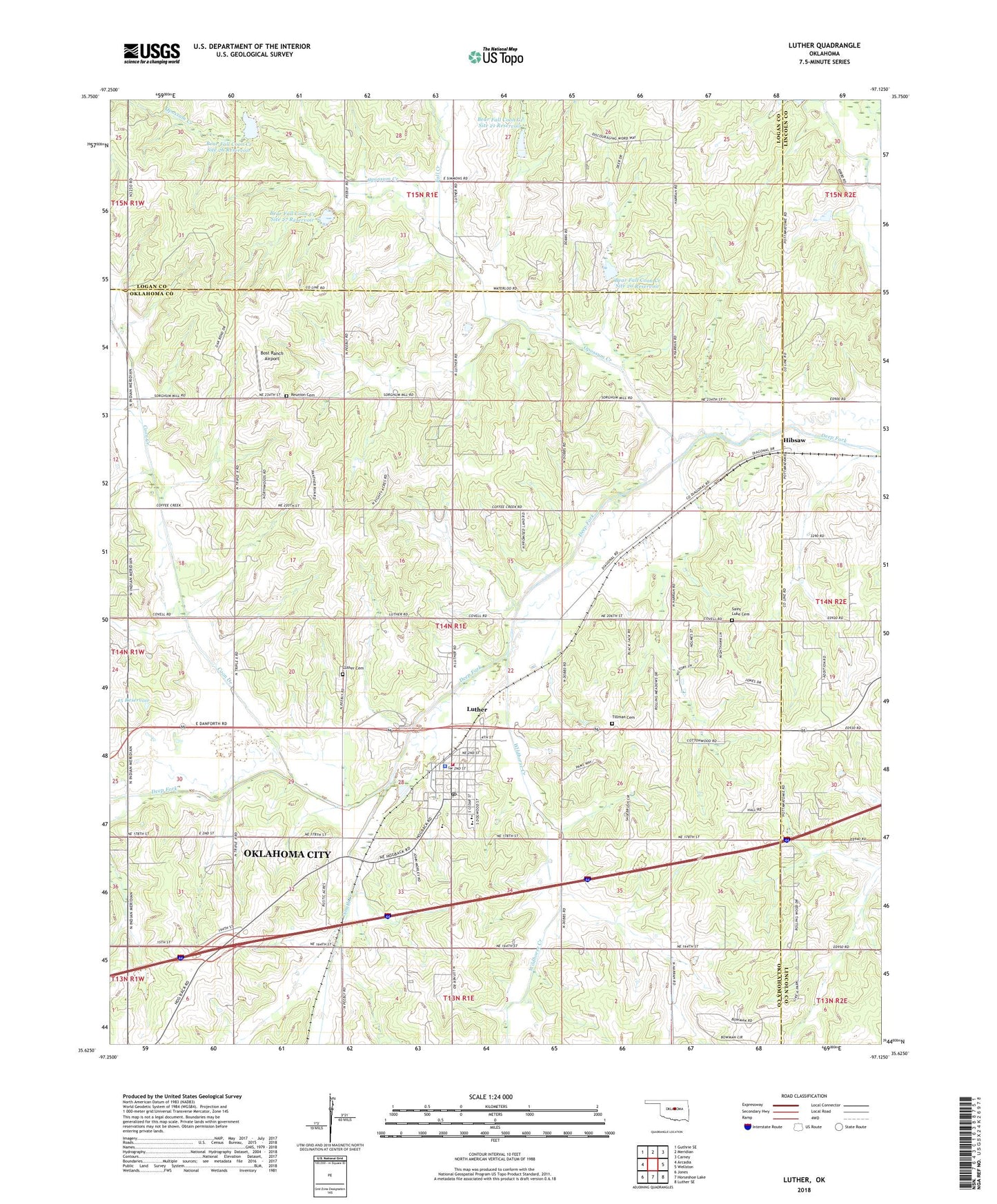
2022 topographic map quadrangle Luther in the state of Oklahoma. Scale: 1:24000. Based on the newly updated USGS 7.5' US Topo map series, this map is in the following counties: Oklahoma, Logan, Lincoln. The map contains contour data, water features, and other items you are used to seeing on USGS maps, but also has updated roads and other features. This is the next generation of topographic maps. Printed on high-quality waterproof paper with UV fade-resistant inks.
Quads adjacent to this one:
West: Arcadia
Northwest: Guthrie SE
North: Meridian
Northeast: Carney
East: Wellston
Southeast: Luther SE
South: Horseshoe Lake
Southwest: Jones
This map covers the same area as the classic USGS quad with code o35097f2.
Contains the following named places: Bear Fall Coon Creek Site 20 Dam, Bear Fall Coon Creek Site 20 Reservoir, Bear Fall Coon Creek Site 21 Dam, Bear Fall Coon Creek Site 21 Reservoir, Bear Fall Coon Creek Site 26 Dam, Bear Fall Coon Creek Site 26 Reservoir, Bear Fall Coon Creek Site 27 Dam, Bear Fall Coon Creek Site 27 Reservoir, Bost Ranch Airport, Coon Creek, Fall Creek, Hibsaw, HSH Airstrip, Luther, Luther Cemetery, Luther Elementary School, Luther Gas and Oil Field, Luther High School, Luther Middle School, Luther Police Department, Luther Post Office, Luther Volunteer Fire Department, Oknoname 15 Dam, Oknoname 15 Reservoir, Opossum Creek, Reunion Cemetery, Ronka Rhey Airport, Saint Luke Cemetery, Smith Creek, South Garden Oil and Gas Field, Tillman Cemetery, Town of Luther, Township of Luther, West Luther Oil and Gas Field, West Wellston Oil and Gas Field, Wildhorse Creek, ZIP Code: 73054