MyTopo
Avant Oklahoma US Topo Map
Couldn't load pickup availability
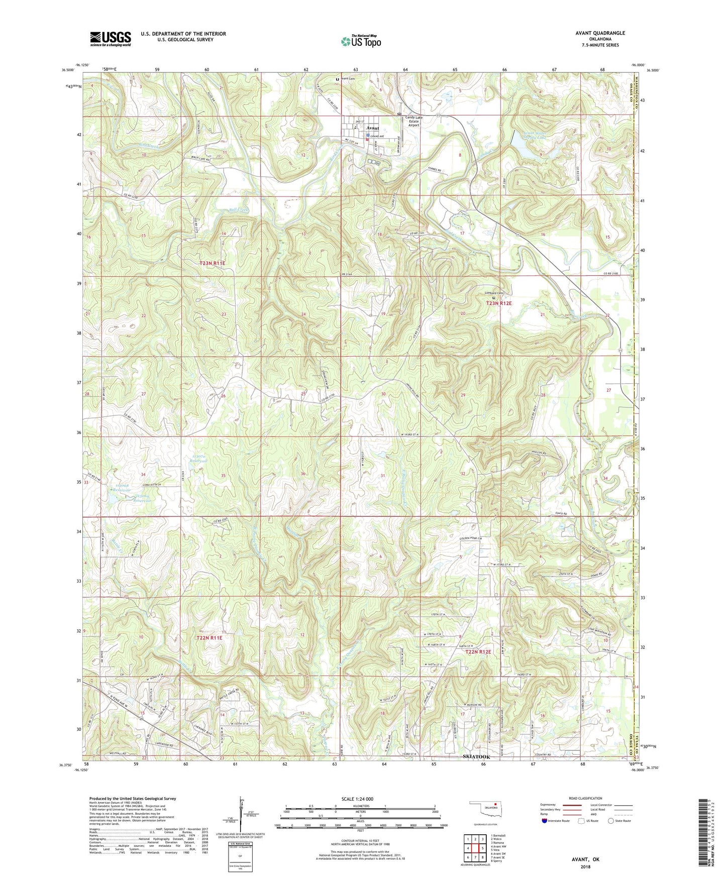
2018 topographic map quadrangle Avant in the state of Oklahoma. Scale: 1:24000. Based on the newly updated USGS 7.5' US Topo map series, this map is in the following counties: Osage, Washington, Tulsa. The map contains contour data, water features, and other items you are used to seeing on USGS maps, but also has updated roads and other features. This is the next generation of topographic maps. Printed on high-quality waterproof paper with UV fade-resistant inks.
Quads adjacent to this one:
West: Avant NW
Northwest: Barnsdall
North: Wolco
Northeast: Ramona
East: Vera
Southeast: Sperry
South: Avant SE
Southwest: Avant SW
Contains the following named places: Avant, Avant Cemetery, Avant Fire Department, Avant Oil Field, Avant Police Department, Avant Post Office, Avant Public School, Avant Water Supply Lake, Avant Water Supply Lake Dam, Battle Creek, Bull Creek, Candy Creek, Candy Lake Estate Airport, Clem Creek, Dripping Spring, East Prong Quapaw Creek, Javine Oil Field, Kourtis Family Farm Airport, Lombard Cemetery, Oknoname 113005 Dam, Oknoname 113005 Reservoir, Oknoname 113068 Dam, Oknoname 113068 Reservoir, Oknoname 113069 Dam, Oknoname 113069 Reservoir, Oknoname 113070 Dam, Oknoname 113070 Reservoir, Skiatook Oil Field, Town of Avant, Tucker Creek, Tyner Creek, West Prong Quapaw Creek, ZIP Codes: 74001, 74070