MyTopo
Avant NW Oklahoma US Topo Map
Couldn't load pickup availability
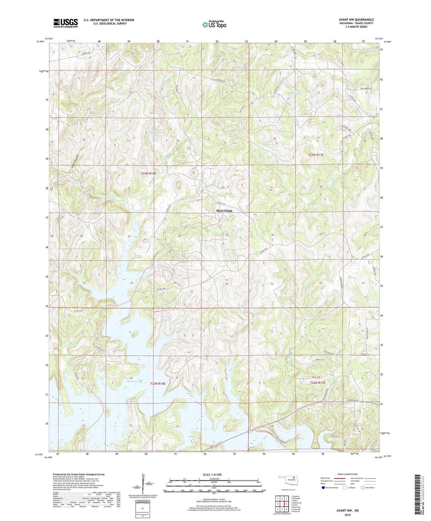
2022 topographic map quadrangle Avant NW in the state of Oklahoma. Scale: 1:24000. Based on the newly updated USGS 7.5' US Topo map series, this map is in the following counties: Osage. The map contains contour data, water features, and other items you are used to seeing on USGS maps, but also has updated roads and other features. This is the next generation of topographic maps. Printed on high-quality waterproof paper with UV fade-resistant inks.
Quads adjacent to this one:
West: Hominy NE
Northwest: Wynona
North: Barnsdall
Northeast: Wolco
East: Avant
Southeast: Avant SE
South: Avant SW
Southwest: New Prue
This map covers the same area as the classic USGS quad with code o36096d2.
Contains the following named places: Bull Creek, Cedar Canyon, Cedar Creek, Eagle Creek, Oknoname 113063 Dam, Oknoname 113063 Reservoir, Oknoname 113064 Dam, Oknoname 113064 Reservoir, Oknoname 113065 Dam, Oknoname 113065 Reservoir, South Barnsdall Oil Field, Turkey Creek, West Avant Oil Field, Wildhorse Creek, Wildhorse NE Oil Field