MyTopo
Avant SW Oklahoma US Topo Map
Couldn't load pickup availability
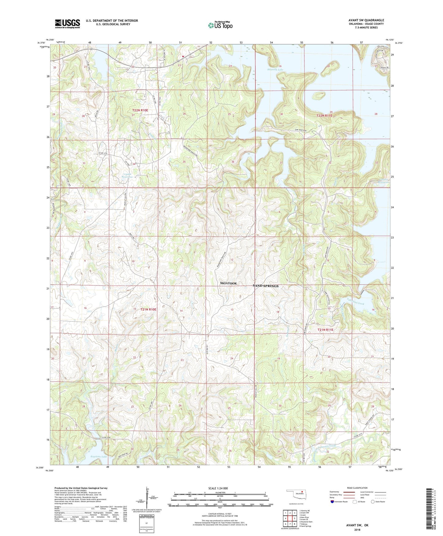
2022 topographic map quadrangle Avant SW in the state of Oklahoma. Scale: 1:24000. Based on the newly updated USGS 7.5' US Topo map series, this map is in the following counties: Osage. The map contains contour data, water features, and other items you are used to seeing on USGS maps, but also has updated roads and other features. This is the next generation of topographic maps. Printed on high-quality waterproof paper with UV fade-resistant inks.
Quads adjacent to this one:
West: New Prue
Northwest: Hominy NE
North: Avant NW
Northeast: Avant
East: Avant SE
Southeast: Sand Springs
South: Wekiwa
Southwest: Keystone Dam
This map covers the same area as the classic USGS quad with code o36096c2.
Contains the following named places: Arrowhead Ranch, Branstetter Oil Field, East Madalene Oil Field, Edgewood South Oil Field, Lost Creek, Madalene Oil Field, Morgans Corner, Morgans Corner Fire Department, Oknoname 113002 Dam, Oknoname 113002 Reservoir, Oknoname 113003 Dam, Oknoname 113003 Reservoir, Oknoname 113004 Dam, Oknoname 113004 Reservoir, Oknoname 113066 Dam, Oknoname 113066 Reservoir, Oknoname 113067 Dam, Oknoname 113067 Reservoir, Prue Oil Field, Skiatook Lake, Township of Black Dog, Triple M Ranch, Wildhorse Oil Field, ZIP Code: 74060