MyTopo
Beggs Oklahoma US Topo Map
Couldn't load pickup availability
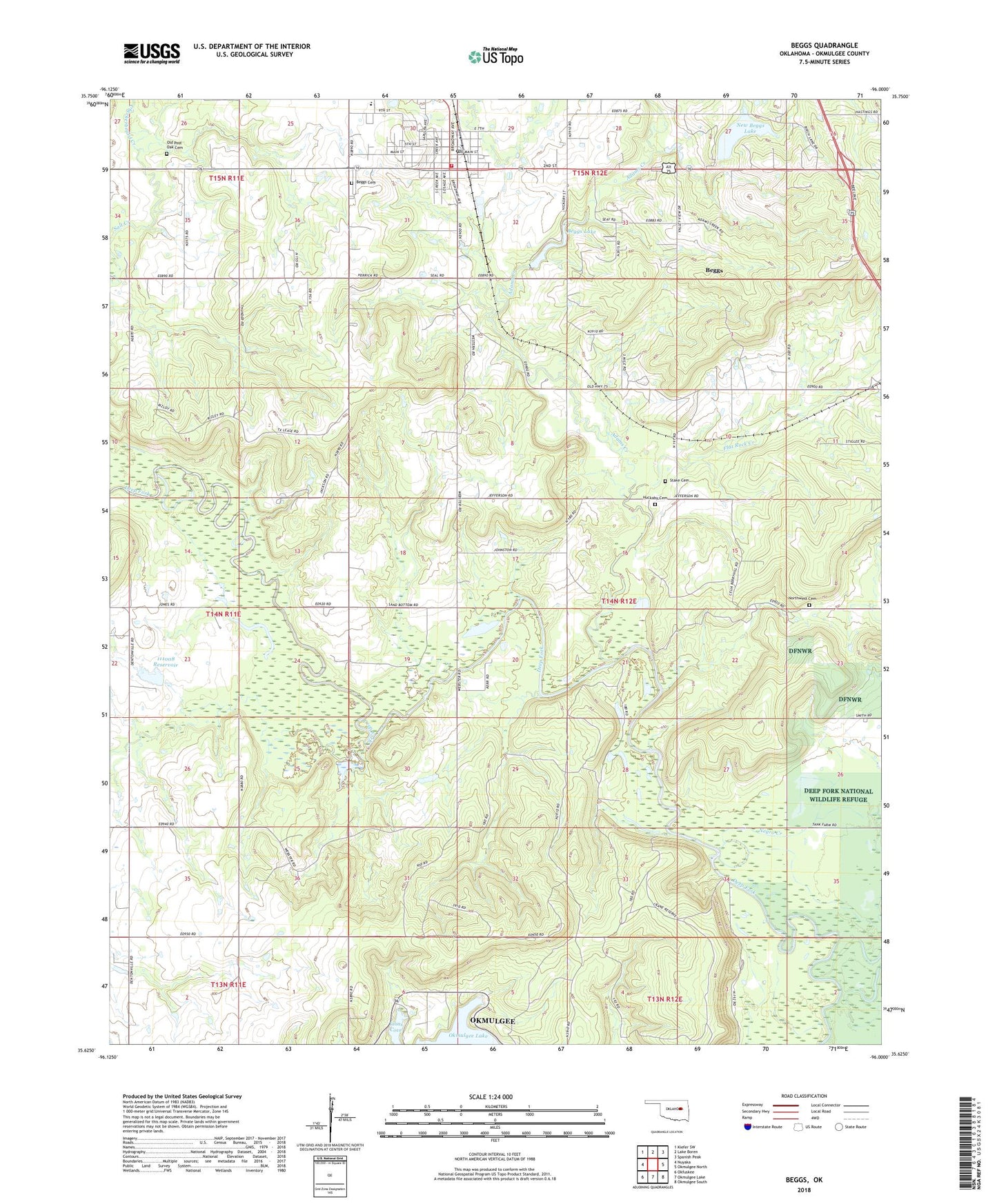
2018 topographic map quadrangle Beggs in the state of Oklahoma. Scale: 1:24000. Based on the newly updated USGS 7.5' US Topo map series, this map is in the following counties: Okmulgee. The map contains contour data, water features, and other items you are used to seeing on USGS maps, but also has updated roads and other features. This is the next generation of topographic maps. Printed on high-quality waterproof paper with UV fade-resistant inks.
Quads adjacent to this one:
West: Nuyaka
Northwest: Kiefer SW
North: Lake Boren
Northeast: Spanish Peak
East: Okmulgee North
Southeast: Okmulgee South
South: Okmulgee Lake
Southwest: Okfuskee
Contains the following named places: Adams Creek, Baptist Church, Beggs, Beggs Cemetery, Beggs City Police Department, Beggs Dam, Beggs High School, Beggs Lake, Beggs Post Office, Beggs Volunteer Fire Department, Checkerboard Creek, City of Beggs, Creek Oklahoma Tribal Statistical Area, Faith Manna Bible Mission, Flat Rock Creek, Huckaby - Perryman Cemetery, Laden, Lions Cove, Negro Creek, New Beggs Lake, New Beggs Lake Dam, Northwest Cemetery, Northwest Church, Okmulgee Division, Okmulgee State Game Management Area, Oknoname 111008 Dam, Oknoname 111008 Reservoir, Oknoname 111087 Dam, Oknoname 111087 Reservoir, Old Post Oak Cemetery, Stake Cemetery, Township of Hamilton, ZIP Code: 74447