MyTopo
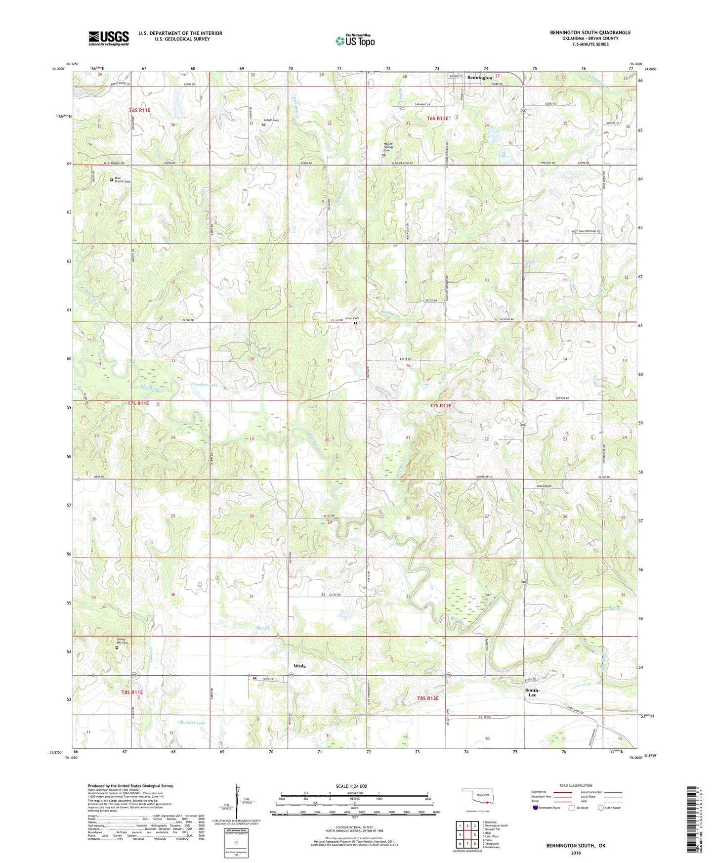
Bennington South Oklahoma US Topo Map
Couldn't load pickup availability
2018 topographic map quadrangle Bennington South in the state of Oklahoma. Scale: 1:24000. Based on the newly updated USGS 7.5' US Topo map series, this map is in the following counties: Bryan. The map contains contour data, water features, and other items you are used to seeing on USGS maps, but also has updated roads and other features. This is the next generation of topographic maps. Printed on high-quality waterproof paper with UV fade-resistant inks.
Quads adjacent to this one:
West: Blue
Northwest: Bokchito
North: Bennington North
Northeast: Boswell SW
East: Lake West
Southeast: Monkstown
South: Telephone
Southwest: Yuba
Contains the following named places: 6B Airfield, 74723, Arnett Church, Beames School, Blue Branch Cemetery, Bokchito Creek, Cherokee Lake, Chishoktak Church, Gregory Lake, Gregory Lake Dam, Julius Cemetery, Labors Cemetery, Manning School, McGee Creek, McGee Springs Cemetery, McIntire Lake, McIntire Lake Dam, Midland Church, Page Lake Dam, Red Branch, Sassafras Creek, Smith-Lee, Spring Hill Cemetery, Sulphur Creek, Sulphur Creek Church, Sulphur Springs Church, Township of Bennington, Wade, Wade Volunteer Fire Department, Wolf Creek