MyTopo
Lake West Oklahoma US Topo Map
Couldn't load pickup availability
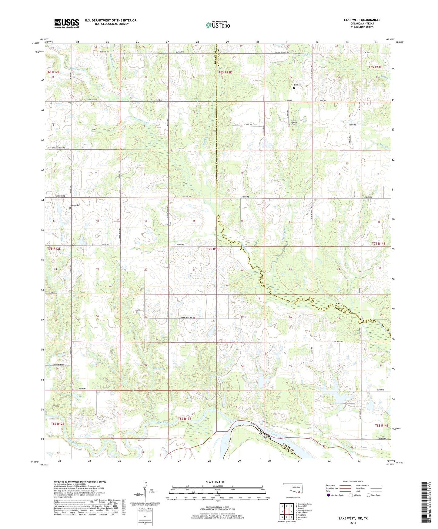
2022 topographic map quadrangle Lake West in the state of Oklahoma. Scale: 1:24000. Based on the newly updated USGS 7.5' US Topo map series, this map is in the following counties: Bryan, Choctaw, Fannin. The map contains contour data, water features, and other items you are used to seeing on USGS maps, but also has updated roads and other features. This is the next generation of topographic maps. Printed on high-quality waterproof paper with UV fade-resistant inks.
Quads adjacent to this one:
West: Bennington South
Northwest: Bennington North
North: Boswell SW
Northeast: Boswell
East: New Oberlin
Southeast: Direct
South: Monkstown
Southwest: Telephone
Contains the following named places: Belvin School, Blue River, Dill Cemetery, Frazier Creek, Good Springs Cemetery, Good Springs Church, Jackson Cemetery, Jackson School, Lake West, Lake West School, Lewis Eastwood Dam, Lewis Eastwood Reservoir, Oknoname 013005 Dam, Oknoname 013005 Reservoir, Oknoname 013006 Dam, Oknoname 013006 Reservoir, Oknoname 013009 Dam, Oknoname 013009 Reservoir, Oknoname 013021 Dam, Oknoname 013021 Reservoir, Page Lake, Patsy Spring, Shady Grove School, Siby Spring, Slash Creek, Teal Lake, Teal Lake Dam, Whitesand Creek, Wilson School, Winters Creek