MyTopo
Bennington North Oklahoma US Topo Map
Couldn't load pickup availability
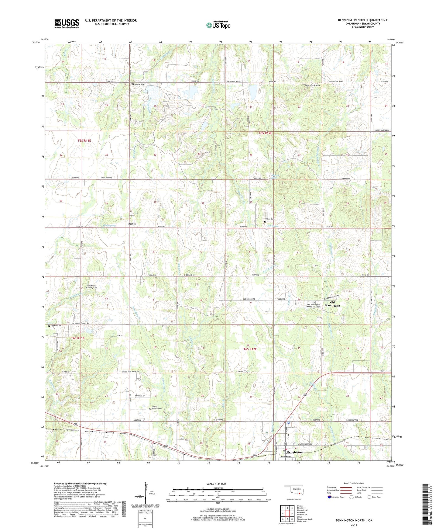
2022 topographic map quadrangle Bennington North in the state of Oklahoma. Scale: 1:24000. Based on the newly updated USGS 7.5' US Topo map series, this map is in the following counties: Bryan. The map contains contour data, water features, and other items you are used to seeing on USGS maps, but also has updated roads and other features. This is the next generation of topographic maps. Printed on high-quality waterproof paper with UV fade-resistant inks.
Quads adjacent to this one:
West: Bokchito
Northwest: Caney
North: Bentley
Northeast: Boswell NW
East: Boswell SW
Southeast: Lake West
South: Bennington South
Southwest: Blue
This map covers the same area as the classic USGS quad with code o34096a1.
Contains the following named places: Armstrong Academy Cemetery, Attaway Spring, Banty, Banty Spring, Bennington, Bennington City Police Department, Bennington Elementary School, Bennington Fire Department, Bennington High School, Bennington Post Office, Impson Cemetery, Impson Family Cemetery, Marshall Airport, Odell Spring, Oknoname 013017 Dam, Oknoname 013017 Reservoir, Oknoname 023008 Dam, Oknoname 023008 Reservoir, Old Bennington, Old Bennington Presbyterian Cemetery, Old Bennington Presbyterian Church, Prentice Lake, Prentice Lake Dam, Rabbit Creek, Reynolds Chapel, Rock Branch, Sugarloaf Mountain, Tenmile Hill, Town of Bennington, Township of Matoy, Wilson Cemetery